Most Digital Twin systems don’t fail because data is missing.
They fail because data exists, but in disconnected systems .
Introduction
In the previous articles, we covered:
how data is captured (IoT, UAVs, LiDAR)
how data flows (pipelines)
Now we come to one of the most challenging layers in Digital Twin architecture:
👉 Integration
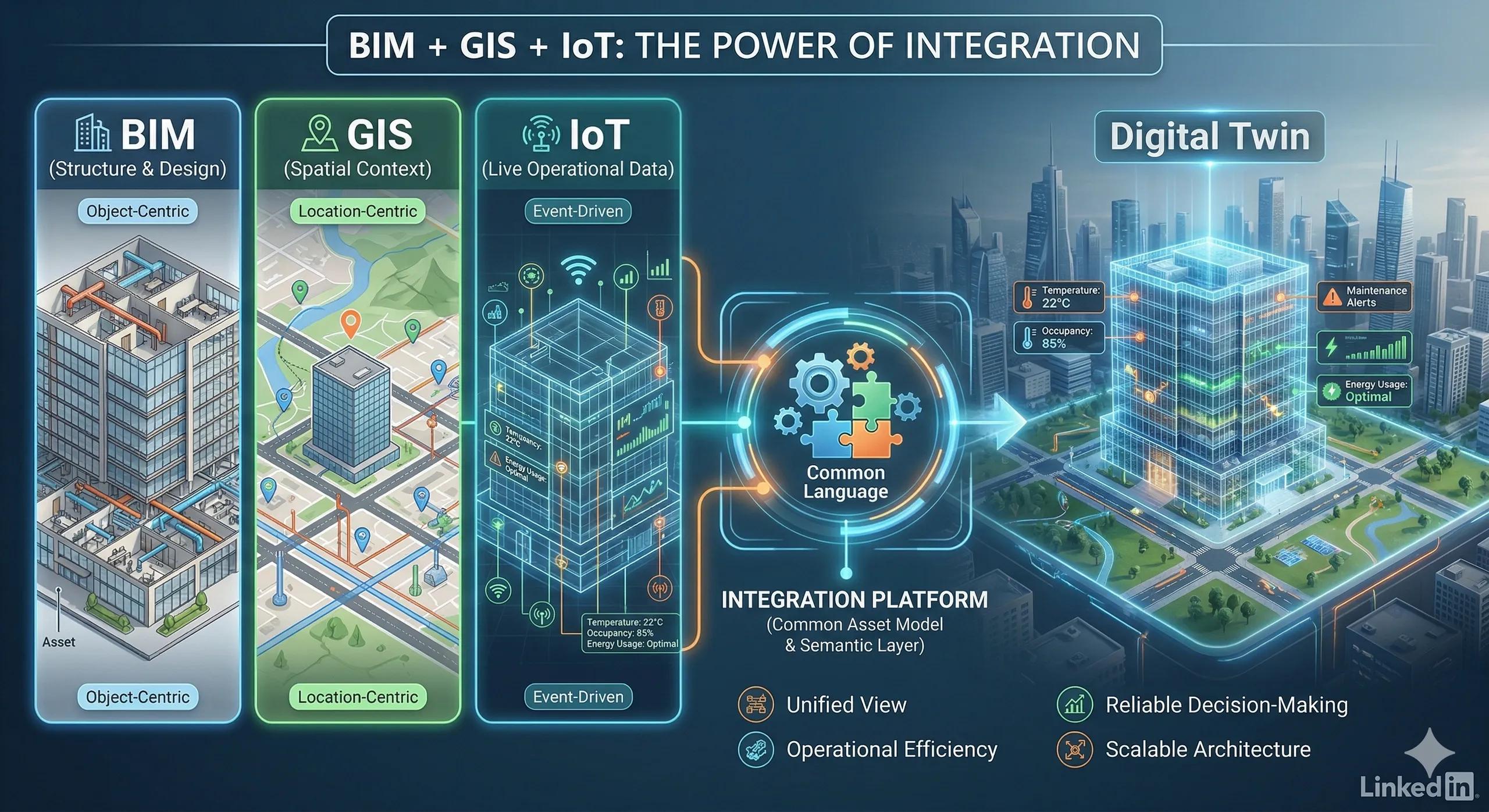
Because in reality, Digital Twins are built across three core domains:
BIM → structure and design
GIS → spatial context
IoT → live operational data
Individually, each system works well.
But the real value comes when:
👉 they operate as one connected system
The Core Problem: Systems That Don’t Speak the Same Language
BIM, GIS, and IoT are fundamentally different:
BIM is object-centric and design-focused
GIS is location-centric and context-driven
IoT is event-driven and time-based
When these systems are integrated without alignment:
data conflicts
context is lost
decisions become unreliable
What Integration Actually Means
Integration is not just connecting APIs.
It means ensuring:
the same asset is understood across systems
data flows consistently
context is preserved
decisions can use combined insights
👉 In simple terms:
One asset, one meaning, across all systems
The 4 Key Integration Challenges
1. Asset Identity Mismatch
A pump in BIM
A point in GIS
A sensor in IoT
👉 Same asset, different representations
Result:
Data cannot be reliably linked
2. Data Model Differences
BIM → rich object attributes
GIS → spatial layers
IoT → time-series signals
👉 No common structure
3. Time vs Space Misalignment
IoT is real-time
BIM is static
GIS is semi-dynamic
👉 Synchronization becomes complex
4. Legacy System Constraints
closed systems
lack of APIs
inconsistent formats
👉 Integration becomes fragile
How to Integrate BIM + GIS + IoT Effectively
1. Define a Common Asset Model
Start with:
👉 a unified definition of assets
unique IDs
shared attributes
consistent naming
This becomes the foundation of integration
2. Establish a Semantic Layer
Instead of just connecting data:
👉 define what the data means
relationships between assets
hierarchy (site → building → equipment)
contextual rules
This ensures:
👉 systems don’t just exchange data, they understand it
3. Use Middleware for Integration
Middleware acts as the connector between systems.
Examples:
API gateways
message brokers (MQTT, Kafka)
integration platforms
👉 This avoids direct system-to-system dependency
4. Align Time and State
synchronize IoT data with BIM/GIS context
maintain both real-time and historical states
👉 Enables accurate analysis and simulation
5. Build for Incremental Integration
Do not integrate everything at once.
Start with:
one use case
one asset category
Then expand.
Practical Example
Scenario: Smart Building
BIM: building structure and asset details
GIS: location, surroundings, utilities
IoT: HVAC performance, occupancy, energy use
Integration enables:
👉 real-time energy optimization
👉 location-aware maintenance
👉 predictive system behavior
Without integration:
systems operate independently
decisions remain fragmented
Where Most Organizations Go Wrong
1. Integration as an Afterthought
Systems are built first, then connected later.
2. Over-Reliance on Tools
Assuming software alone will solve integration.
3. Ignoring Semantics
Connecting data without defining meaning.
4. One-Time Integration
No provision for scaling or evolution.
Ask Yourself
Are your systems connected or do they actually understand each other?
Indian Context
In India, integration challenges are amplified due to:
legacy infrastructure
multiple vendors
fragmented data ownership
A structured integration approach:
reduces duplication
improves interoperability
enables scalable Digital Twin systems
Benefits of Proper Integration
unified view of assets
reliable decision-making
improved operational efficiency
scalable architecture
better ROI
Conclusion
A Digital Twin is not created by connecting systems.
It is created when:
👉 BIM, GIS, and IoT operate with a shared understanding of reality
Integration is not a technical step.
It is an architectural discipline .