Two Landscapes, Two Stories of the Same Crust
India is a geological paradox. The same tectonic plate that forged the towering Himalayas also sculpted the flat-topped Deccan Plateau , two extremes of elevation, structure, and energy born from the same lithospheric motion.
If the Himalaya is a zone of construction , where the crust is being compressed and lifted, the Deccan is a zone of preservation , shaped by ancient volcanism and long-term stability. Together, they represent a perfect contrast in morpho-tectonics , the interaction between landform evolution (morphology) and deep Earth processes (tectonics).
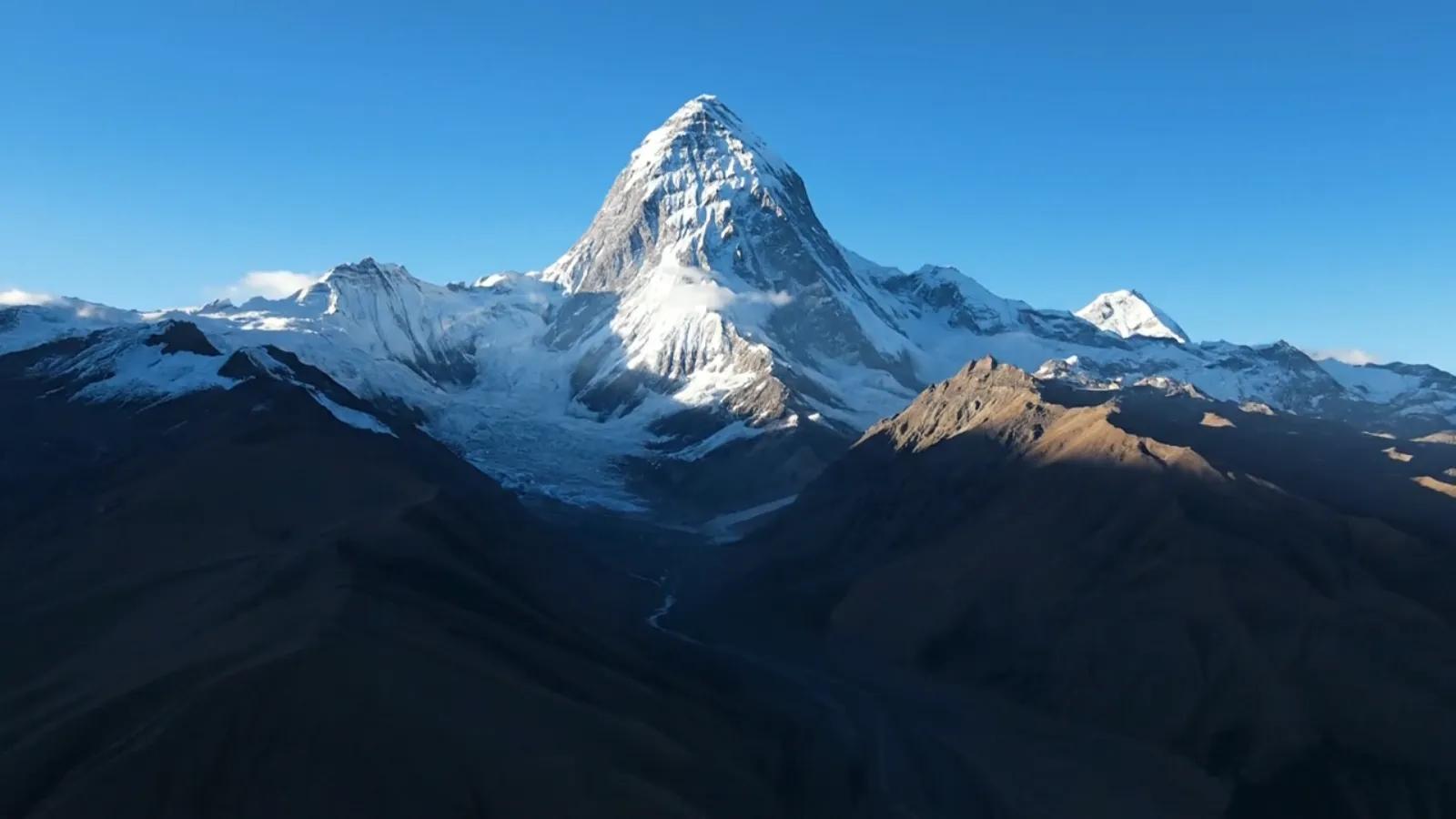
Decoding the Himalayan Arc: Active Uplift in Motion
The Himalayas are the world’s youngest and most dynamic mountain system, a living laboratory of orogenesis. Formed by the collision of the Indian and Eurasian plates about 50 million years ago, they continue to rise at a rate of 5–10 mm per year , counteracted by intense erosion.
Geomorphic and tectonic characteristics:
Compression and Folding: The crust here is under horizontal compression, forming thrusts and nappes like the Main Boundary Thrust (MBT) and Main Central Thrust (MCT).
River Incision and Relief: Steep gradients and deeply incised valleys (Ganga, Brahmaputra) show active fluvial downcutting keeping pace with uplift.
Seismic Activity: Frequent earthquakes reflect ongoing strain accumulation.
Glacial Morphodynamics: Erosion from glaciers continually reshapes the upper Himalayan topography.
From a geospatial perspective, the Himalayas exemplify a high-relief, high-energy system , where continuous tectonic deformation and surface processes are in equilibrium, a dynamic twin between uplift and erosion.
Decoding the Deccan Plateau: Ancient Stability and Structural Heritage
In contrast, the Deccan Plateau tells a quieter but equally powerful geological story. Formed from Cretaceous flood basalts around 66 million years ago, it represents one of the largest volcanic provinces on Earth.
Geomorphic and tectonic characteristics:
Basaltic Terrain: Layered flows create stair-step topography (the word “Deccan Trap” derives from the Swedish trappa , meaning steps).
Tectonic Stability: Lies in the Indian shield region with low seismicity, yet dissected by ancient fracture zones like the Godavari and Tapi rift systems.
Erosional Landforms: Mesas, buttes, and valleys dominate, shaped by differential weathering of basalt layers.
Drainage Networks: Rivers like Godavari and Krishna cut across plateaus following paleo-fracture alignments, visible as linear valleys in satellite imagery.
The Deccan’s geomorphology preserves the memory of deep-time volcanism while reflecting slow tectonic rejuvenation, an archive of the continent’s structural history.
Digitizing the Contrast: Remote Sensing and GIS Insights
Modern remote sensing reveals the morpho-tectonic dichotomy between these two regions vividly:
DEM Analysis: SRTM and CartoDEM data show extreme relief variance, Himalaya >6,000 m vs. Deccan 500–1,000 m.
Lineament Mapping: NE–SW trends dominate in the Deccan, while the Himalaya shows N–S compression-aligned thrusts.
Drainage Density & Slope Maps: High drainage density and steep slopes in the Himalayas reflect active tectonics; low slope, dendritic drainage in Deccan reflects stability.
InSAR & GNSS Data: Measure crustal deformation, compression in the north, slight flexure and intraplate stress in the Deccan.
By integrating these datasets, GIS provides a quantitative framework for comparing tectonic activity across terrains, from the restless mountains to the ancient plateau.
Amplifying Understanding: How These Systems Interact
Though morphologically distinct, both regions are linked by tectonic inheritance and geodynamic feedback:
The Indian Plate’s push under Eurasia causes flexural bending of its southern lithosphere, influencing uplift in the Himalayas and minor warping in the Deccan.
Drainage evolution connects them: rivers originating in the Himalayas feed plains that end in the Deccan basins.
Stress transfer from the active north margin sometimes reactivates old faults in peninsular India, an example of intraplate tectonics.
These interactions show that India’s topography is not static, it’s a spatial dialogue between old and young tectonic forces.
Case Example: Morpho-Tectonic Zonation via Geospatial Analysis
Recent studies using multi-source geospatial data have delineated India into morpho-tectonic zones integrating DEMs, seismicity, gravity, and magnetic data.
Himalaya: Classified as an Active Orogenic Zone with evolving thrust systems and high erosion rates.
Deccan Plateau: Identified as a Stable Shield Zone with localized uplift along pre-Cambrian faults.
Central India: Transitional corridor where stress migration from the north occasionally triggers seismic reactivation (e.g., Latur, Koyna).
This zonation helps in land-use planning, groundwater management, and seismic risk assessment , connecting morphology directly to national-scale decision-making.
Outlook: From Surface Patterns to Deep-Time Processes
Future Earth models will integrate both vertical and lateral tectonic motions into time-aware digital twins of India’s terrain. Such systems will simulate not just how the Himalayas rise or the Deccan erodes, but how both influence each other across geological time.
Imagine an India-wide geospatial model where uplift, stress, and erosion interplay continuously, from glaciers in Ladakh to basalt mesas in Maharashtra. That’s the next step in morpho-tectonic intelligence.
Conclusion
The Himalaya and Deccan aren’t opposites, they’re two expressions of India’s tectonic journey. One speaks of collision, the other of endurance. By decoding their contrasting morpho-tectonics, geospatial intelligence bridges the story of a restless north and a resilient south , capturing the dynamic equilibrium that defines the Indian subcontinent.