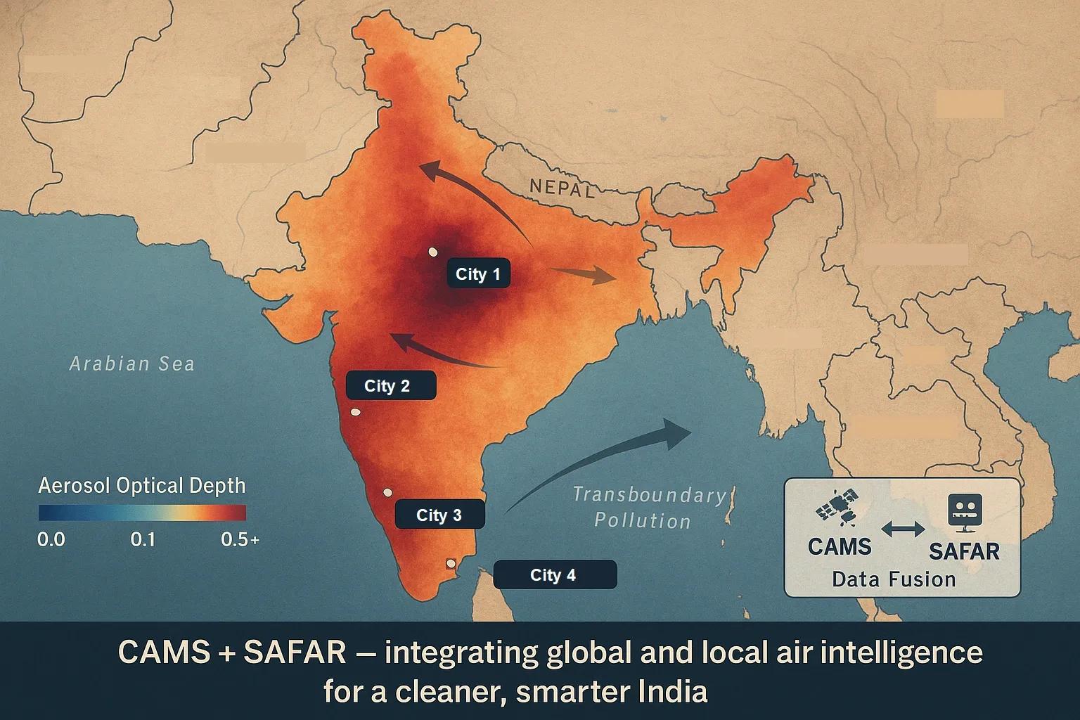
The Air Quality Data Puzzle
India’s air quality monitoring landscape is expanding fast, yet the data that could guide real action remains fragmented across systems .
Two of the most advanced yet underlinked frameworks are:
CAMS (Copernicus Atmosphere Monitoring Service) , Europe’s global satellite–model fusion platform.
SAFAR (System of Air Quality and Weather Forecasting And Research) , India’s city-scale forecasting network operated by IITM Pune.
Together, they hold the potential to create an end-to-end atmospheric digital twin for India, linking global dynamics with hyperlocal impacts.
But today, they operate as parallel silos , each powerful yet incomplete.
CAMS: The Global View from Space
The Copernicus Atmosphere Monitoring Service (CAMS) provides continuous data on atmospheric composition, including:
Aerosols (AOD, PM2.5, PM10)
Reactive gases (NO₂, O₃, CO, SO₂)
Greenhouse gases (CO₂, CH₄)
Fire emissions (GFAS)
It merges satellite observations (Sentinel-3, Sentinel-5P, MODIS) with global chemistry–transport models (IFS-CB05, MOZART).
Key features:
Spatial resolution: 0.1° (~10 km).
Temporal resolution: Hourly.
Forecast horizon: 120 hours.
Free and open access via ECMWF APIs.
CAMS provides a synoptic-scale context , identifying transboundary pollution inflows (e.g., dust from Arabia or smoke from Myanmar), but lacks city-level accuracy .
SAFAR: The Local Intelligence Layer
SAFAR , developed by IITM Pune under MoES, bridges the gap between meteorology and public health at an urban scale.
Operating in Delhi, Pune, Mumbai, and Ahmedabad , it fuses:
Ground-based sensors (PM₂.₅, PM₁₀, NO₂, CO, O₃).
Mesoscale weather models (WRF-Chem) for local dispersion.
Emission inventories at 1×1 km grid resolution.
Outputs:
72-hour air quality forecasts.
Health advisories.
Emission contribution analysis (e.g., transport, dust, biomass).
In essence, SAFAR is bottom-up , while CAMS is top-down , the missing link is how these two views converge.
The Integration Gap: Where Global Meets Local
Despite overlapping objectives, CAMS and SAFAR rarely interoperate due to structural differences:
Parameter - CAMS - SAFAR - Integration Potential
Scale - Global (~10 km) - Urban (1 km) - CAMS downscaling to SAFAR cities
Focus - Atmospheric composition - Local air quality - Combined vertical profiling
Data Source - Satellites + models - Ground + models - Data assimilation synergy
Frequency - Hourly - 3-hourly - Harmonized temporal resolution
Accessibility - Open API - Limited web dashboards - API exchange and standardization
By integrating CAMS’s satellite-based aerosol reanalysis with SAFAR’s ground observations and emissions inventories, India could build a multi-layer atmospheric intelligence network .
Why Integration Matters
🌍 1. Transboundary Pollution Tracking
CAMS can identify long-range dust and smoke transport that local sensors can’t see, critical for Delhi’s winter smog linked to stubble burning and dust inflow .
🏙️ 2. Model Calibration and Validation
CAMS data can help bias-correct SAFAR’s WRF-Chem outputs , improving predictive skill.
📡 3. Seamless Vertical Data Fusion
CAMS offers aerosol vertical profiles (up to 5 km), while SAFAR provides surface concentrations , together forming a 3D pollution field .
📊 4. Policy-Level Visibility
A unified framework can link source attribution to mitigation action , aligning city, national, and global emission reporting.
Technical Path Forward: The Air Quality Digital Twin
India can architect an Atmospheric Digital Twin Framework integrating CAMS + SAFAR through three tiers:
Tier 1, Data Assimilation Layer
Merge CAMS reanalysis and Sentinel-5P products with SAFAR’s ground and WRF-Chem outputs.
Use Ensemble Kalman Filters (EnKF) or 4D-Var to blend datasets.
Tier 2, AI-Based Downscaling
Apply machine learning to enhance CAMS’s 10 km data to 1 km SAFAR grids.
Models: U-Net, ConvLSTM , or GeoGAN for spatial super-resolution.
Tier 3, Advisory and Action Layer
Develop open APIs for municipalities, health agencies, and citizen dashboards.
Trigger real-time advisories and mitigation plans using fused AQI data.
The resulting twin would provide real-time, multi-scale visibility from global to street level.
Example: Delhi’s Air Quality Fusion Model
A pilot study by IITM (2023) combined CAMS AOD data , Sentinel-5P NO₂ columns , and SAFAR surface PM₂.₅ readings for Delhi:
Achieved correlation R² = 0.89 for PM₂.₅ nowcasts.
Identified biomass burning plume transport from Punjab 36 hours before surface detection.
Enabled early public health alerts and advisories.
This is proof that cross-system fusion can work , if data access and computation pipelines are standardized.
The Governance Challenge
While technical capability exists, the main barriers are institutional:
Data ownership silos between MoES, MoEFCC, and CPCB.
Access restrictions on model outputs.
Lack of national air data exchange standards.
A centralized Air Data Integration Framework (ADIF) could mirror the success of India-WRIS , hosting real-time air composition, reanalysis, and forecast layers from all sources.
Outlook: From Air Quality to Air Intelligence
The CAMS + SAFAR integration isn’t just about merging datasets, it’s about enabling anticipatory environmental governance.
A unified system can:
Predict air quality three days ahead with global inflow context.
Trigger adaptive emission control plans.
Support compliance reporting for carbon and pollutant inventories.
Inform climate-health analytics in real time.
The goal isn’t more models, it’s interoperability between models .
Conclusion
India stands at a rare atmospheric crossroads: CAMS gives the view from orbit , SAFAR gives the view from the street .
Bridging them will unlock the full spectrum of air intelligence , from global cause to local consequence.
Air doesn’t respect boundaries; our data shouldn’t either.