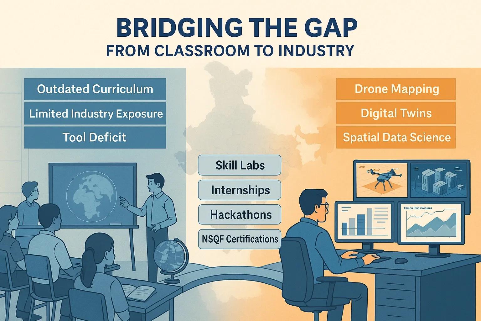
India stands at a crucial juncture in its geospatial journey, with robust policy support, new regulations, and a soaring demand for location-based intelligence in governance, infrastructure, environment, and business. However, despite its promise, the geospatial sector faces a pressing talent shortage and skill mismatch that threatens to slow down its growth and innovation. Addressing this gap is no longer optional, it is foundational to digital transformation and national competitiveness.
The Geospatial Industry’s Growth Trajectory and Demand for Talent
The geospatial industry in India has witnessed exponential growth, driven by government programs (such as Digital India, Smart Cities Mission, and Gati Shakti), the liberalized geospatial policy environment, and the proliferation of applications in AI, IoT, Digital Twins, and data analytics. Market projections estimate the sector's workforce requirement will quadruple between 2018 and 2025.
Yet, the availability of job-ready geospatial professionals remains critically low . While world-class institutions such as ISRO, IITs, and private sector leaders accelerate innovation, the supply of skilled graduates, especially with interdisciplinary expertise, lags significantly behind.
Key Gaps in India’s Geospatial Talent Pipeline
1. Outdated Curricula and Pedagogical Rigidities
Many polytechnics, engineering colleges, and universities still teach geospatial basics but lag behind the rapid pace of industrial innovation , particularly in remote sensing, AI, cloud GIS, and data integration.
Courses often do not reflect the needs of emerging industries, which now require expertise in programming, AI/ML, big data, BIM, and systems integration.
Only a minority of universities offer specialized degrees in geoinformatics, and even fewer offer research or doctoral programs.
2. Limited Industry-Academia Collaboration
A lack of deep partnerships restricts exposure to real-world challenges and hinders curriculum updates.
Internship and apprenticeship opportunities are limited and, when available, often lack alignment with live industry projects.
3. Fragmented Skilling Across Education Tiers
Polytechnics mainly provide technician-level training, but seldom articulate pathways for further study or direct employability in advanced geospatial domains.
Engineering and science graduates get foundational theory but miss practical, cross-domain, and enterprise-scale exposure.
4. Acute Shortage at Entry and Advanced Levels
Fresh graduates often lack hands-on skills, contemporary tools knowledge, and ‘innovation thinking’ necessary for immediate contribution.
There is a shortfall of high-calibre professionals at both the technician/analyst level (requiring programming and tool proficiency) and project management/solution architect levels (demanding domain, integration, and leadership skills).
5. Awareness and Accessibility
Geospatial education is rarely a top career choice, often due to lack of career counselling, societal advocacy, and direct visibility of geospatial opportunities.
Opportunities to Bridge the Gap
1. Curriculum Modernization and Flexibility
Polytechnics, engineering colleges, and universities must urgently revamp syllabi , integrating latest advances: AI/ML, cloud GIS, IoT, scripting, Digital Twins, and BIM.
Encourage interdisciplinary modules and electives to bring geospatial perspectives into mainstream engineering, planning, and data science programs.
2. Industry-Academia Partnerships
Initiate co-developed courses, industry-led workshops, guest lectures, and live projects .
Private sectors and public leaders like ISRO should partner to offer internships, apprenticeships, and certification aligned with market needs.
Institutionalize advisory boards comprising both academic and industry experts to continually update training to real-world relevance.
3. Skilling for All Tiers
Education Level - Training Focus - Desired Outcomes
Polytechnics - Tool proficiency, field mapping, basic GIS - Technician/analyst-level employment
Engineering Colleges - Advanced technical depth, systems integration, programming - Solution architects, analysts, developers
Universities - Research, entrepreneurship, policy - Next-gen innovators, domain experts
Implement articulated pathways from diploma to degree to advanced research, enabling upskilling and reskilling across careers.
4. Experiential and Lifelong Learning
Promote ‘learning-by-doing’ via simulation labs, real-world problem statements, hackathons, and online platforms (MOOCs, micro-certifications).
Champion re-skilling, up-skilling , and short-term courses for working professionals to adapt rapidly to technological shifts.
5. National Policy and Strategic Initiatives
Align skilling efforts to the National Education Policy 2020, Skill India Mission, and Atmanirbhar Bharat vision.
Government-led challenges (e.g., Geo-Innovation Challenge) and capacity-building summits bring together academia, industry, and policy-makers for continuous dialogue and roadmap creation.
6. Advocacy, Outreach, and Cross-Sectoral Integration
Boost geospatial career visibility through education fairs, awareness campaigns, and school-level STEM integration .
Encourage diversity, gender, geography, economic background, to widen the talent pool.
Conclusion: From Challenge to Opportunity
India’s emerging geospatial economy offers a watershed moment to create a globally competitive talent pipeline. However, bridging the current divide requires a multipronged, sustained strategy .
Modernizing the curriculum
Fostering deep, two-way industry-academia engagement
Creating clear, articulated skilling pathways from diploma to advanced research
Scaling experiential learning across education tiers
Encouraging lifelong skilling and government participation
Amplifying outreach to transform perceptions and attract top minds
By addressing structural barriers and accelerating both systemic and grassroots innovation in skilling, India can secure its place as a geospatial powerhouse, not only filling industry needs but also shaping digital transformation at the national and global levels .
This expository analysis aims to inspire policy leaders, academic heads, and business strategists to collaborate for a more connected, future-ready geospatial workforce, unlocking a new era of growth, inclusion, and impact for India.