The World’s Largest Geospatial Blind Spot
The Himalaya is one of the most studied mountain systems on Earth, and simultaneously one of the hardest to observe.
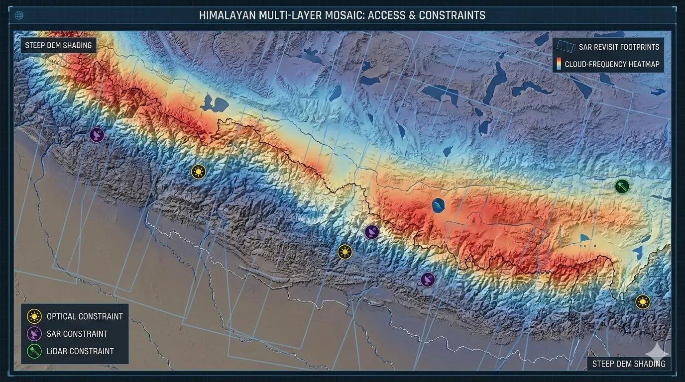
Its steep relief, deep valleys, monsoon clouds, sparse ground networks, and rapidly changing cryosphere create a data-access bottleneck unlike any other region on the planet .
Even with dozens of satellites overhead, the Himalaya routinely asks a difficult question: Do we truly “see” the mountains, or do we interpolate around the parts we can’t see?
Geospatial science in these ranges is as much about data availability as it is about data interpretation .
Why the Himalaya Is a Data Challenge
Three constraints define Himalayan remote sensing:
1️⃣ Terrain Complexity
Vertical cliffs, hanging valleys, and narrow gorges distort:
Pixel geometry
Radiometric consistency
Solar illumination angles
Shadowing in optical imagery (especially winter)
Layover & foreshortening in SAR data
Even high-quality DEMs struggle with steep ridgelines.
Terrain itself becomes the first and largest layer of data loss.
2️⃣ Clouds & Atmospheric Constraints
The Himalaya sits under persistent cloud cover for most of the year.
Monsoon (Jun–Sep): 60–80% cloud cover
Winter storms: heavy snow + moisture
Spring: dust + haze from Indo-Gangetic plains
Valley inversions: persistent fog pockets
This severely limits the optical data cadence .
Example: A Sentinel-2 5-day revisit may deliver only one usable image per month during monsoon.
This is why Himalayan analytics lean heavily on SAR, DEMs, microwave sensors, and multi-temporal cloud-free composites .
3️⃣ Cadence & Continuity, The Temporal Gap
Many critical processes in the Himalaya evolve faster than satellite return cycles:
Avalanches → minutes to hours
GLOFs → hours
Rockfalls → instant
Snowmelt pulses → days
Landslide creep → weeks
Glacier surface changes → months
But satellite cadence is often:
Optical: 5–15 days
SAR: 6–12 days (Sentinel-1), daily only for commercial systems
LiDAR (ICESat-2) : single ground track every 90 days
Very-high-resolution optical: on-demand, tasking constraints
This mismatch means many hazard precursors occur “between images” .
The mountains change faster than we can consistently observe.
How Geospatial Science Overcomes These Constraints
A. Using SAR as the Himalayan Backbone
Synthetic Aperture Radar penetrates clouds and darkness, making it the primary dataset for:
Snow classification
Landslide detection
Glacier velocity
Terrain subsidence
Wet-snow avalanches
Lake expansion
Freeze–thaw cycles
Sentinel-1, ALOS-2, TerraSAR-X, and NISAR (upcoming) together create a more reliable time-series in a region where optical is unreliable.
B. DEM Fusion for Reliable Terrain Modeling
DEM accuracy is critical for:
Avalanche zonation
Hydrology
Glacier mass balance
Road and tunnel planning
Visibility and shadow modeling
Himalayan DEM improvements use:
SRTM + ASTER + ALOS fusion
TanDEM-X for steep ridges
Planet stereo DEMs (3–4 m)
ICESat-2 elevation control points
UAV photogrammetry for sub-meter accuracy in critical valleys
DEM fusion is a central part of Himalayan geospatial science.
C. Cloud-free Compositing & Seasonal Mosaics
Tools like Harmonic regression , median mosaics , and multi-year blending allow reliable optical imagery where single scenes fail.
In the Himalaya:
6-month composites often replace “fresh” images
Monsoon composites help identify landslide scars
Winter composites reveal snowline trends
The strategy is: If you cannot see the mountains today, look at them through time.
D. Blended Workflows: Optical + SAR + Ancillary Data
Almost every critical analysis in the Himalaya now uses blended stacks:
Glacier mass balance → ICESat-2 + TanDEM-X + SAR
Snow hydrology → optical albedo + SAR snow depth + reanalysis SWE
Landslide detection → optical scars + InSAR deformation
GLOF risk → optical lake area + SAR coherence + DEM morphology
Permafrost → thermal LST + rock glacier mapping + InSAR subsidence
This hybrid approach compensates for missing or low-cadence data.
The Himalayan Data Ecosystem in Practice (India)
1. NRSC & ISRO
Bhuvan Himalayan datasets
Snow & glacier products
SAR-based deformation analytics
River basin management layers
2. SASE / DRDO
Avalanche hazard alerts
Field snowpack profiles
SAR-based wet-snow analytics
3. Geological Survey & Wadia Institute
Landslide zonation
Rock glacier inventories
Field validation
4. IMD & IITs
Weather + snow hydrology models
Nowcasting layers
High-altitude AWS networks
5. International Missions
ICESat-2, TerraSAR-X, Sentinel-1/2
CryoSat-2 thickness data
NASA SRTM, AIRS, ECOSTRESS
This ecosystem is evolving into an integrated mountain observation system .
Toward a Himalayan Data Digital Twin
A Himalayan Digital Twin would integrate:
Multi-sensor imagery
DEM evolution
Snow and glacier dynamics
Landslide and subsidence fields
Real-time weather and AWS data
Hazard triggering conditions
Infrastructure exposure layers
This twin could provide:
Automatic hazard warning maps
Seasonal water forecasts
Glacier mass balance dashboards
Avalanche corridor updates
Real-time GLOF monitoring
Infrastructure risk scores
In a region where data access is difficult, a digital twin becomes the unifying intelligence layer .
Conclusion
The Himalaya is a landscape that hides itself, behind clouds, under snow, and within steep, complex topography.
Yet the same region demands the densest geospatial intelligence: for water, hazards, infrastructure, and climate adaptation.
Terrain, clouds, and cadence form the Himalayan data problem.
Hybrid remote sensing, SAR dominance, DEM fusion, and future digital twins form the Himalayan data solution.