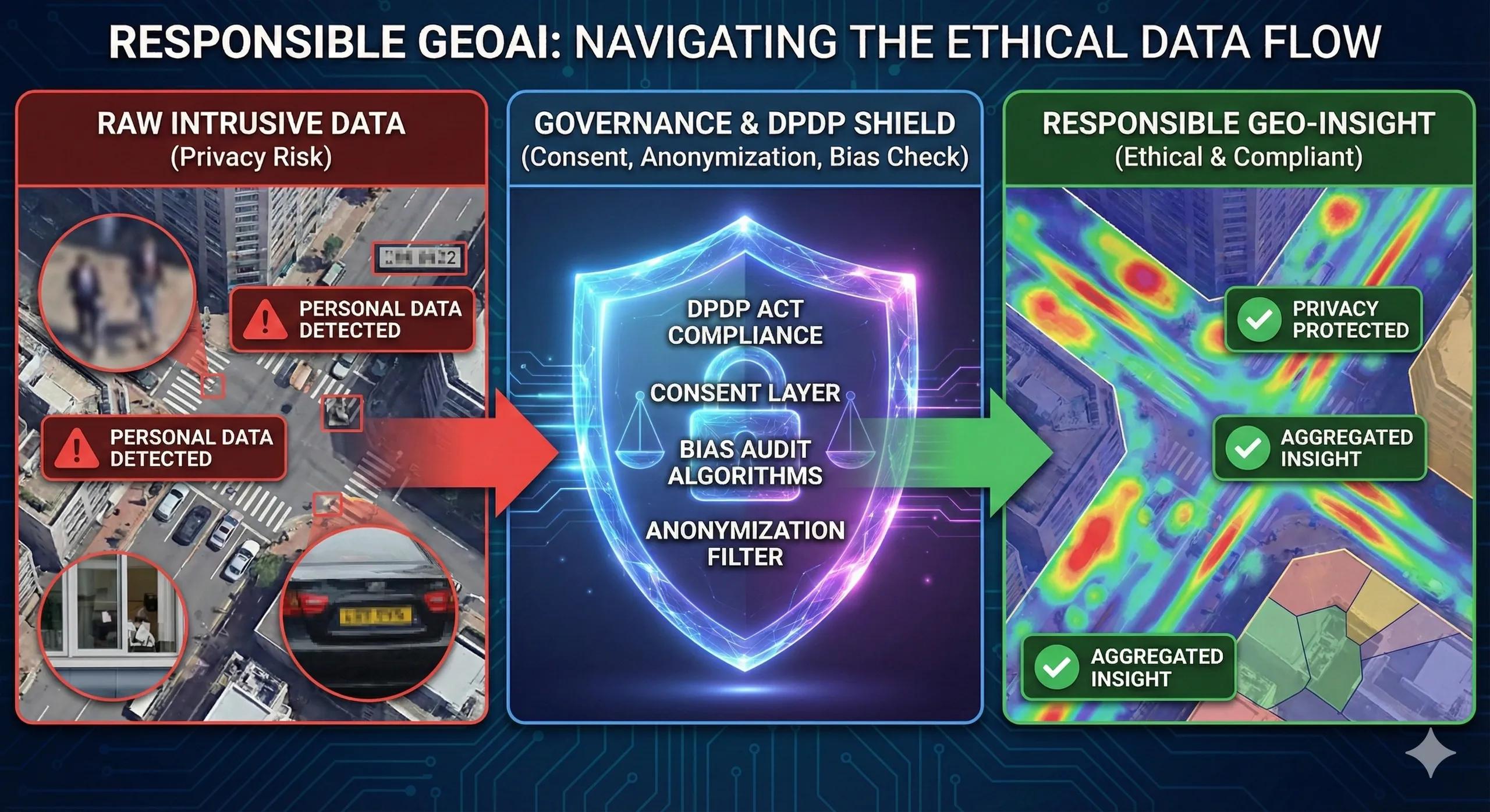
Geospatial AI is moving fast, faster than most governance systems can keep up with. As satellite data, UAV imagery, and spatial analytics become embedded in everyday operations, one question keeps returning: How do we protect people when location becomes the strongest identifier of all?
India’s Digital Personal Data Protection (DPDP) Act makes this even more urgent.
Location is personal data. GeoAI models can infer far more than what is explicitly collected. And as we automate decisions, from crop advisories to land records verification to urban mobility planning, the stakes rise.
Today’s theme focuses on how governance, consent, privacy, and bias shape the future of Responsible GeoAI .
1. Why Governance Matters Now
Geospatial systems today don’t just map the world, they predict , classify , and influence decisions across governments, agriculture, utilities, logistics, and public health.
This introduces governance risks:
Location trails revealing personal habits
AI models amplifying social or geographic bias
Datasets collected without informed consent
Automated decisions affecting entitlements or compliance
Cross-border data flows without adequate safeguards
As GeoAI penetrates public infrastructure and citizen services, governance becomes a foundational layer, not an afterthought.
2. DPDP Act: What It Means for Geospatial Data
India’s DPDP Act sets a clear direction: purpose limitation, user consent, and lawful processing .
For geospatial applications, this translates into:
Explicit consent when location data can identify a person
Notice that explains what the geospatial data will be used for
Data minimization collect only what is needed for the service
Secure processing of high-sensitivity layers (health facilities, security zones)
User rights : withdrawal of consent, correction, grievance redressal
Stringent obligations for data fiduciaries using GeoAI models
The Act does not restrict innovation, it guides how to build trustworthy systems that businesses can confidently scale.
3. The Bias Problem in GeoAI Models
GeoAI models inherit bias from three sources:
a) Skewed Datasets
Urban areas often have richer imagery and IoT coverage
Rural regions appear sparse, creating distorted predictions
Historical data can encode inequities (e.g., land-use restrictions)
b) Algorithmic Bias
Models may overfit dominant terrain, climatic zones, or socio-economic patterns, reducing accuracy for under-represented regions.
c) Deployment Bias
Where the AI is used, and by whom, can shift outcomes.
Example: a crop stress model calibrated in Punjab may mislead farmers in Telangana without local tuning.
Bias isn’t a technical flaw alone. It becomes a governance issue when GeoAI outputs influence:
Subsidy eligibility
Environmental inspections
Compliance decisions
Flood/heat vulnerability assessments
Credit/insurance risk scoring
4. A Responsible GeoAI Framework for India
A practical framework to align geospatial innovation with DPDP and global governance standards:
1️⃣ Transparent Purpose Definition
Clearly define why each dataset is collected and how AI outputs will be used.
2️⃣ Consent + Privacy by Design
Collect coarse-grained data when fine-grained is unnecessary
Use anonymization and differential privacy for sensitive geographies
Provide easy consent withdrawal mechanisms
3️⃣ Bias Detection Pipelines
At model-training and deployment stages, track:
Accuracy drift by region
False positives/negatives for different terrain types
Representation gaps in training datasets
4️⃣ Accountability & Human Oversight
Automated GeoAI decisions must have:
A human review path
Clear escalation channels
Documented decision logic
5️⃣ Secure & Sovereign Data Infrastructure
On-prem or sovereign cloud for regulated sectors
Role-based access
Encryption for sensitive layers
6️⃣ Impact Audits
Annual or quarterly audits covering:
DPDP compliance
Environmental and social impact
Bias, drift, and model explainability
Vendor compliance for third-party datasets
5. Example: Responsible GeoAI in Agriculture Advisory
Consider a state-wide crop advisory system using satellite data, soil sensors, and weather models.
Risks if not governed well:
Farmers’ location trails misused by third parties
Advice biased toward well-instrumented districts
Automated alerts misinterpreted as compliance notices
Responsible approach:
Collect only plot-level data required for advisories
Mask farmer identity in all analytics layers
Use district-specific calibration models
Share transparent model accuracy reports
Provide farmers with opt-in/opt-out rights
This shifts the system from “AI telling farmers what to do” to “AI assisting farmers with their consent.”
6. Why This Matters for Businesses
Businesses deploying geospatial systems gain:
Reduced regulatory risk
Higher customer trust
Better model performance with bias checks
Easier enterprise adoption due to governance clarity
Smoother audits & certification pathways
Responsible GeoAI isn’t overhead, it’s a competitive advantage.
Closing Insight
As GeoAI becomes embedded in India’s public systems, agriculture, utilities, and infrastructure, trust becomes the currency of scale .
Governance is not about slowing innovation. It creates the foundation for safe, compliant, and equitable geospatial intelligence, where people know their data is respected, and businesses know their systems are future-proof.
Would you trust an AI system that knows where you are, if you don’t know how it works?