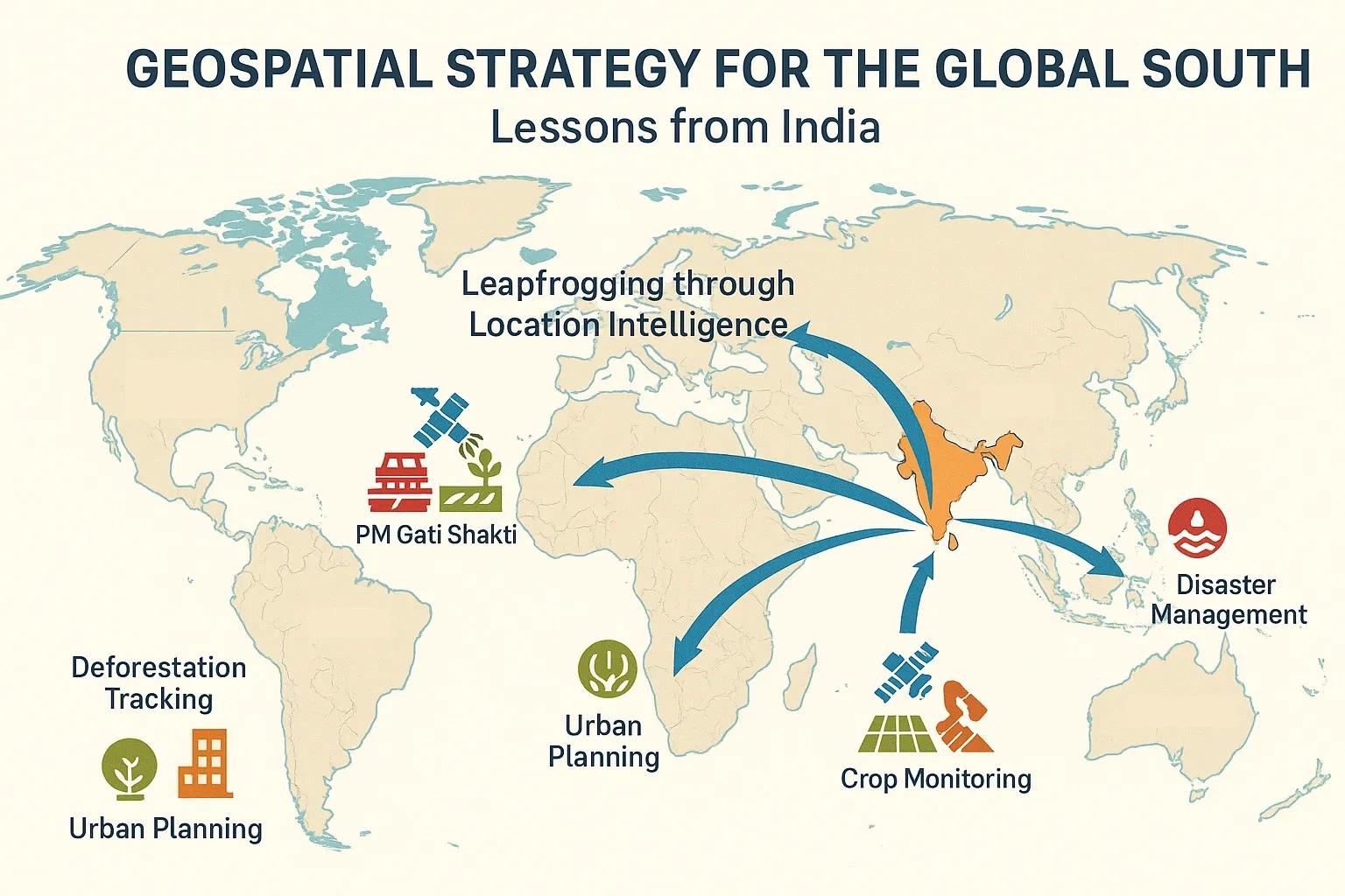
In recent years, Global South, a term broadly used for countries in Asia, Africa, and Latin America, has faced increasing pressure to solve complex development challenges with limited resources. Issues like climate change, urban sprawl, food insecurity, and infrastructure gaps demand data-driven, location-based insights. One proven way to address these issues is through a robust geospatial strategy. India, with its rapid advancements in geospatial data infrastructure, regulatory liberalization, and integration of geospatial technologies across sectors, offers a practical roadmap for other emerging economies to follow.
This article outlines key lessons from India’s geospatial evolution and explains how countries in the Global South can build efficient, scalable, and inclusive geospatial ecosystems, not by following the traditional, incremental model of Western nations, but by leapfrogging with targeted policy, innovation, and public-private collaboration.
The Importance of a National Geospatial Strategy
A national geospatial strategy aligns the collection, governance, and use of geospatial data to drive development goals. For emerging economies, this includes:
Improving decision-making with real-time, location-specific insights
Supporting infrastructure development (roads, utilities, urban planning)
Enhancing agriculture and rural services via precision farming and resource mapping
Enabling disaster preparedness and climate resilience
Accelerating digital governance through spatially-enabled public services
In short, a geospatial strategy is not just about maps, it’s about enabling smarter policies and measurable development outcomes.
Lesson 1: Liberalizing the Geospatial Economy, The Indian Policy Shift
Until 2021, India’s geospatial sector was heavily restricted, with limitations on who could collect and use spatial data. This led to slow adoption, duplicated efforts, and underutilization of location intelligence.
In February 2021, India launched a new geospatial data policy that:
Deregulated geospatial data collection by Indian private companies
Removed licensing and approval restrictions for mapping
Promoted open data sharing across government departments
Encouraged startups to use high-resolution data without red tape
Impact: Within two years, India saw a rise in private-sector participation, satellite startups, AI-based GIS solutions, and integration of location data across e-governance platforms. Countries in the Global South can replicate this by removing outdated colonial-era restrictions and aligning policy with innovation needs.
Lesson 2: Building Foundational Infrastructure, Digital India and Bhuvan
India's success is anchored in its national digital infrastructure. The Digital India initiative created a backbone of digital IDs (Aadhaar), payment systems (UPI), and data governance frameworks. These layers are now being integrated with Bhuvan, India’s national geoportal developed by ISRO, which provides:
Satellite imagery (IRS, Cartosat)
Thematic layers (land use, water bodies, terrain)
Tools for spatial analysis
APIs for developers and researchers
Takeaway: A central, government-supported spatial data platform ensures equal access to critical datasets. Emerging economies should invest in localized versions of such platforms, preferably open-source and built using regional languages and local data.
Lesson 3: Use Cases That Matter, From Agriculture to Urban Planning
India’s geospatial efforts are not limited to cartographic outputs. Several mission-driven projects illustrate how geospatial data directly supports economic and social progress:
PM Gati Shakti: A GIS-based infrastructure master plan aligning transport, energy, and logistics projects
Soil Health Cards and Crop Monitoring: Use of satellite imagery and field sensors to optimize fertilizer use and crop cycles
Smart Cities Mission: Urban utilities, disaster risk maps, and mobility analysis using GIS platforms
Digital India Land Records Modernization Programme (DILRMP): Geo-referenced land records for ownership clarity and financial inclusion
Recommendation: Start with sector-specific geospatial programs tied to national priorities, agriculture, utilities, transportation, health, or climate resilience, and expand iteratively.
Lesson 4: Leveraging Public-Private-Academic Collaboration
The Indian model demonstrates how government initiatives combined with private-sector innovation and academic research can accelerate outcomes:
Startups like Satsure, MapmyIndia, and Indshine provide analytics platforms built on open or commercial satellite imagery
Institutions like IITs, IIIT-Hyderabad, and ISRO contribute R&D, training, and technical validation
Government programs create demand and set quality standards
This ecosystem approach ensures that solutions are context-specific and scalable.
For other Global South nations, nurturing such ecosystems involves:
Offering grants and incubators for geospatial startups
Promoting research-industry partnerships
Hosting open innovation challenges
Mandating local data storage and edge processing to ensure sovereignty
Lesson 5: Data Standards, Interoperability, and Ethics
India’s growing adoption of standards like OGC (Open Geospatial Consortium) protocols ensures interoperability across platforms. The National Geospatial Policy 2022 introduced governance frameworks for:
Metadata standards
Quality validation
Data sharing protocols
Ethical use of AI in spatial analysis
Countries with emerging digital ecosystems must ensure that their geospatial strategies align with:
Interoperable platforms , enabling data sharing between ministries, companies, and civil society
Data privacy and protection laws , such as India’s Digital Personal Data Protection Bill , to balance innovation with individual rights
AI and automation standards , to ensure that location data used in decision-making is explainable and unbiased
How to Leapfrog: Action Plan for Emerging Economies
Instead of replicating the slow, phased geospatial adoption models of the West, emerging economies can leapfrog with this phased approach:
Regulatory Enablement Deregulate mapping and satellite data use Define data ownership and access rights
Baseline Infrastructure Build a national spatial data portal (open-source preferred) Integrate with national ID, digital payments, and sectoral databases
Targeted Sector Pilots Start with agriculture, land records, or logistics Use public-private partnerships for scale and speed
Workforce Development Launch short-term GIS training programs for local youth Partner with universities for diploma and certification programs
Incentivize Local Innovation Offer sandbox environments for startups Host spatial hackathons focused on real-world problems
Regional Cooperation Collaborate across borders for satellite data sharing, disaster alerts, and knowledge exchange Develop standards and regional data commons for the Global South
Conclusion
India’s geospatial journey is still evolving, but it already offers valuable lessons. With the right mix of policy liberalization, foundational infrastructure, sectoral focus, and ecosystem building, emerging economies can avoid legacy pitfalls and create spatially intelligent nations faster.
Geospatial strategy is not just a tech upgrade, it's a developmental imperative. For the Global South, this is the moment to leap.