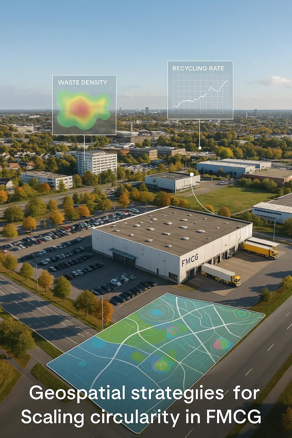
The Fast-Moving Consumer Goods (FMCG) industry, encompassing packaged food, personal care products, beverages, and household essentials, is among the most resource-intensive sectors globally. With its vast and complex supply chains, short product life cycles, and high volumes of packaging waste, FMCG contributes significantly to environmental degradation. In response, businesses across the sector are now adopting circular economy models to reduce waste, optimize resources, and build resilience.
But the shift from linear to circular operations is not just a matter of changing materials or introducing recycling programs. It requires strategic visibility, data-driven decision-making, and localized planning, capabilities that can be unlocked through geospatial intelligence. This article explores how geospatial technologies, including Geographic Information Systems (GIS), remote sensing, and location analytics, enable FMCG companies to scale circular strategies across their operations.
The Circular Imperative in FMCG
Circular economy in FMCG focuses on:
Designing products and packaging for reuse or recyclability
Sourcing renewable or recycled raw materials
Creating reverse logistics systems for collection and reuse
Localizing production to reduce emissions and supply chain risks
Unlike durable goods sectors, FMCG operates on rapid production and consumption cycles, making traditional sustainability approaches less effective. Geospatial tools address this by offering real-time, location-specific insights into sourcing, distribution, consumption, and waste patterns, essential for operationalizing circularity at scale.
Key Geospatial Applications in FMCG Circular Strategies
1. Mapping Waste Generation and Recovery Zones
FMCG brands generate large volumes of packaging waste, especially in plastic and multi-layered formats. Using GIS, companies can:
Identify high-density consumption zones based on sales, population, and retail footprints
Overlay this with municipal waste generation and recycling infrastructure data
Detect underserved regions with poor waste collection or processing access
This supports targeted investment in collection points, Material Recovery Facilities (MRFs), and take-back schemes, especially in emerging markets where waste leakage is high.
2. Optimizing Reverse Logistics for Packaging and Reuse
Circularity depends on efficient reverse logistics, bringing back used packaging or unsold goods for reuse, recycling, or remanufacturing. Geospatial routing tools can:
Design optimized pickup routes for returnable packaging (e.g., crates, refill bottles)
Identify backhaul opportunities from retail locations to reduce empty runs
Model hub-and-spoke systems for sorting and redistribution centers
By minimizing transportation costs and emissions, geospatial routing ensures that circular flows are both environmentally and economically sustainable.
3. Supporting Localized Manufacturing and Sourcing
FMCG companies are increasingly adopting local production models to reduce supply chain disruptions and environmental impact. GIS tools enable:
Site selection for regional manufacturing or co-packing facilities based on proximity to raw materials, markets, and infrastructure
Analysis of local water, energy, and waste capacity to ensure sustainable operations
Mapping suppliers with access to circular feedstock (e.g., rPET, compostable materials, agricultural residues)
This helps shift from global, linear supply chains to resilient, circular value chains.
4. Monitoring Agricultural Supply Chains for Circular Input
For food and beverage manufacturers, circularity starts at the farm level. GIS and remote sensing are used to:
Monitor soil health, crop rotation, and water use in regenerative farming systems
Identify zones for bio-waste collection and conversion into packaging or energy
Support supplier compliance with sustainable sourcing standards
These capabilities align with circular goals by ensuring that raw materials are sourced regeneratively and transparently.
Enabling Extended Producer Responsibility (EPR) with GIS
Many governments are implementing Extended Producer Responsibility (EPR) policies requiring FMCG companies to take back a portion of their packaging or pay for its recovery. GIS helps organizations:
Visualize their product footprint across geographies
Plan logistics and partnerships with local recyclers
Generate dashboards to track and report EPR compliance
For example, in India, brands must show geo-tagged evidence of waste collected and processed against targets. GIS platforms streamline this through real-time waste traceability.
Case Example: Circular Refill Stations for Personal Care Products
A multinational FMCG brand pilots refill stations for shampoos and detergents across urban centers.
Geospatial Role:
GIS is used to map store density, consumer demographics, and waste collection infrastructure
Ideal pilot zones are identified by layering sales data, customer footfall, and local waste management quality
As the program scales, location analytics guide where to expand refill models and where to use alternative circular packaging
Result: A 30% reduction in single-use plastic in selected markets, with plans to expand to 100+ cities using a GIS-driven rollout strategy.
Benefits of Geospatial Strategies in FMCG Circularity
Impact Area: Geospatial Contribution
Waste Reduction: Targeted mapping of leakage hotspots and recovery planning
Operational Efficiency: Optimized logistics and infrastructure siting
Compliance: Geo-tagged monitoring for EPR and ESG reporting
Resource Optimization: Better site selection for circular sourcing and local manufacturing
Customer Engagement: Customized circular models based on regional behaviors and needs
Integration with Other Technologies
Geospatial data becomes more powerful when integrated with:
IoT : Sensors on packaging and bins provide real-time waste tracking
Digital Twins : Simulate FMCG supply chain behavior to plan circular flows
AI and ML : Predict waste generation, route optimization, and demand for recycled content
BIM : Plan circular-ready infrastructure for factories and distribution centers
Together, these systems enable intelligent circular ecosystems that are responsive, efficient, and scalable.
Challenges to Address
Challenge: Mitigation Strategy
Data gaps in emerging markets: Partner with local agencies, NGOs, and remote sensing providers
Fragmented waste systems: Use spatial tools to unify recovery networks and track flows
Resistance to reverse logistics costs: Demonstrate ROI through routing optimization and secondary material value
Regulatory complexity: Implement geospatial dashboards for real-time compliance visibility
Scaling circularity in FMCG requires not only tech adoption but also cross-sector collaboration, policy engagement, and consumer education.
Conclusion
For the FMCG industry, circularity isn’t just a sustainability trend, it’s a business imperative. However, achieving it at scale requires granular, location-based decision-making across sourcing, distribution, waste recovery, and compliance.
Geospatial strategies provide the necessary intelligence and visibility to operationalize circularity. From mapping waste flows and optimizing reverse logistics to planning localized sourcing and infrastructure, GIS is becoming a foundational layer for circular FMCG models.
Companies that embed geospatial tools into their operations will be better positioned to meet sustainability goals, comply with evolving regulations, and lead in the next generation of consumer engagement, one that’s not just fast-moving, but also regenerative and responsible.