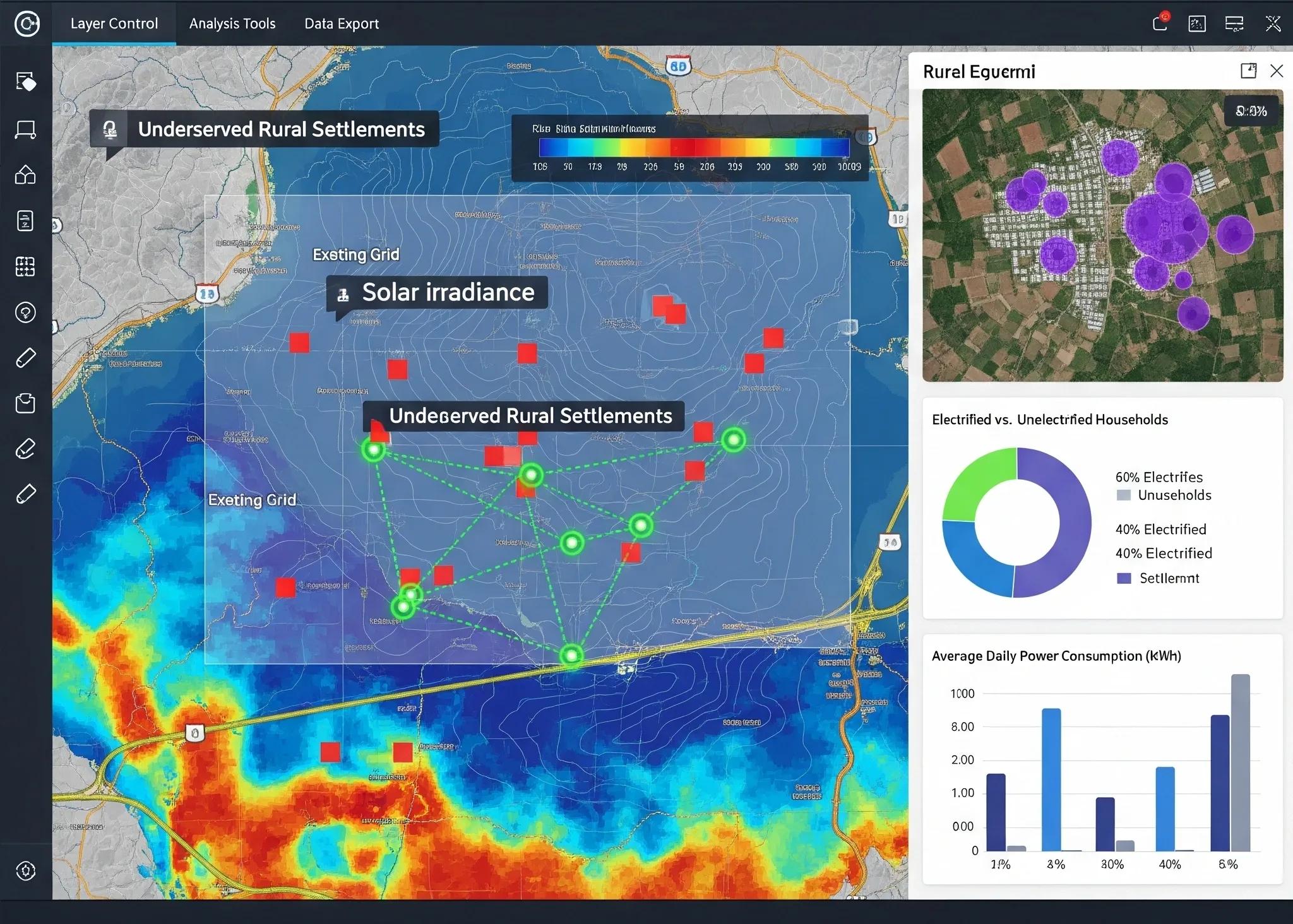
The global push toward decentralized energy systems is accelerating, especially in underserved and remote regions where traditional grid extension is economically or technically unviable. Microgrids, localized energy systems capable of operating independently or in conjunction with the main grid, are emerging as a resilient and scalable solution. One of the key enablers of successful microgrid planning and deployment is geospatial intelligence (GEOINT) .
Geospatial intelligence, which involves the analysis and visualization of spatial data to support decision-making, plays a critical role in identifying viable microgrid sites, optimizing resource allocation, and ensuring operational efficiency. This article explores how GEOINT supports grid decentralization, particularly in underserved areas, through a technical lens.
1. Understanding Grid Decentralization and Microgrids
Decentralized energy refers to the generation and distribution of electricity closer to the point of consumption. Unlike centralized grids, which depend on large-scale power plants and extensive transmission infrastructure, decentralized grids often include small-scale energy sources such as solar PV, wind turbines, biomass, and energy storage systems.
Microgrids are a prominent form of decentralized energy infrastructure. These systems:
Serve specific communities or facilities.
Integrate various distributed energy resources (DERs).
Can operate autonomously in "island mode" during main grid failures.
Microgrids are especially beneficial for rural or underserved populations where electrification through conventional grids is prohibitively costly or delayed.
2. The Role of Geospatial Intelligence in Microgrid Planning
GEOINT leverages spatial data from Earth observation (EO) satellites, UAVs (drones), GIS, and remote sensing tools to analyze geographic patterns and infrastructure conditions. Here’s how it applies across key phases of microgrid development:
a. Site Identification and Feasibility Analysis
Geospatial data layers, such as population density, land use/land cover (LULC), topography, solar insolation, wind potential, and proximity to existing infrastructure, can be overlaid and analyzed to:
Pinpoint off-grid and underserved communities.
Identify optimal locations for renewable energy assets.
Avoid unsuitable areas like flood zones, dense forests, or protected lands.
Example: Remote sensing and GIS tools can assess solar PV potential by analyzing historical solar radiation data, tilt and orientation of terrain, and atmospheric transparency. This enables prioritization of high-yield solar sites.
b. Demand Mapping and Load Forecasting
Accurate energy demand estimation is vital. GEOINT supports:
Mapping building footprints using satellite imagery and object detection models.
Estimating household sizes and consumption patterns using census data linked to geospatial layers.
Classifying regions by commercial, agricultural, or residential use to tailor grid capacity.
Machine learning algorithms trained on spatial datasets can forecast seasonal and long-term energy demands with higher accuracy, even in data-scarce regions.
c. Infrastructure Planning and Optimization
Microgrid performance depends on well-planned infrastructure. GEOINT enables:
Route optimization for power lines and distribution networks.
Terrain analysis to minimize construction challenges.
Identification of bottlenecks or overlaps in resource distribution.
GIS-based network modeling helps simulate different grid layouts and select the most cost-effective and technically feasible option.
3. Integrating Socioeconomic and Environmental Variables
In underserved regions, microgrid adoption hinges not just on technical viability but also on social, economic, and environmental suitability. GEOINT allows planners to incorporate these multidimensional variables:
Socioeconomic data (e.g., income, employment, education) geotagged with settlement locations helps determine willingness to pay, affordability, and suitable business models (pay-as-you-go, community-owned, etc.).
Environmental constraints like protected biodiversity zones, land tenure conflicts, or seasonal flooding zones can be identified early to prevent project delays.
Climate vulnerability layers , such as heat maps and flood risk zones, inform grid resilience planning.
By integrating these data layers into a geospatial platform, stakeholders can assess trade-offs and design microgrids that are both sustainable and equitable.
4. Dynamic Monitoring and Predictive Maintenance
GEOINT isn't limited to planning, it also plays a major role in real-time monitoring and maintenance post-deployment.
Drones equipped with thermal and visual sensors monitor the health of solar panels, wind turbines, and transmission lines.
Change detection algorithms applied on satellite imagery detect land encroachments or environmental degradation around infrastructure sites.
IoT sensors can stream performance data to centralized geospatial dashboards, enabling predictive maintenance using spatial alerts.
For instance, spatial heatmaps can be used to track battery degradation or identify high-loss zones in the distribution network.
5. Supporting Regulatory and Financial Decisions
For governments and investors, geospatial dashboards offer a high-level overview of electrification progress and ROI:
Project prioritization: Areas with the highest electrification gaps and renewable potential can be fast-tracked.
Subsidy targeting: GEOINT helps allocate public funds based on spatial equity, ensuring marginalized populations benefit first.
Impact assessment: Before-and-after satellite imagery helps visualize development outcomes, newly electrified homes, nightlight growth, or business activity, thereby aiding in policy review and future planning.
6. Challenges in GEOINT-Driven Microgrid Planning
Despite its advantages, GEOINT-based microgrid planning faces several challenges:
Challenge - Details
Data Scarcity - In many underserved regions, up-to-date spatial and socioeconomic data is missing or unreliable.
Limited Ground Verification - Satellite data needs to be ground-truthed, especially for localized infrastructure details.
Technical Capacity Gaps - Regional planners may lack skills in GIS tools, modeling, or spatial analytics.
Privacy and Land Ownership Issues - Mapping personal properties can raise privacy or legal concerns without proper frameworks.
These challenges call for capacity building, collaborative data sharing platforms, and integration of community-driven data collection.
7. India’s Context: Geospatial Push for Decentralized Electrification
In India, initiatives like the Revamped Distribution Sector Scheme (RDSS) and KUSUM are increasingly embracing GIS tools for power infrastructure planning. The recently launched National Geospatial Policy (2022) provides a framework for improving access to spatial data, which can accelerate microgrid deployments in states like Jharkhand, Chhattisgarh, and parts of the Northeast.
Nonprofits like SELCO Foundation and Smart Power India are already using GIS platforms to identify dark spots (unelectrified hamlets) and plan solar microgrids in tribal and forested areas.
8. The Way Forward: A Unified Spatial Platform for Grid Planning
To fully leverage geospatial intelligence in grid decentralization, there’s a need for integrated platforms combining:
Satellite data providers (e.g., ISRO, Sentinel, Landsat)
Local energy utilities
IoT-based asset management
Cloud-based GIS dashboards
AI-driven spatial analytics
Such platforms will enable collaborative, real-time, and data-driven decisions, maximizing the efficiency and scalability of microgrid solutions.
Conclusion
Geospatial intelligence transforms how we plan, build, and manage decentralized energy systems. In the context of underserved regions, it enables precision targeting, inclusive infrastructure design, and lifecycle monitoring of microgrids. As the energy transition accelerates globally, embedding GEOINT into decentralized electrification strategies is no longer optional, it’s essential.
The future of clean, reliable energy for all may very well lie at the intersection of GIS maps, satellite pixels, and community-level microgrids.