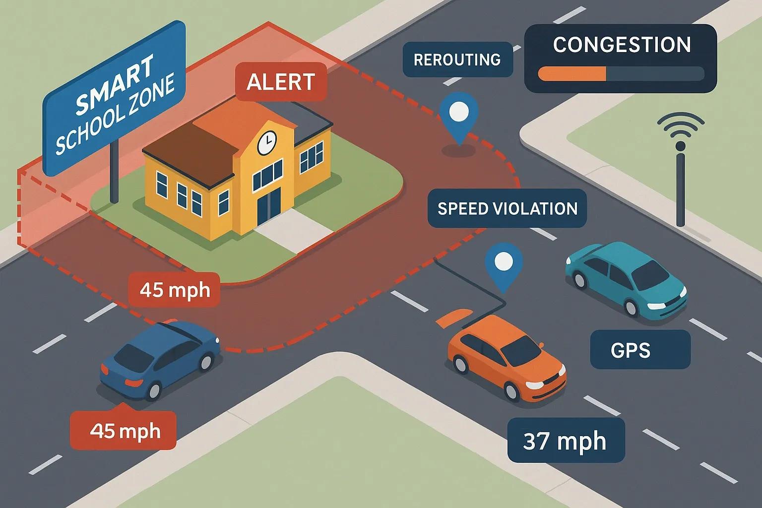
Road safety around schools is a pressing urban planning challenge. With increasing urban traffic volumes, the safety of school-going children and the need to regulate vehicle movement in sensitive areas has become critical. Traditional signage and manual enforcement often fall short. In this context, geofencing, a location-based service that uses GPS, RFID, Wi-Fi, or cellular data to create virtual boundaries, presents a scalable and proactive solution for safer school zones.
Geofencing enables automated enforcement of speed limits, alerts for overspeeding, dynamic traffic rerouting, and real-time communication with drivers. By integrating geospatial technology with connected infrastructure, authorities can create safer environments for children while easing congestion during peak hours.
What is Geofencing?
Geofencing involves creating a virtual perimeter for a real-world geographic area. When a device, typically a smartphone, vehicle, or IoT sensor, enters or exits this defined boundary, the system triggers predefined actions such as notifications, alerts, or automated responses.
In school zone applications, geofencing is used to:
Monitor vehicle speeds within defined areas.
Send alerts to drivers when entering a school zone.
Trigger automated enforcement actions or notifications.
Reroute vehicles during school hours to avoid congestion.
Key Components of a Geofencing-Based School Zone Safety System
Geospatial Mapping Accurate digital maps are foundational. The system needs high-resolution geospatial data to define the boundaries of school zones accurately. These include roads, intersections, pedestrian crossings, and nearby traffic flow patterns.
GPS and IoT Sensors Vehicles must be equipped with GPS and communication devices to interact with the geofence. Similarly, fixed infrastructure such as smart poles, RFID tags, or BLE (Bluetooth Low Energy) beacons are deployed within school zones for passive tracking and data capture.
Communication Network A robust network layer (4G/5G, NB-IoT, LoRaWAN) ensures seamless data transmission between mobile units and the control center.
Backend Systems and Analytics A centralized platform processes geospatial data in real-time, applying rules such as speed thresholds and restricted access timings. It generates insights for enforcement, planning, and public communication.
User Interfaces Dashboards for school authorities, law enforcement, and city planners enable real-time monitoring, alert generation, and data visualization. Mobile apps for parents and drivers can issue safety updates and alerts.
Functional Capabilities in a School Zone Context
Dynamic Speed Monitoring When vehicles enter a geofenced school zone during active hours (e.g., 7:00 AM – 5:00 PM), onboard GPS systems can receive push notifications to reduce speed. If a vehicle exceeds the speed threshold, an alert is logged or sent to enforcement authorities.
Congestion Detection and Rerouting Geofencing systems can track traffic density and dynamically reroute vehicles using alternate paths to minimize bottlenecks near school entrances. This reduces idling vehicles, air pollution, and the risk of pedestrian accidents.
Time-Based Access Control Certain roads or parking areas near schools can be made inaccessible during pick-up and drop-off hours. Geofencing ensures only authorized vehicles, like school buses or emergency services, can enter restricted areas during those times.
Driver Behavior Alerts Repeated offenses such as harsh braking, speeding, or long idling can be tracked and flagged. Authorities can use this data to enforce corrective measures or educate drivers.
Emergency Notifications In case of incidents such as accidents or suspicious activity near school zones, geofencing-enabled systems can instantly alert parents, staff, and local enforcement.
Integration with Broader Smart City Infrastructure
Geofencing doesn’t operate in isolation. For maximum impact, it should be integrated with:
Traffic Signal Control Systems Synchronizing geofence alerts with traffic lights allows dynamic adjustment of green-red cycles to manage flow more effectively during school hours.
Video Surveillance and ANPR Cameras License plate recognition cameras can help identify vehicles that breach school zone rules, supporting automated challans or fines.
Public Transport and School Bus Systems Real-time visibility into school bus locations can improve pickup efficiency and reduce roadside waiting, improving safety.
Citizen Engagement Platforms Mobile applications can allow parents and residents to report traffic violations, unsafe conditions, or suggest improvements.
Case Study: Hyderabad’s Smart School Zones
In Hyderabad, India, a pilot project initiated by the municipal corporation and traffic police created geofenced zones around high-risk schools. The system used:
High-definition maps created using drone-based surveys.
RFID-equipped school buses.
Bluetooth beacons installed at key road junctions.
Cloud-based analytics for real-time monitoring.
The result was a 22% reduction in overspeeding incidents and a 15% improvement in traffic flow during school hours within three months of deployment.
Implementation Challenges
Despite its promise, geofencing for school zone safety faces a few implementation challenges:
Data Accuracy Reliable geospatial data is crucial. Poor-quality maps or GPS drift can result in false alerts or missed detections.
Device Compatibility Older vehicles or low-end smartphones may not support the technology needed to interact with geofences.
Privacy Concerns Tracking driver behavior or location raises concerns about surveillance and data misuse. Policies need to ensure data is anonymized and used responsibly.
Enforcement Gaps Without integration into legal and regulatory frameworks, geofencing alerts might not translate into enforceable actions.
Awareness and Adoption Drivers need to be aware of the presence and implications of geofenced zones. Campaigns, signboards, and app-based notifications are essential to ensure compliance.
Future Outlook
With the ongoing development of smart cities, geofencing is expected to become a standard safety feature around schools. Upcoming trends include:
AI-Powered Prediction Combining geofence data with AI can help forecast congestion patterns or predict likely overspeeding events before they occur.
Edge Processing Localized processing at roadside units can reduce latency and improve real-time responses for critical safety events.
Integration with EV and Autonomous Vehicles As electric and autonomous vehicles become more common, geofencing will serve as a mechanism for automated compliance with school zone rules.
Policy and Incentive Models Cities may offer incentives such as lower insurance premiums for drivers who comply with geofence alerts or penalties for repeated non-compliance.
Conclusion
Geofencing represents a practical, scalable solution to the long-standing issue of road safety near educational institutions. It bridges the gap between physical infrastructure and digital governance. When effectively deployed, it not only prevents speeding and reduces congestion but also fosters a culture of responsibility and awareness among drivers. As technology becomes more accessible and regulations catch up, geofenced school zones are set to become a key component of safe, child-friendly cities.