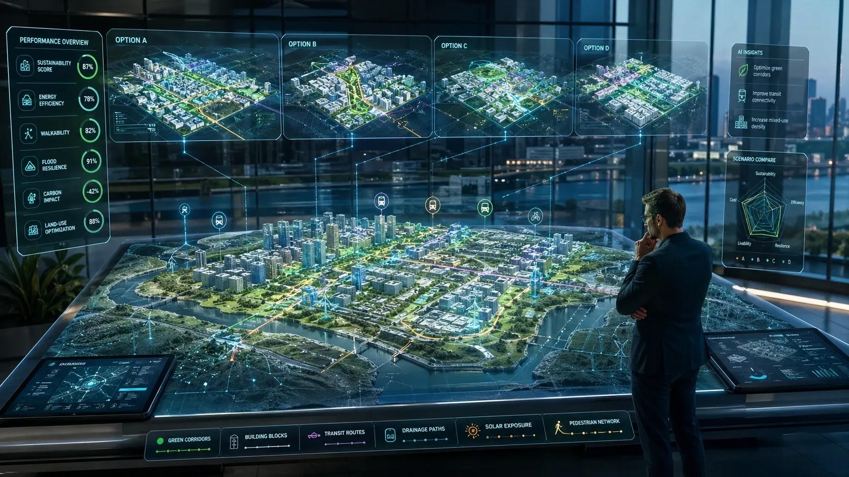
Cities have always been designed through a mix of vision, regulation, engineering, negotiation, and compromise.
A planner studies the land. An architect imagines the built form. An engineer checks feasibility. A policymaker applies rules. A developer weighs cost. A community lives with the outcome.
But what if the city could be tested before it is built?
What if thousands of possible layouts, street networks, building orientations, green corridors, drainage flows, and energy scenarios could be explored before a single foundation is laid?
That is where generative design begins to change the conversation.
The concept is simple but powerful: instead of designing one option and then testing it, we define the goals, constraints, and data inputs first. Then algorithms generate multiple design possibilities that can be compared for performance, sustainability, cost, resilience, and human impact. This idea, outlined in the reference document on generative design for sustainable urban planning, pushes us from mapping cities to optimizing them.
Context: Urban Planning Has Become Too Complex for Linear Thinking
Urban planning today is no longer just about land use.
It is about climate risk. It is about mobility. It is about water stress. It is about energy demand. It is about affordability. It is about data privacy. It is about public health. It is about economic productivity. It is about quality of life.
In India, this complexity is visible in every growing city. Hyderabad, Bengaluru, Pune, Mumbai, Delhi NCR, Chennai, Ahmedabad, and many Tier-2 cities are expanding faster than traditional planning systems can respond.
A new road changes land value. A metro corridor changes density. A lake encroachment changes flood risk. A high-rise cluster changes wind flow and heat patterns. A missing drainage layer changes disaster preparedness.
The problem is not that planners lack intelligence.
The problem is that cities now behave like dynamic systems, while many planning decisions are still made through static drawings, isolated reports, and disconnected approvals.
This is where geospatial intelligence, BIM, IoT, digital twins, and generative design begin to converge.
The Deeper Question: Are We Designing Cities, or Only Documenting Them?
Most digital transformation in urban planning still focuses on representation.
We create maps. We build 3D models. We prepare dashboards. We visualize terrain. We digitize master plans. We publish GIS layers.
All of this is useful. But representation is not the same as intelligence.
A map can show where a road exists. A BIM model can show how a building is constructed. A digital twin can show how an asset behaves. But generative design asks a different question:
What should exist here, and why?
This changes the role of technology.
The city is no longer just observed. It is questioned. It is simulated. It is optimized. It is compared against multiple futures.
That is a major shift.
In traditional planning, humans generate a few possible options and then test them. In generative planning, humans define objectives, values, and constraints. The system then explores hundreds or thousands of possible solutions.
For example:
Which building orientation reduces heat gain? Which street layout improves walkability? Which land-use mix reduces commute time? Which green corridor improves microclimate? Which drainage alignment reduces flood accumulation? Which development pattern balances density and livability?
The value is not in replacing human planners.
The value is in expanding the design space beyond what humans can manually test.
Spatial Intelligence Perspective: Data Becomes the Design Material
Generative design depends on inputs.
This is where geospatial technology becomes foundational.
Satellite imagery can provide land cover, heat islands, vegetation, and water bodies. UAV surveys can capture high-resolution site conditions. LiDAR and photogrammetry can generate terrain and 3D context. BIM can define building rules, massing, materials, and construction logic. IoT sensors can provide live data on air quality, traffic, water levels, and energy use. Digital twins can simulate how systems behave over time.
Once these layers are connected, planning becomes performance-based.
Instead of saying, “This layout looks good,” we can ask:
How does this layout perform at 2 PM in May? How does it handle a 100 mm rainfall event? How much solar exposure does it receive? How much cooling load will it create? How many people can access public transport within 10 minutes? How much carbon can be reduced through design choices?
This is the real strength of generative design.
It does not treat design as a drawing exercise. It treats design as a system of measurable outcomes.
A city block can be optimized for daylight, shade, pedestrian comfort, stormwater movement, EV charging access, rooftop solar potential, and emergency response routes.
A real estate township can compare multiple layouts for energy demand, open space distribution, wind flow, and construction cost.
An industrial estate can test logistics movement, worker safety, drainage, utilities, and future expansion.
A smart city corridor can evaluate mobility, land value, carbon impact, and public service access before implementation.
This is where geospatial thinking becomes more than mapping.
It becomes decision intelligence.
Real-World Implication: Sustainability Needs Better Design Choices, Not Just Better Reporting
Many organizations now talk about sustainability.
They prepare ESG reports. They measure carbon. They discuss green buildings. They talk about smart infrastructure.
But the largest sustainability decisions are often locked in at the design stage.
Once a building is poorly oriented, HVAC demand becomes a permanent burden. Once a road cuts through a natural drainage channel, flood risk becomes expensive to manage. Once housing is planned far from jobs and transit, carbon emissions become a daily reality. Once green spaces are treated as decoration instead of infrastructure, heat stress increases.
Generative design helps move sustainability upstream.
It allows planners and developers to test trade-offs before construction begins.
For example, in real estate, generative design can help orient buildings to reduce heat gain and improve natural ventilation. In infrastructure, it can help select routes that reduce ecological disruption and land acquisition challenges. In agriculture-linked planning, it can optimize greenhouse placement, irrigation paths, and access networks. In industrial planning, it can reduce internal movement, improve safety zones, and support energy-efficient layouts.
For Indian cities, this could be especially valuable.
We are dealing with rapid urbanization, climate vulnerability, infrastructure pressure, and rising demand for affordable development. The planning challenge is not only to build more, but to build better.
Generative design can support that shift.
But only if the data is reliable. Only if the constraints are correctly defined. Only if local regulations are included. Only if community needs are considered. Only if human judgment remains central.
Otherwise, we risk creating optimized designs that look efficient on screen but fail in social reality.
GeoThinking Insight: The Future City Will Be Co-Designed by Humans, Data, and Constraints
Generative design does not remove creativity.
It changes where creativity sits.
The creative act is no longer only in drawing the final form. It is also in defining the right question.
What are we optimizing for?
Lowest cost? Lowest carbon? Highest density? Best mobility? Maximum comfort? Fastest approval? Better resilience? Social inclusion?
Every generative system reflects the values we feed into it.
That is why urban generative design must not become a purely technical tool. It must become a governance tool, a sustainability tool, and a public-interest tool.
A city optimized only for traffic speed may harm walkability. A city optimized only for real estate yield may reduce open space. A city optimized only for energy efficiency may ignore social life. A city optimized only for density may create heat and pressure on utilities.
The deeper point is this:
The algorithm does not know what a good city is. Humans must define that.
But once we define it well, technology can help us explore possibilities at a scale and speed that traditional methods cannot match.
Closing Reflection
The next generation of urban planning will not be built only through CAD drawings, GIS maps, policy documents, or 3D visualizations.
It will be built through intelligent design ecosystems.
Geospatial data will describe the place. BIM will define the built logic. IoT will reveal live behavior. Digital twins will simulate change. Generative design will explore what is possible.
Together, these technologies can help cities move from reactive planning to anticipatory planning.
From “Where are we now?” To “What could happen next?” To “What should we design before the problem appears?”
That is the real promise of generative design in sustainable urban planning.
Not automation for its own sake.
But better choices before concrete, steel, roads, utilities, and communities are locked into decades of consequences.