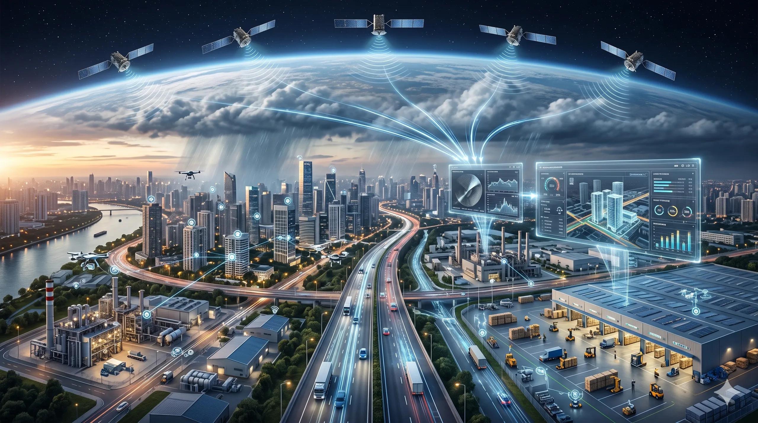
The Shift: From Seeing the World to Acting on It
For many years, geospatial intelligence was treated as a visibility layer.
We captured the Earth.
We mapped assets.
We monitored change.
We created dashboards.
We delivered reports.
That was useful. But it was still largely observational.
The next phase is different.
Geospatial intelligence is now moving from “seeing the world” to helping organizations understand what changed, why it matters, what could happen next, and what action should follow.
This shift is creating a new operational stack.
It begins with satellite constellations, especially Synthetic Aperture Radar (SAR). It moves through AI-based change detection and change explanation. It connects to 3D reconstruction, BIM, IoT, UAV data, robotics, and simulation. It finally becomes useful when it feeds a dynamic digital twin that supports real decisions in real time.
That is the real story behind the current wave of developments in Earth observation and spatial AI.
SAR Constellations: The New Monitoring Infrastructure
The launch of more SAR satellites is not just a space industry milestone. It is an infrastructure intelligence signal.
SAR matters because it can observe through clouds, darkness, smoke, and weather disruption.
For a country like India, and for many climate-exposed regions, this is not a technical detail. It directly affects flood monitoring, landslide risk, urban expansion tracking, rail and road corridor surveillance, asset movement, coastal change, mining activity, and disaster response.
Optical imagery tells us what the eye can see.
SAR tells us what operations cannot afford to miss.
This is why SAR constellations are becoming operational infrastructure, not just imaging assets.
When revisit frequency improves and analytics mature, SAR becomes part of the monitoring layer for cities, utilities, ports, highways, agriculture, and emergency management.
But raw observation is not enough.
The Next Step: From Change Detection to Change Explanation
The bigger change is happening in how AI interprets Earth observation data.
Traditional change detection often stops at a mask: something changed here.
That is helpful, but not sufficient for decision-making.
A municipal officer, infrastructure operator, insurance analyst, port authority, carbon auditor, or disaster-response team does not only need to know that change occurred.
They need to know what changed, where it changed, how serious it is, what asset or community is exposed, and what action should be considered.
This is where remote-sensing change captioning becomes important.
The future of change detection is not only a coloured polygon on a map. It is a plain-language explanation connected to location, asset context, risk, and workflow.
Imagine a flood monitoring system that does not simply show inundated pixels, but explains:
“Water spread has increased along the eastern edge of the industrial zone, affecting access roads near two warehouse clusters. The change is likely operationally significant because it blocks vehicle movement and may disrupt outbound logistics.”
Or a construction monitoring system that says:
“New ground disturbance is visible along the planned corridor alignment, but activity appears outside the approved work boundary.”
Or a carbon MRV system that reports:
“Vegetation loss is detected in the monitored parcel. The affected area requires field validation before it can be included in the next reporting cycle.”
This is the move from change detection to change intelligence.
3D Reconstruction: Lowering the Cost of Digital Twin Creation
The next layer is 3D reconstruction.
Digital twins have often been slowed down by capture cost, data preparation, and the difficulty of keeping models updated.
Traditional high-quality 3D reconstruction usually depends on planned surveys, calibrated cameras, point clouds, structured capture workflows, and expert processing.
That will not disappear.
Survey-grade capture will remain essential for engineering, compliance, and high-accuracy asset management.
But a second layer is emerging.
Sparse-view reconstruction, 3D Gaussian Splatting, structured indoor reconstruction, and video-to-3D methods are reducing the friction of building visual and operational twins from limited imagery.
This matters for warehouses, industrial plants, construction sites, road corridors, campuses, ports, substations, and logistics yards.
A facility twin should not require a complete restart every time the layout changes.
A warehouse twin should be able to absorb new visual evidence from cameras, mobile devices, drones, or robots.
A construction twin should be able to compare planned progress with observed reality.
A road-corridor twin should combine satellite change, UAV inspection, vehicle camera capture, and field validation into one operational view.
This is where the stack starts becoming powerful.
SAR gives resilient outside-in monitoring.
Optical imagery gives visual context.
UAVs give local inspection-grade detail.
Mobile and ground cameras give operational proximity.
3D reconstruction turns images into spatial context.
IoT gives live condition data.
BIM gives asset structure.
AI explains change.
Digital twins connect everything to decisions.
Why the Future Is 4D, Not Just 3D
The most important next step is not 3D.
It is 4D.
A 3D twin shows the shape of an asset or environment.
A 4D twin adds time, motion, interaction, and operational behaviour.
This is critical because infrastructure is not static.
Warehouses move goods.
Ports move vessels and containers.
Roads move vehicles.
Factories move materials.
Cities move people, water, waste, power, and risk.
Construction sites change every day.
Disaster zones change every hour.
A digital twin that only represents geometry is useful for visualization.
A digital twin that represents movement, change, condition, sequence, and consequence becomes useful for operations.
That is why 4D reconstruction, UAV-ground collaboration, and physics-aware robotic simulation are important signals for geospatial intelligence.
They show that the future twin is not just a model of the built environment.
It is a decision environment.
UAV-Ground Intelligence: Why Autonomy Needs Spatial Reasoning
This matters because autonomous systems are entering physical operations.
Drones are inspecting roads, bridges, power lines, pipelines, mines, crops, and disaster zones.
Ground robots are entering warehouses, factories, logistics yards, and hazardous environments.
Cameras and sensors are becoming distributed across cities, campuses, vehicles, and industrial sites.
But autonomy cannot rely on object recognition alone.
It needs spatial reasoning.
A drone and a ground robot may see the same site from completely different perspectives.
A satellite may detect change over a wide area, while a ground camera may confirm the local condition.
A BIM model may show what should exist, while live data shows what is actually happening.
The real challenge is alignment.
Can the system connect different views of the same reality?
Can it understand location, scale, direction, obstruction, movement, and risk?
Can it preserve evidence continuity from observation to decision?
Can it support action without creating a noisy dashboard?
This is the difference between geospatial visualization and operational geospatial intelligence.
The New Operational Stack
The old stack was built around maps, layers, and reports.
The new stack is built around sensing, reconstruction, explanation, simulation, and decision support.
It may look like this:
Satellite constellations observe change at scale.
SAR ensures monitoring continuity in difficult conditions.
AI converts change into explanation.
UAVs and ground systems validate the local reality.
3D reconstruction updates the asset environment.
IoT adds live operational state.
BIM and GIS provide structure and location context.
4D digital twins simulate time, movement, and impact.
Decision workflows convert intelligence into action.
This is not a future reserved only for defence or national security.
It is directly relevant to civil infrastructure, smart cities, climate resilience, utilities, logistics, agriculture, carbon MRV, industrial safety, and disaster management.
Why This Matters for India
For India, the opportunity is significant.
We are building roads, railways, airports, ports, industrial corridors, data centers, renewable energy parks, smart cities, and logistics infrastructure at massive scale.
At the same time, we face floods, heat stress, water pressure, landslides, urban congestion, encroachment, asset degradation, and climate uncertainty.
We cannot manage this complexity only through periodic surveys and static dashboards.
We need operational geospatial intelligence.
That means systems that can observe continuously, explain clearly, reconstruct rapidly, simulate consequences, and support accountable decisions.
My Perspective
The winners in geospatial AI will not be those who visualize the world best.
They will be those who help operators act on it fastest, with confidence, traceability, and context.
This is the real promise of the new stack.
From SAR constellations to 4D digital twins, geospatial intelligence is becoming less about producing maps and more about managing reality.
The map is no longer the final output.
It is becoming the operating layer.