Maturity doesn’t improve by accident
Most organizations don’t consciously decide to remain at Level 2.
They simply stay busy.
Spatial tools get deployed. Dashboards get built. Pilots show promise. But without a structured progression plan, maturity plateaus.
Improvement requires intent.
The real decision behind progression
Moving up the geospatial maturity curve is not a technical upgrade.
It is a leadership decision to:
Standardize how spatial insight influences planning
Align location metrics with financial KPIs
Redesign workflows around evidence
Hold decision-makers accountable to spatial scoring
Without that commitment, progress remains experimental.
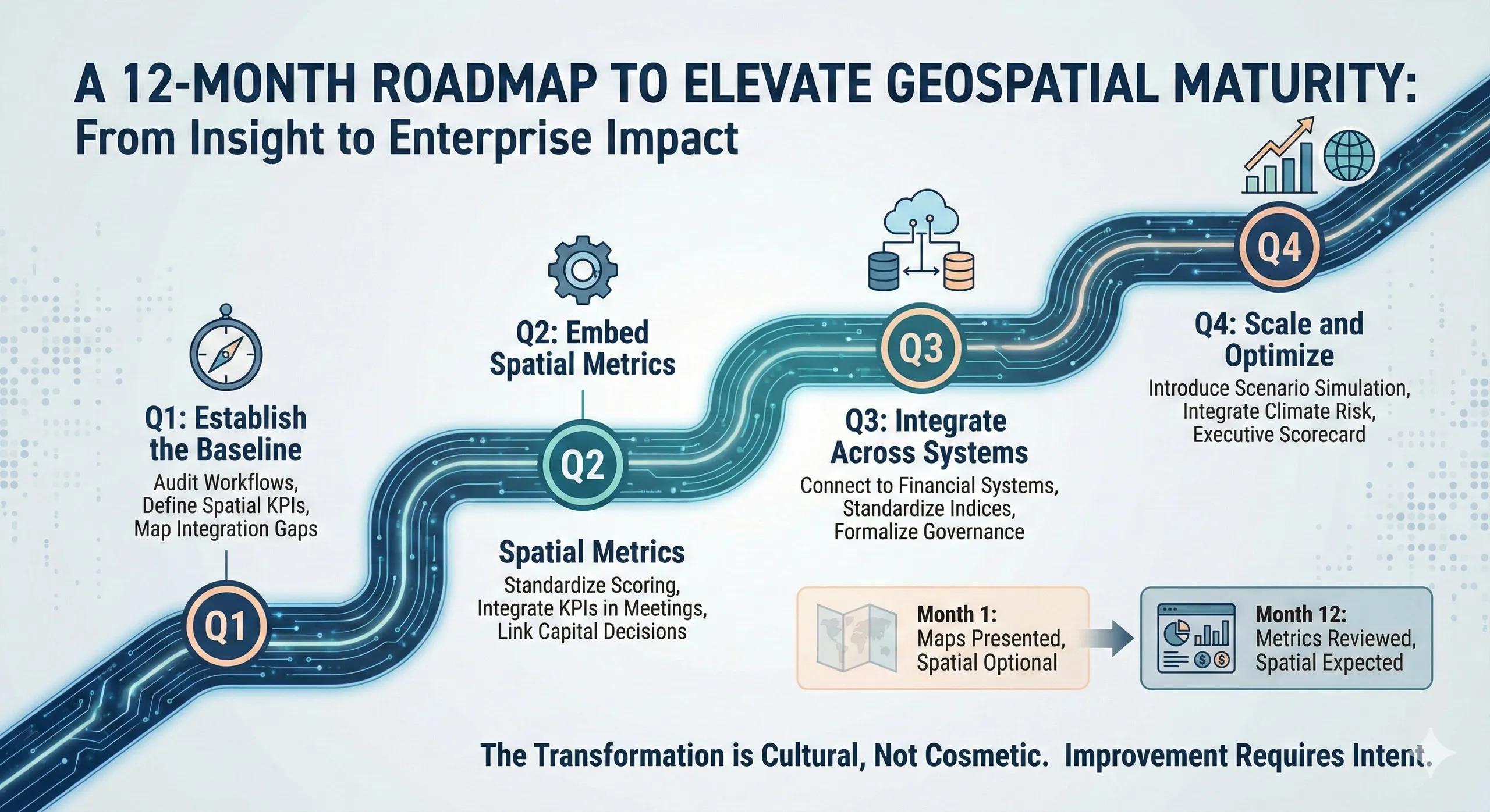
A practical 12-Month progression model
Below is a structured roadmap designed for organizations currently operating between Level 2 (Analytical Support) and Level 3 (Integrated Decision Support) , aiming toward enterprise integration.
Quarter 1: Establish the Baseline
Objective: Clarity before expansion.
Focus areas:
Audit current geospatial workflows
Identify decision points where spatial input is missing
Define 3–5 executive-relevant spatial KPIs
Map integration gaps with ERP / asset systems
Deliverable:
A documented maturity baseline and prioritized integration list.
Outcome:
Leadership alignment on where spatial insight should influence decisions.
Quarter 2: Embed Spatial Metrics into Decisions
Objective: Move from maps to metrics.
Focus areas:
Convert spatial analysis into standardized scoring frameworks
Integrate spatial KPIs into asset prioritization meetings
Link at least one capital decision to spatial risk/opportunity scoring
Begin ROI tracking for influenced decisions
Deliverable:
Spatial metrics included in operational dashboards.
Outcome:
Location intelligence begins influencing structured planning.
Quarter 3: Integrate Across Systems
Objective: Break silos.
Focus areas:
Connect geospatial outputs to financial systems
Standardize risk and opportunity indices
Train cross-functional teams
Formalize governance structure for spatial decision-making
Deliverable:
Enterprise dashboard incorporating geographic scoring.
Outcome:
Spatial intelligence becomes repeatable and auditable.
Quarter 4: Scale and Optimize
Objective: Move toward predictive capability.
Focus areas:
Introduce scenario simulation for major capital decisions
Integrate climate and risk layers into planning cycles
Automate parts of scoring workflows
Formalize board-level geographic reporting
Deliverable:
Executive-ready spatial performance scorecard.
Outcome:
Location intelligence becomes embedded in governance.
What changes over 12 months
If executed properly, the shift is visible:
Month 1 - Month 12
Maps presented - Metrics reviewed
Pilots discussed - Capital influenced
Analysts lead - Executives aligned
Spatial optional - Spatial expected
The transformation is cultural, not cosmetic.
A practical scenario
Consider an infrastructure firm currently at Level 2.
After 12 months:
Upgrade sequencing incorporates spatial risk scoring
Capital allocation dashboards include exposure indices
Executive reviews require geographic impact metrics
Climate overlays inform long-term asset reinforcement
The same tools exist.
The difference is integration and accountability.
Where roadmaps fail
Common obstacles include:
Treating roadmap as a technical checklist
Underestimating change management
Failing to align financial KPIs
No executive sponsor
Measuring usage instead of influence
Progress must be measured by decisions changed, not dashboards deployed.
The monetization bridge
As organizations formalize this progression, many seek structured advisory frameworks and scalable spatial decision systems that support maturity benchmarking, KPI alignment, integration design, and governance rollout. The real acceleration comes when roadmap execution is supported by architectural discipline, not ad-hoc experimentation.
Looking ahead
Within a year, organizations can move from sporadic analysis to structured decision infrastructure.
The longer they wait, the wider the gap grows between them and competitors embedding spatial intelligence into capital and risk systems.
Closing insight
Maturity is not a feature you install.
It is a capability you build, deliberately, quarter by quarter.