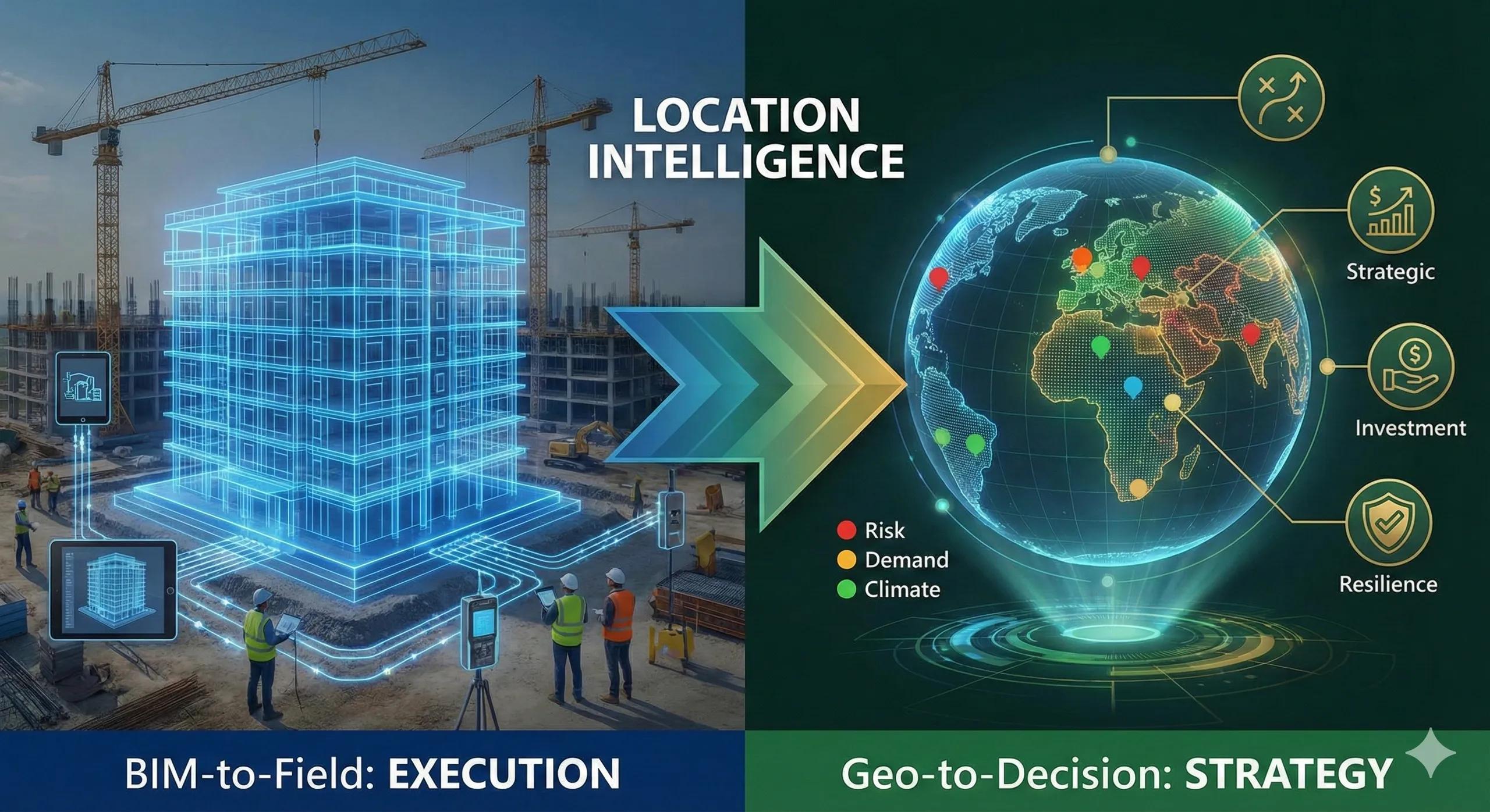
Over the past 60 days, we explored a complete journey, how Building Information Modeling moves beyond design and connects to field execution, asset tracking, commissioning, and long-term operations.
That series focused on one central idea: data should not stop at the model; it must flow into real-world action.
Now that journey has reached a natural milestone.
But it also opens a much larger question.
If BIM helps us understand what to build and how to build , what helps us decide where , when , and why to build in the first place?
The answer lies in geospatial intelligence.
This next phase shifts the conversation from execution to decision-making .
The natural evolution: From project intelligence to location intelligence
The BIM-to-Field series showed how structured digital information improves construction accuracy, coordination, and lifecycle management. It focused on:
Model-driven execution
Field integration
IoT-enabled monitoring
Digital handover
Long-term asset intelligence
But before any project reaches that stage, there is a deeper layer of decision-making that determines success or failure:
Which land is suitable?
Which location carries risk?
Where is demand strongest?
How will climate affect long-term performance?
Which regions offer the best return on investment?
These are not BIM questions.
These are geospatial questions.
Why this shift matters now
Organizations across infrastructure, utilities, logistics, agriculture, and urban development are facing a common challenge:
They have data.
They have technology.
But they lack location-driven insight to guide strategic decisions.
This gap leads to:
Poor site selection
Underutilized assets
Higher operational risk
Inefficient expansion planning
Costly long-term corrections
Geospatial intelligence fills this gap by turning location data into decision frameworks.
It connects physical reality with business outcomes.
From “What are we building?” to “Where should we act?”
BIM excels at answering:
What is the structure?
How will it be constructed?
How will it perform over time?
Geospatial intelligence answers:
Where should we invest?
Which zones carry risk?
Where is demand growing?
Which assets need attention first?
When combined, they form a complete decision ecosystem:
Geospatial → guides strategy
BIM → supports execution
IoT → powers operations
Digital twins → sustain performance
This is where real transformation begins.
The rising importance of location-driven decisions
Across sectors, location is becoming a core business variable.
A few examples:
Retail chains use spatial analytics to choose store locations.
Hospitals use demographic mapping to identify underserved areas.
Governments use geospatial models to plan infrastructure corridors.
Agriculture uses satellite data to monitor crop health and soil patterns.
Utilities map risk zones for predictive maintenance.
In each case, the biggest gains happen before construction or deployment starts.
Decisions made at the location level shape long-term outcomes.
What this means for the future of digital transformation
We are moving toward a world where decisions are increasingly supported by spatial intelligence.
Instead of reacting to problems, organizations can:
Predict demand
Identify risk early
Optimize expansion
Prioritize investments
Plan at regional and national scale
This is where geospatial data becomes a strategic asset, not just a mapping tool.
It becomes the foundation for:
Smart infrastructure planning
Climate-resilient development
Data-driven governance
Scalable digital twin ecosystems
Introducing the next journey
With this context, the next phase of this newsletter will focus on a new theme:
How geospatial intelligence supports real-world decisions.
We will explore practical use cases across sectors, including:
Site selection and expansion planning
Infrastructure prioritization
Asset monitoring and risk mapping
Agriculture and environmental intelligence
Business growth through spatial analytics
The fusion of GeoAI, IoT, and digital twins
Each article will focus on how location data translates into measurable value.
Not theory.
Not just technology.
But decisions that impact outcomes.
A simple question to reflect on
Before any project begins, the most important question is often not:
“How do we build?”
It is:
“Are we building in the right place?”
The more complex the world becomes, the more critical this question becomes.
And the more valuable geospatial intelligence becomes.
What comes next
The BIM-to-Field series showed how digital models transform execution.
The next journey will show how geospatial intelligence transforms strategy.
Because when location insight comes first:
Planning improves
Risk reduces
Investments perform better
Systems become more resilient
This is the shift from Geo-data to Geo-decisions .
And that is where the next set of conversations begins.