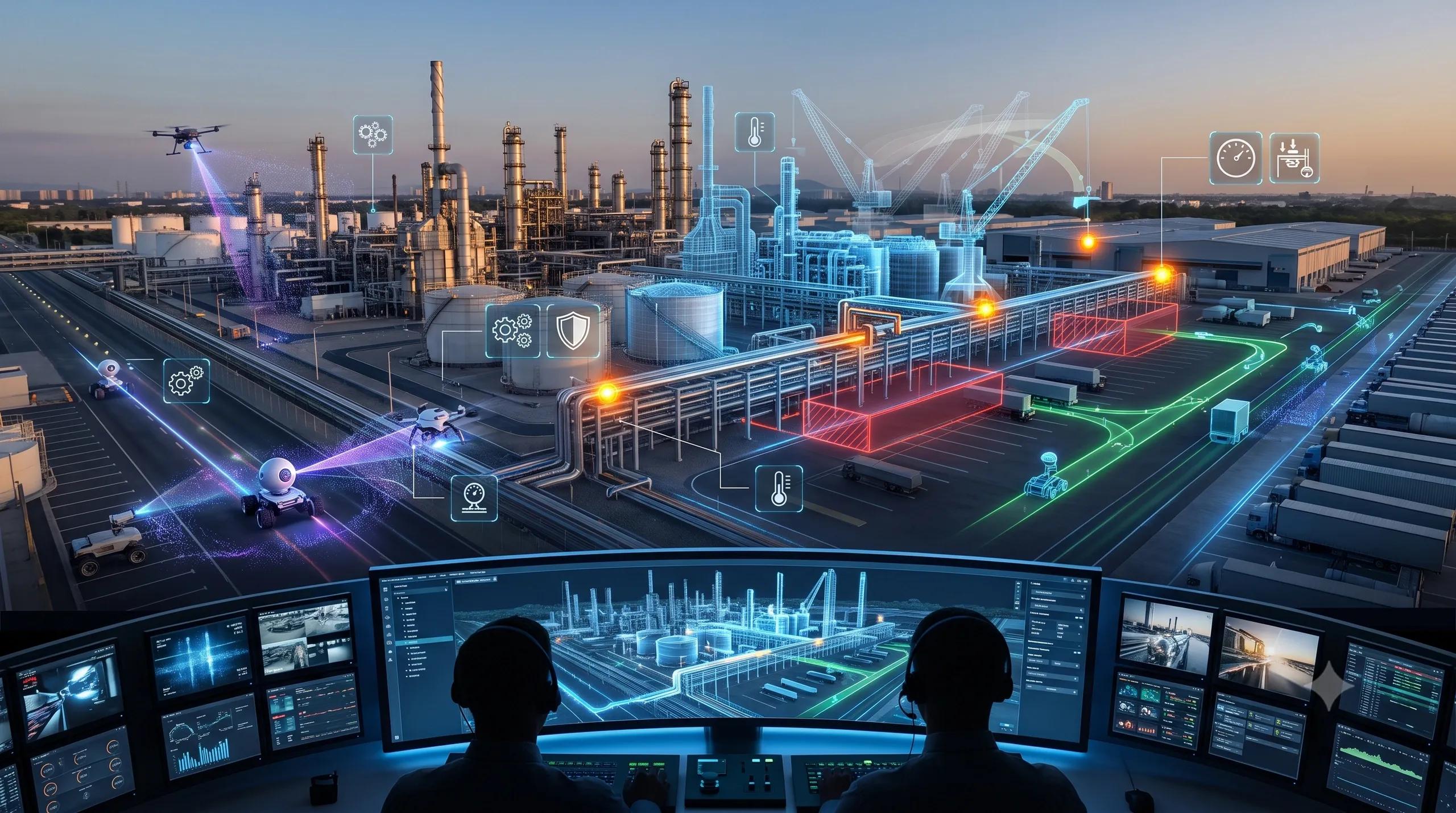
For many organizations, the first digital twin journey started with a simple question:
Can we create a digital replica of our asset, facility, project, road, warehouse, plant, or city?
That was an important step.
A 3D model helped teams see what existed. A dashboard helped them monitor what was happening. A BIM model helped them understand design intent. A GIS layer helped them place the asset in its real-world context. IoT sensors added live signals. Drone imagery, LiDAR, and 360° cameras made site capture faster and more visual.
But we are now entering the next stage.
The real question is no longer:
Can we see the asset digitally?
The question is:
Can the twin understand what is changing, simulate what may happen next, and guide the right operational response?
That is where operational digital twins are moving.
From static 3D models to time-aware 4D simulation.
From passive inspection to active scene understanding.
From visual dashboards to decision-support systems.
From “what does this site look like?” to “what is changing, what does it mean, and what should we do next?”
360° inspection is becoming more than visual documentation
360° imagery has already become useful in construction, facility management, road inspection, warehouse monitoring, and industrial walkthroughs.
A site team can capture a corridor, plant room, road stretch, warehouse aisle, construction floor, or utility zone and review it later without physically revisiting the location.
This is useful.
But the next layer is far more powerful.
360° inspection is moving from visual record to operational interface.
Instead of only storing panoramic images, systems are starting to understand objects, conditions, defects, obstructions, safety risks, movement patterns, and spatial relationships inside those scenes.
This means an operator should eventually be able to ask:
Where are the blocked emergency exits?
Which assets are missing labels?
Has this wall section changed since the last inspection?
Are materials stored in the wrong zone?
Which road defects are new?
Where is the equipment not matching the approved layout?
Which part of the facility needs attention before the next audit?
This is not only computer vision. It is spatial reasoning.
The value is not in capturing a 360° image. The value is in making that scene queryable, comparable, and actionable.
The inspection layer must connect to the twin
Many organizations still treat inspection data as a separate workflow.
Drone photos sit in one folder.
360° walkthroughs sit in another platform.
BIM models remain with the design or engineering team.
GIS data sits with the planning team.
IoT data sits in dashboards.
Work orders sit in ERP, CAFM, CMMS, or facility management systems.
This fragmentation limits operational value.
A 360° image becomes powerful only when it is connected to asset identity, location, time, condition, ownership, maintenance history, and business rules.
A crack on a wall is not only a crack.
It has a location.
It has a timestamp.
It belongs to an asset or structure.
It may have appeared after a previous inspection.
It may have a severity score.
It may affect compliance.
It may need a work order.
It may need escalation.
It may influence future risk.
This is the shift from inspection media to operational intelligence.
4D simulation adds the missing dimension: time
Most digital twins are still used as spatial containers.
They show where things are.
But operations are not static.
Construction sites change every day.
Road conditions change after rain, traffic, and repairs.
Warehouses change with inventory movement.
Factories change with production cycles.
Cities change with construction, encroachment, flooding, congestion, and public works.
Agriculture changes with crop stage, soil moisture, weather, pest stress, and irrigation.
Utilities change with load, failures, vegetation growth, and maintenance cycles.
That is why time is becoming central to digital twin maturity.
A 4D twin is not just a 3D model with a schedule attached. At its best, it becomes a living spatial timeline of change.
It can help teams compare planned versus actual progress.
It can show how conditions evolved.
It can simulate operational scenarios.
It can forecast risk.
It can test alternatives before real-world execution.
It can help decision-makers understand not only what exists today, but what may happen tomorrow.
Simulation-ready twins will become a serious advantage
The next layer of digital twins will not stop at monitoring.
They will simulate.
This matters because many operational decisions carry cost, delay, safety, or compliance consequences.
Before changing a warehouse layout, can we simulate movement flow?
Before sending a maintenance crew, can we prioritize risk zones?
Before approving a construction sequence, can we test schedule impact?
Before planning a city intervention, can we simulate traffic, drainage, utility, and citizen impact?
Before deploying autonomous systems, can we test scene variations?
Before responding to flood risk, can we simulate vulnerable locations and response routes?
Simulation-ready twins give leaders a safer way to test decisions before acting in the real world.
This is especially important for infrastructure, smart cities, logistics, industrial operations, emergency response, and climate resilience.
A dashboard may tell us what is happening.
A simulation-ready twin helps us explore what could happen.
That difference is important.
The role of AI is changing
AI in digital twins should not be limited to object detection or anomaly alerts.
The deeper role of AI is to help the twin observe, interpret, compare, predict, and recommend.
That requires multiple capabilities working together:
360° scene understanding.
Image-to-geometry workflows.
Change detection across time.
BIM-GIS-IoT integration.
Computer vision for defects and conditions.
Language-based querying.
Simulation models.
Operational rules.
Human validation.
Workflow integration.
This is where the digital twin becomes more than a visual environment. It becomes an operational reasoning layer.
But there is also a risk.
If the underlying data is weak, the AI layer will only make weak assumptions faster.
A twin that looks realistic can still be operationally unreliable.
That is why data quality, metadata, asset hierarchy, spatial accuracy, change history, and validation workflows matter.
The future will not be won by the most beautiful twin.
It will be won by the most trustworthy twin.
Change detection will become a core twin function
Operational teams do not only need to know what exists.
They need to know what changed.
What changed since yesterday?
What changed since the last drone survey?
What changed since the approved BIM model?
What changed after the flood?
What changed across this road corridor?
What changed between two crop cycles?
What changed across different cities, seasons, or sensors?
This is where GeoAI-based change detection becomes central.
For construction, it can track progress and deviations.
For utilities, it can detect encroachment, vegetation risk, and corridor changes.
For smart cities, it can track illegal construction, road damage, drainage issues, and land-use changes.
For agriculture, it can monitor crop health, field condition, and seasonal variation.
For climate and carbon MRV, it can support evidence-based monitoring.
However, change detection must work beyond controlled demos.
It must survive different lighting, sensors, locations, weather, seasons, and operating conditions.
That is the real test.
The operational twin needs a closed loop
The strongest digital twin architecture will not be a one-way visualization stack.
It will be a closed loop:
Capture the physical world.
Convert it into spatial and asset intelligence.
Detect change.
Understand context.
Simulate possible outcomes.
Recommend action.
Trigger workflows.
Validate results.
Update the twin.
This is the real meaning of an operational digital twin.
Not just a digital copy.
Not just a dashboard.
Not just a 3D model.
A decision-support system connected to the physical world.
What this means for business leaders
For leaders in infrastructure, real estate, utilities, manufacturing, logistics, smart cities, agriculture, and climate intelligence, the message is simple:
Do not build digital twins only for visualization.
Build them for operational consequence.
Ask these questions before starting:
What decisions should this twin support?
What field data will keep it updated?
Can inspection data be linked to asset identity?
Can 360° imagery become searchable and comparable?
Can change be detected across time?
Can the system simulate future scenarios?
Can actions be assigned, tracked, and validated?
Can the output be trusted by operations teams?
These questions separate a digital twin showcase from a digital twin strategy.
The next layer
The next generation of operational digital twins will combine 360° inspection, GeoAI, BIM, GIS, IoT, computer vision, language interfaces, and 4D simulation.
This is where spatial intelligence becomes practical.
A site can be inspected remotely.
A scene can be queried in natural language.
A change can be detected automatically.
A future condition can be simulated.
A decision can be guided with evidence.
A workflow can be triggered.
A result can be verified.
That is the real shift.
From seeing the asset.
To understanding the operation.
From recording the present.
To simulating the future.
From digital replica.
To operational intelligence.
At BSMA Enterprises, we help organizations move beyond static digital twins toward geospatially intelligent, simulation-ready operational systems that connect inspection, context, change, and decision-making.
Because the future of digital twins is not only 3D.
It is spatial, temporal, intelligent, and operational.