Land doesn’t change suddenly.
It changes slowly, until the impact becomes irreversible.
Introduction
In the previous articles, we explored how Digital Twins enable:
predictive maintenance in infrastructure
real-time coordination in airports
safety-driven intelligence in railways
optimization in manufacturing and logistics
risk monitoring in energy systems
environmental compliance in mining
flood prediction in water systems
Now we move to a sector where:
👉 change is continuous, distributed, and often unnoticed
👉 Forestry & Land Use
This domain involves:
forests and vegetation
land use changes
environmental monitoring
conservation efforts
In Phase 3, the focus remains:
👉 how Digital Twins enable monitoring, prediction, and large-scale decision-making
The Core Problem: Delayed Awareness of Change
Most forestry and land use systems today:
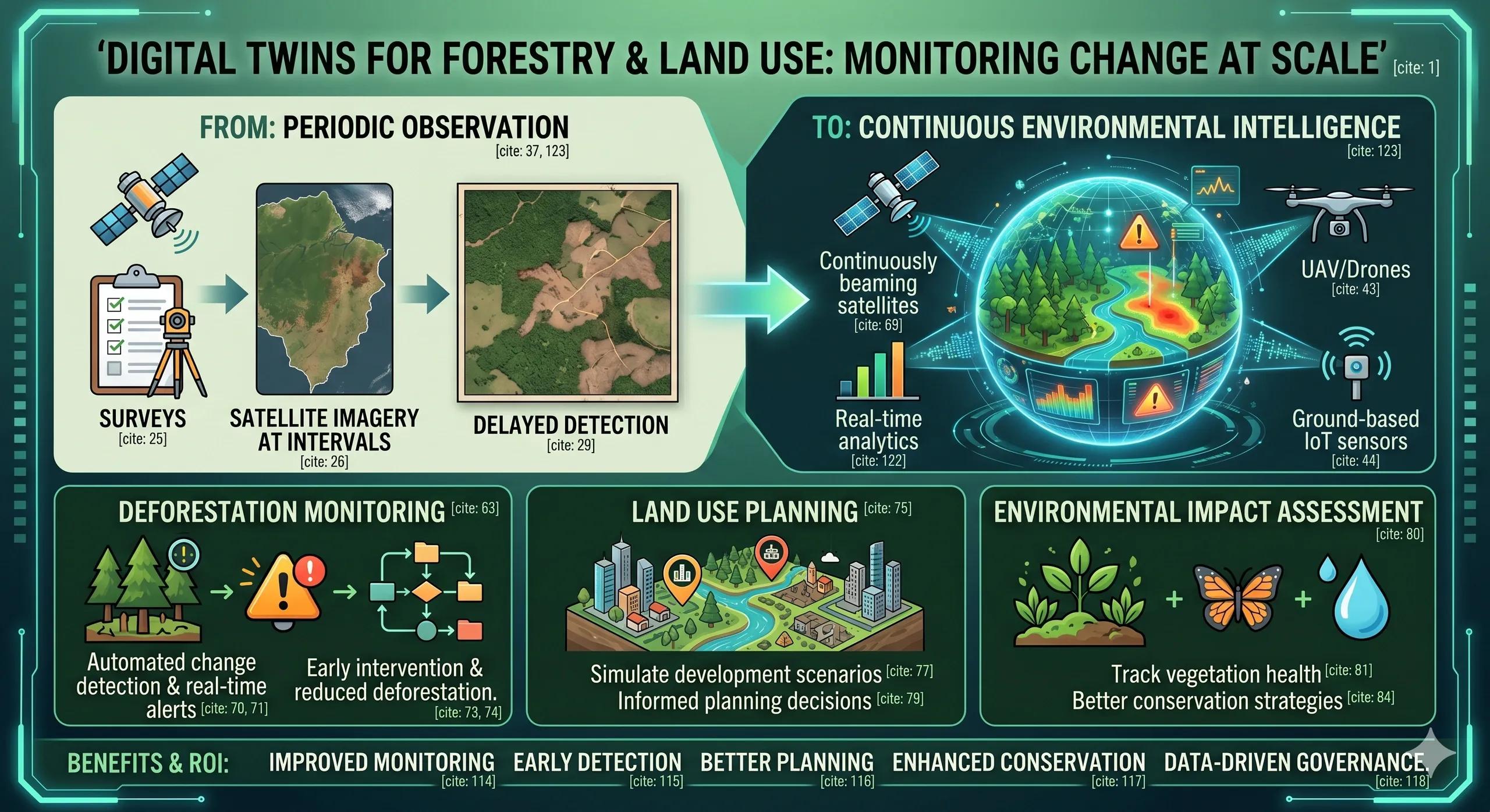
rely on periodic surveys
use satellite imagery at intervals
respond after visible change occurs
This leads to:
delayed detection of deforestation
unplanned land degradation
ineffective conservation efforts
👉 The system reacts after change has already happened.
Where Digital Twins Change the Approach
A Forestry Digital Twin enables:
👉 continuous monitoring of land and environmental change
Instead of:
periodic observation
It creates:
a dynamic, evolving view of land systems
Key Components of a Forestry Digital Twin
1. Data Layer
satellite imagery
UAV/drone surveys
IoT sensors (where applicable)
climate and weather data
2. Integration Layer
combines: spatial data environmental data historical records
👉 creates a unified land use view
3. AI/ML Layer
detects land cover changes
identifies deforestation patterns
predicts environmental impact
4. Simulation Layer
models land use scenarios
evaluates conservation strategies
5. Visualization Layer
GIS maps
change detection heatmaps
temporal analysis dashboards
Use Case 1: Deforestation Monitoring
Traditional Approach
periodic surveys
delayed reporting
👉 limited intervention capability
Digital Twin Approach
continuous satellite monitoring
automated change detection
real-time alerts
👉 Outcome:
early intervention
reduced deforestation
Use Case 2: Land Use Planning
analyze land use changes
simulate development scenarios
👉 Outcome:
informed planning decisions
Use Case 3: Environmental Impact Assessment
track vegetation health
monitor biodiversity indicators
👉 Outcome:
better conservation strategies
Practical Example
Scenario: Illegal Land Clearing
satellite imagery detects sudden vegetation loss
AI identifies:
👉 anomaly in land cover
System triggers:
alert to authorities
investigation workflow
👉 Outcome:
early intervention
reduced damage
Where Most Implementations Fail
1. Monitoring Without Action
changes detected 👉 no timely response
2. Data Silos
environmental and planning data not integrated
3. Lack of Predictive Capability
focus on detection, not forecasting
4. Delayed Decision-Making
action taken after significant impact
Ask Yourself
Are you:
👉 observing land changes
Or
👉 managing them proactively?
Indian Context
India faces:
deforestation challenges
land use conflicts
environmental sustainability concerns
Digital Twins can help:
👉 monitor land at scale
👉 support policy decisions
👉 improve conservation outcomes
Benefits & ROI
improved environmental monitoring
early detection of land changes
better planning decisions
enhanced conservation efforts
data-driven governance
Conclusion
Land systems are dynamic and complex.
Managing them requires:
👉 continuous monitoring
👉 predictive insight
👉 timely action
Digital Twins enable this shift.
From:
👉 periodic observation
to 👉 continuous environmental intelligence