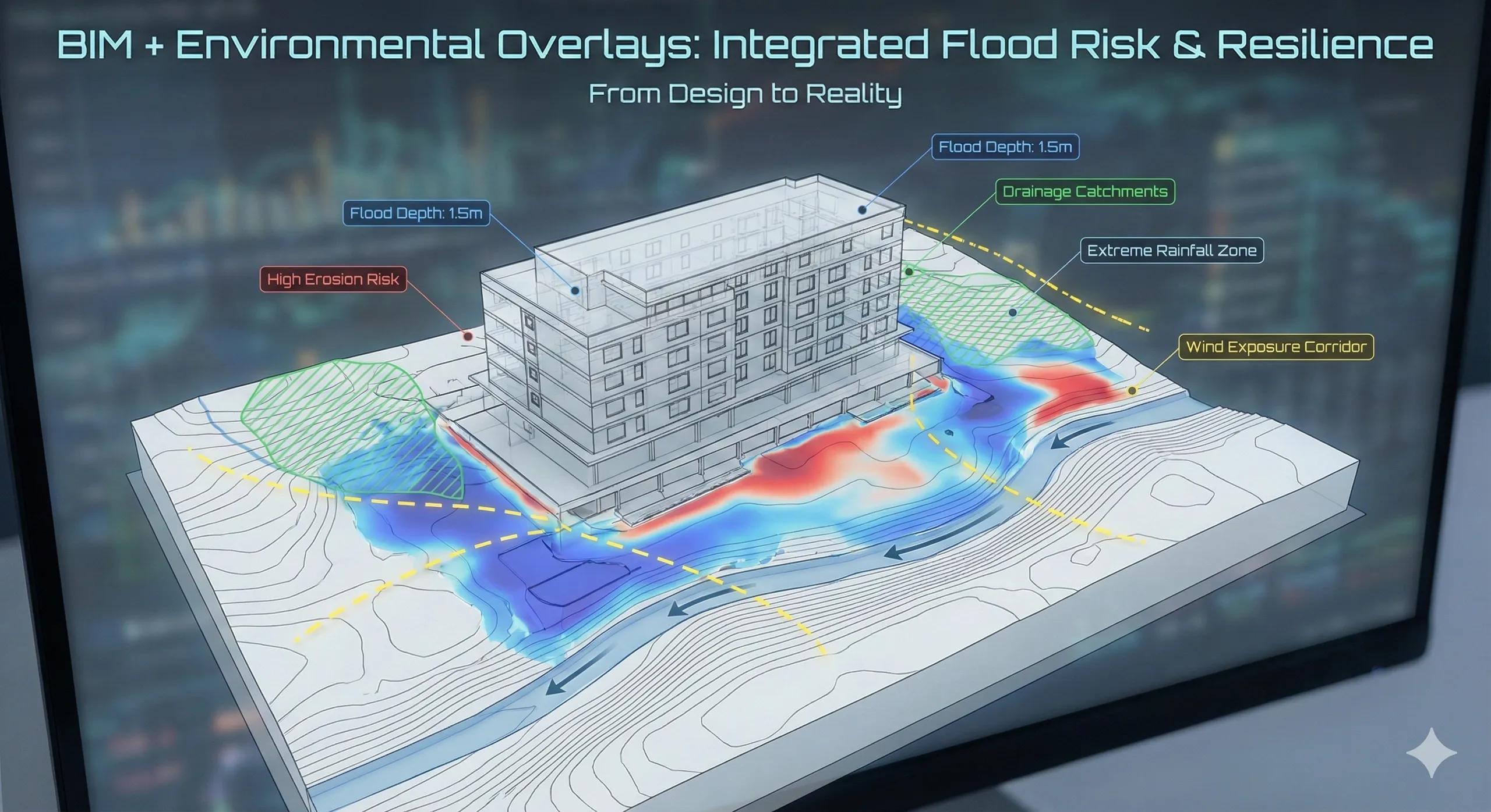
Most BIM models are excellent at answering what is being built.
Very few are designed to answer a harder question:
What happens to this asset when nature intervenes?
Flooding, heat stress, erosion, wind exposure, and environmental constraints are rarely BIM problems. They are context problems . When these risks are ignored, or added late, projects become reactive instead of resilient.
Environmental overlays are how BIM starts engaging with real-world risk .
1. Why BIM Alone Cannot See Environmental Risk
BIM models typically:
Focus on design intent
Use idealized terrain
Assume stable conditions
Environmental risk, however, depends on:
Terrain and catchments
Historical flood behavior
Climate patterns
Land-use change
Regulatory zones
None of this lives inside BIM by default.
2. What Environmental Overlays Actually Are
Environmental overlays are geospatial intelligence layers that sit alongside BIM, such as:
Flood inundation maps
Drainage catchments
Rainfall intensity zones
Soil permeability
Heat and wind exposure
Coastal and river buffers
They do not replace BIM geometry.
They inform how that geometry behaves .
3. Flood Risk Is Not Binary
Flood risk is often treated as:
Flood zone = yes or no
In reality, flood risk varies by:
Depth
Duration
Frequency
Seasonality
A BIM model that ignores these gradients creates false confidence.
Overlaying flood data allows teams to:
Compare finished floor levels
Test access routes
Identify vulnerable equipment zones
4. Why Terrain and Hydrology Must Come First
Flood overlays only make sense when:
DSM/DTM is accurate
Vertical datums are aligned
Drainage paths are understood
Without this foundation:
Flood maps are misleading
Mitigation measures are misplaced
Design responses are ineffective
Hydrology is the logic layer beneath flood risk.
5. From Compliance to Design Intelligence
Environmental data is often used only for:
Approvals
Reports
Regulatory checklists
This is a missed opportunity.
When integrated early, overlays can:
Inform building placement
Guide plinth and podium levels
Shape landscape and drainage design
Reduce long-term operational risk
Risk-aware design is better design.
6. Environmental Overlays in Construction Planning
Environmental risk doesn’t end at design.
Construction is affected by:
Seasonal flooding
Waterlogging of access roads
Heat stress on labor
Monsoon-driven delays
Overlaying environmental data helps:
Plan sequences
Adjust schedules
Reduce safety incidents
7. India Context: Why This Matters Urgently
In India:
Extreme rainfall events are increasing
Urban drainage is overstressed
Informal land-use changes flood behavior
Climate variability is high
Ignoring environmental overlays leads to:
Repeated waterlogging
Emergency redesigns
Costly retrofits
Climate-aware BIM is no longer optional.
8. Environmental Intelligence Enables Better Digital Twins
A digital twin that ignores environment:
Reacts late
Misses risk patterns
Cannot simulate extremes
Environmental overlays allow:
Scenario testing
Predictive risk analysis
Resilience planning
This is where BIM starts supporting policy and long-term stewardship .
9. Governance Matters More Than Data Volume
More data does not mean better decisions.
What matters:
Source credibility
Temporal relevance
Resolution fit
Clear interpretation rules
Environmental overlays must be governed, not dumped.
10. A Simple Risk Rule
If your BIM model cannot answer “what happens during an extreme event,” it is not decision-ready.
Conclusion
BIM excels at building coordination.
Environmental overlays introduce situational awareness .
When flood and environmental risk are integrated:
Designs become resilient
Construction becomes predictable
Assets perform better long term
BIM supports real-world decisions
Without them, BIM remains blind to the forces that matter most.