The Field Isn’t Separate from Data, It Feeds It
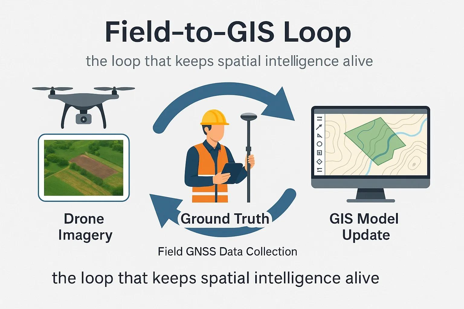
Every map, no matter how advanced, begins and ends in the field. Drones capture what satellites miss, surveyors validate what sensors predict, and together they form a continuous Field-to-GIS Loop , the feedback mechanism that keeps spatial data alive and accurate.
In this loop, drones gather , teams verify , and models evolve .
The result: a geospatial system that doesn’t just describe reality, it learns from it.
From Sky to Ground: The Modern Mapping Pipeline
The Field-to-GIS Loop bridges three essential stages of spatial intelligence:
1️⃣ Drone Data Capture
UAVs collect high-resolution aerial imagery and LiDAR data.
Outputs include orthomosaics , point clouds , and digital surface models (DSMs) with sub-5 cm accuracy.
In rugged or inaccessible areas, drones bridge the data gap between satellite scale and ground truth precision.
2️⃣ Ground Truth Validation
Field teams use GNSS/RTK devices to validate control points and feature boundaries.
These checkpoints calibrate the drone data, ensuring centimeter-level geolocation accuracy.
In environmental or construction monitoring, in-situ soil samples, vegetation counts, or material audits serve as thematic ground truth.
3️⃣ GIS Model Update
Drone and field data flow into enterprise GIS platforms for change detection, volumetric analysis, and asset updates.
Machine learning algorithms re-train using new field-validated samples.
The loop closes when models self-correct, what the field sees becomes what the GIS knows.
This integration ensures that spatial models don’t age, they evolve.
India’s Field-to-GIS Transformation
Across India, industries are embedding this loop into daily operations:
Infrastructure: NHAI uses drone surveys to update digital twins of highways every month, detecting encroachments or material deviations automatically.
Mining: The Indian Bureau of Mines (IBM) integrates UAV orthomosaics into compliance GIS to monitor lease boundaries and overburden volumes.
Agriculture: States like Telangana deploy drone-based crop health assessments, validated by farmer field data, feeding into geo-fenced subsidy systems.
Disaster Management: NDMA and NRSC combine UAV reconnaissance with on-ground GPS-tagged damage reports for rapid map updates during floods and landslides.
Each use case strengthens one principle, data credibility improves only when field validation is part of the workflow.
Why Closing the Loop Matters
Without the Field-to-GIS Loop, spatial systems drift, data becomes outdated, models lose accuracy, and decisions rely on assumptions.
When the loop is active:
Accuracy improves (from 90% → 98% positional reliability).
Operational delays shrink (map updates in hours instead of weeks).
Predictive analytics gain confidence (AI models trained with verified samples).
It’s not just about collecting more data, it’s about ensuring the data returns to the source and strengthens the model.
Technical Workflow Snapshot
Stage - Data Type - Key Tools - Outcome
Drone Capture - RGB, LiDAR, Multispectral - DJI Phantom 4 RTK, M300, LiDAR sensors - Orthomosaic / DSM
Ground Validation - GNSS, RTK, Survey forms - Emlid Reach, Trimble R10, Survey123 - Control points, field logs
GIS Update - Vector/Raster integration - ArcGIS Pro, QGIS, PostGIS - Updated layers / metadata
Model Re-training - ML-ready samples - TensorFlow, Scikit-learn - Improved accuracy metrics
This is where spatial workflows become living systems , constantly informed by real-world feedback.
Case Example: Urban Infrastructure Twin, Hyderabad
During a recent stormwater audit, a municipal agency used the Field-to-GIS Loop to update its drainage network model:
Drone flights captured orthophotos at 3 cm resolution.
Field crews verified drain alignments and inlet blockages using GNSS tablets.
GIS analysts ran change detection to identify mismatches between plan and reality.
The final updated twin improved flood simulation accuracy by 42% , reducing false hotspots in predictive flood maps.
This is how smart cities stay truly smart , not just through automation, but through active spatial feedback loops.
GeoAI: Automating the Loop
With AI, the Field-to-GIS process is shifting from manual to adaptive:
Computer Vision: Detects infrastructure anomalies directly from drone imagery.
Auto-Mapping Pipelines: Convert orthomosaics to vector maps using deep learning segmentation.
Smart Ground Apps: Field data auto-syncs to GIS dashboards in real time.
Continuous Model Training: Each validated point becomes new training data for the next model iteration.
GeoAI doesn’t replace human validation, it prioritizes where humans should look.
Outlook: The Future Is a Self-Updating Map
In the next few years, geospatial platforms will operate as closed-loop ecosystems , where drones, IoT sensors, and field surveys continuously refresh spatial databases.
Imagine a scenario where a UAV detects an anomaly, triggers a field task, and, once verified, the GIS twin updates itself automatically.
This is not fiction. It’s the future of operational geospatial intelligence, where the Earth’s data corrects itself.
Conclusion
The Field-to-GIS Loop is the circulatory system of modern mapping.
Without it, data stagnates. With it, every observation, aerial or terrestrial, becomes part of a living model that refines itself.
In this feedback loop, the goal isn’t just to map reality. It’s to stay synchronized with it.