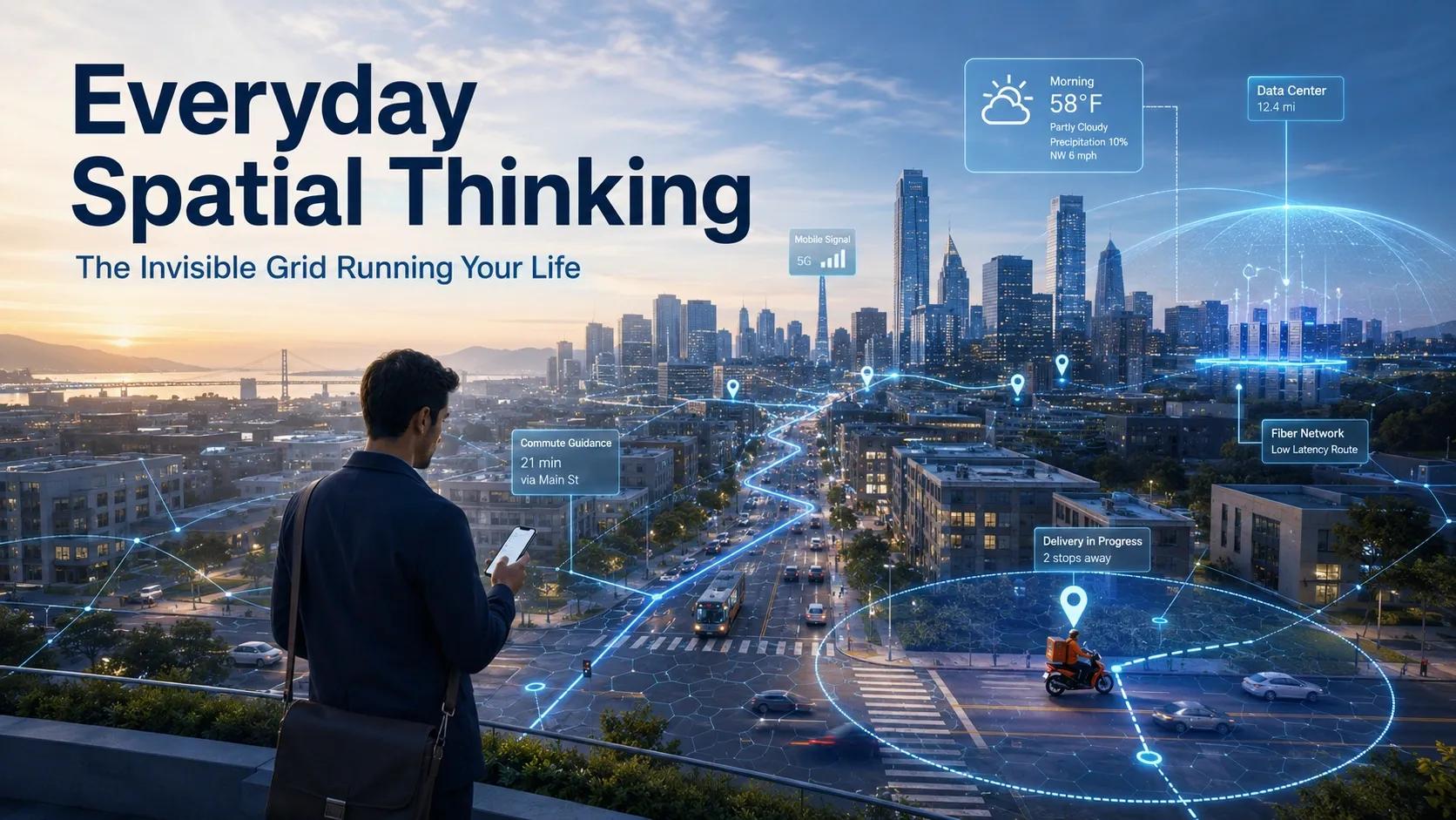
Opening Reflection: You Wake Up Inside a Map
Before you open your laptop, book a cab, order breakfast, or check the weather, your day has already entered a spatial system.
Your phone knows where you are.
Your weather app reads your location.
Your food delivery app calculates who can reach you fastest.
Your commute app compares traffic, road closures, and travel time.
Your internet speed depends on physical infrastructure you may never see.
We often think of geography as something outside daily life: maps, borders, land records, satellite images, city plans, and navigation screens.
But the truth is much closer.
Geography is not just something we look at. It is something we live inside.
Every convenience we now take for granted is running on location, distance, proximity, routing, accessibility, time zones, demand zones, delivery radii, network coverage, and physical infrastructure.
This is everyday spatial thinking.
And most of the time, it is invisible.
The Morning Grid: Location Before Action
A normal morning begins with spatial intelligence.
When you check the weather, the app is not giving you a generic forecast. It is using your coordinates, local weather stations, satellite feeds, and forecast models to tell you what may happen around you.
When your smart devices adjust schedules, alarms, or routines, they are connected to local time, network availability, and device proximity.
When your phone connects to a mobile tower or Wi-Fi network, it is not just “getting signal.” It is negotiating with a physical communication grid designed around coverage, density, terrain, buildings, and user movement.
Even before you step outside, your day has been shaped by spatial decisions.
The system already knows one important thing: where you are.
That single question drives a chain of decisions.
What is near you?
What can reach you?
What is available in your zone?
What is the fastest path?
What is the risk of delay?
What service can be activated at this location?
This is why location is no longer just a coordinate.
It has become context.
The Commute Matrix: Roads Are No Longer Static Lines
When you open a navigation app, you are not simply asking for directions.
You are asking a live spatial model to make a decision.
The app does not only calculate the shortest route. It considers traffic density, road hierarchy, speed patterns, closures, diversions, estimated travel time, historical movement, and sometimes even demand concentration.
Ride-hailing platforms go further.
They divide cities into operational zones. They estimate where demand is rising. They match drivers and passengers based on distance, time, supply, and movement patterns. Pricing may change because the city itself is behaving differently across space.
A road is no longer just a road.
It is a live corridor of movement, demand, congestion, and probability.
This is the deeper shift.
Urban mobility is moving from map-based navigation to real-time spatial operations.
The city is being read continuously.
The Geography of “Now”: Why Delivery Speed Is a Spatial Problem
Instant delivery is not only a logistics achievement. It is a geospatial achievement.
A 10-minute or 30-minute delivery promise depends on one simple question: can the system place inventory close enough to demand before the order is placed?
That is why modern retail and delivery networks rely on micro-fulfillment centers, dark stores, local hubs, and neighborhood-level demand mapping.
The location of a small warehouse is not random. It is decided by population density, income patterns, road access, delivery radius, traffic conditions, building clusters, and order frequency.
A delivery rider reaching your home quickly is only the final visible step.
Behind it sits a spatial model answering several questions:
Where should inventory be placed?
Which neighborhoods generate demand?
What is the reachable service radius?
Which roads slow down delivery?
Which product should be stored where?
How many riders are needed in each zone?
The product does not move fast only because the rider is fast.
It moves fast because the network was designed spatially.
This is why the future of commerce will not be defined only by apps and discounts. It will be defined by the quality of location intelligence behind fulfillment.
The Physical Web: Your Cloud Has a Location
We often speak of the cloud as if it is weightless.
But the cloud has land requirements.
It consumes energy.
It needs cooling.
It depends on fiber routes.
It has latency.
It is exposed to climate risk, water stress, power availability, and regulatory geography.
A video streaming smoothly on your phone depends on data centers, cables, power grids, network routes, and edge infrastructure. The experience feels digital, but the system is deeply physical.
Even the internet has geography.
Submarine cables follow physical routes across oceans. Data centers are placed based on power availability, cooling efficiency, network connectivity, tax structures, land availability, and disaster risk. Edge servers are located closer to users to reduce delay.
This means digital performance is also a spatial outcome.
The closer the infrastructure is to the user, the faster the response. The stronger the network design, the better the experience. The more resilient the physical layer, the more reliable the digital service.
The internet may feel borderless, but it is built on land, water, energy, and distance.
That is why the cloud is not only an IT topic.
It is also a geospatial infrastructure topic.
The Deeper Question: Are We Users or Spatial Nodes?
The modern individual is not just using spatial systems.
We are also feeding them.
Every commute improves traffic prediction.
Every delivery order updates demand models.
Every location ping strengthens movement analytics.
Every search for “near me” teaches the system what proximity means in practice.
Every payment, click, route, and pause adds another signal.
In other words, we are not outside the grid.
We are part of it.
This creates both opportunity and responsibility.
On one side, spatial intelligence makes life easier. It reduces uncertainty, improves access, saves time, and helps services reach people faster.
On the other side, it raises important questions about privacy, consent, governance, data ownership, and algorithmic influence.
Who controls the spatial data we generate?
How is it being used?
Can people understand the systems shaping their movement and choices?
Are convenience platforms becoming invisible decision-makers?
These questions matter because spatial intelligence is moving from the background to the operating layer of modern life.
The Spatial Intelligence Perspective
The real power of geospatial technology is not that it creates better maps.
It creates better decisions.
A map shows where things are.
A spatial model explains how things interact.
A spatial operating layer helps decide what should happen next.
This is the shift that many organizations still miss.
Whether we are talking about smart cities, logistics, digital twins, retail, infrastructure, climate risk, energy networks, or public services, the core issue is the same:
Can we understand physical reality well enough to act on it?
That is where GeoThinking becomes important.
GeoThinking is not only about GIS professionals, remote sensing analysts, BIM teams, or digital twin experts.
It is a way of understanding how location shapes behavior, access, risk, cost, time, and decisions.
It helps us see the hidden structure behind everyday life.
The cab arriving at the right gate.
The parcel reaching within an hour.
The network switching towers.
The app suggesting the nearest store.
The data center reducing latency.
The city redirecting traffic.
The utility detecting an outage.
The insurer pricing risk.
The government planning services.
All of these are spatial decisions.
Real-World Implication: The Next Competitive Advantage Is Spatial Awareness
For businesses, this has a clear message.
If your operations depend on movement, assets, customers, infrastructure, field teams, supply chains, risk zones, or service areas, then spatial intelligence is not optional.
It is a business capability.
Companies that understand location better will respond faster.
Cities that integrate spatial data better will govern better.
Infrastructure operators that model physical context better will maintain assets better.
Retailers that understand demand geography better will serve customers better.
AI systems that understand space better will make more useful recommendations.
This is why the future will not belong only to organizations that collect more data.
It will belong to those that convert spatial context into operational decisions.
Closing Reflection: The Map Is No Longer Separate from Life
The invisible grid is already running around us.
It guides movement.
It shapes convenience.
It influences access.
It powers digital services.
It connects physical assets to digital decisions.
Most people may never call this geospatial intelligence.
But they experience it every day.
The next time a cab reaches exactly where you stand, a parcel arrives faster than expected, a weather alert is accurate for your neighborhood, or a video streams without delay, remember this:
Behind that convenience is a spatial system.
Behind that system is a model of the physical world.
And behind that model is a simple truth:
We are not just living in places anymore.
We are living inside intelligent spatial networks.