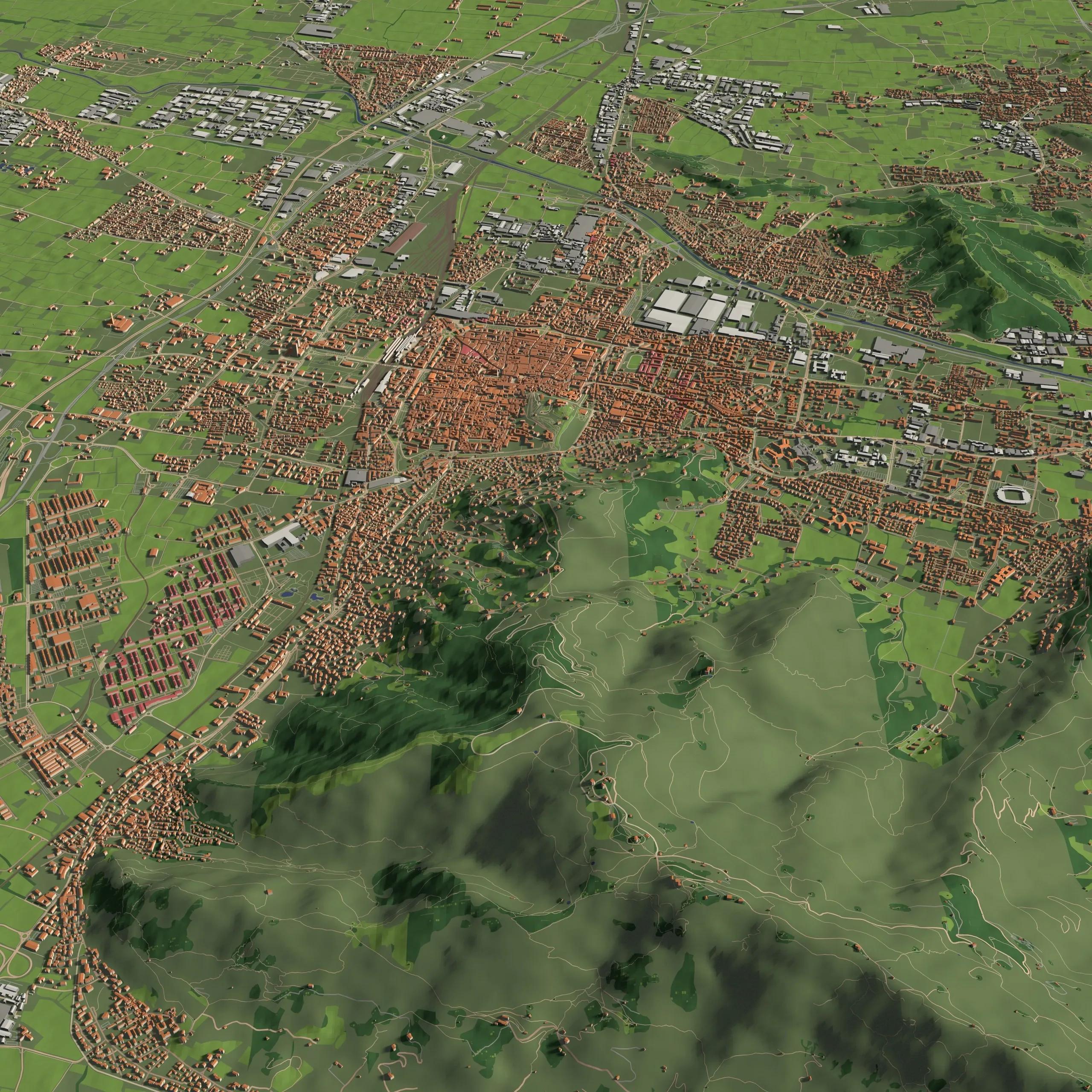
Accurate property tax assessments are critical to ensuring fair and equitable taxation, as they directly impact municipal revenue collection and public services. Traditionally, property tax assessments have relied on manual surveys, outdated records, and 2D maps. These methods, though functional, often lack precision and can lead to inaccuracies in property valuations. With the rapid advancements in geospatial technologies, the integration of 3D geospatial models has emerged as a transformative solution for improving property tax assessments.
Our 3D geospatial models offer municipalities and tax authorities the ability to visualize and analyze properties in unprecedented detail. By leveraging digital twin technology, municipalities can maintain up-to-date property data, minimize errors, and ensure more accurate and fair property tax evaluations. This article explores how 3D geospatial models enhance property tax assessments, the underlying technologies, and their broader implications for urban governance.
The Challenges in Traditional Property Tax Assessments
Traditional methods of property tax assessments have several inherent limitations. These include:
Manual Surveys : Property data is often collected through manual surveys, which are time-consuming, labor-intensive, and prone to human error.
Outdated Records : Property records are frequently outdated, especially in rapidly growing cities where properties may undergo significant changes in structure, area, or use over time.
Inconsistent Data : Discrepancies in property data, such as boundary inaccuracies or incorrect building height measurements, can lead to errors in tax assessments.
2D Limitations : Conventional 2D maps and aerial imagery fail to provide a complete understanding of property dimensions, building volumes, or the topographical context, leading to potential inaccuracies in valuations.
These limitations not only affect the accuracy of tax assessments but also lead to inequities, with some properties being overvalued while others are undervalued. This, in turn, affects the fairness of the taxation system and can create public dissatisfaction.
The Role of 3D Geospatial Models in Property Assessments
3D geospatial models offer a modern approach to overcoming the challenges associated with traditional property tax assessments. By capturing and analyzing properties in three dimensions, these models provide a more comprehensive and accurate representation of buildings and land. Below are some of the ways in which 3D geospatial models improve property tax assessments:
1. Precise Property Boundaries and Measurements
Unlike 2D maps, which often represent properties using flat polygons, 3D geospatial models allow for the precise measurement of property boundaries, heights, and volumes. This is particularly important in urban areas where properties are densely packed and multi-story buildings are common. With 3D models, tax authorities can accurately determine the floor area ratio (FAR) of buildings, which is a crucial factor in property tax calculations.
Moreover, 3D models can detect encroachments, unauthorized extensions, or discrepancies between registered property dimensions and actual structures. This enables municipalities to update property records in real-time, ensuring that tax assessments are based on the most current data available.
2. Digital Twin Technology for Continuous Monitoring
A digital twin is a dynamic digital replica of a physical asset or environment, continuously updated with real-time data. In the context of property tax assessments, digital twin technology allows municipalities to monitor property changes over time, such as new construction, renovations, or demolitions. By integrating Internet of Things (IoT) sensors and aerial imagery into the digital twin, tax authorities can detect changes as they happen, reducing the reliance on periodic manual surveys.
Digital twins also enable predictive analysis, allowing municipalities to forecast changes in property values based on trends in urban development, infrastructure improvements, or zoning changes. This foresight can be invaluable for budget planning and resource allocation.
3. Enhanced Data Integration and Visualization
3D geospatial models are not just limited to representing buildings; they also incorporate various other data layers, such as land use, infrastructure, and environmental factors. This multi-layered approach allows for more holistic property assessments by considering the surrounding context of a property.
For example, properties located near green spaces, commercial hubs, or transportation nodes may have higher valuations due to their prime locations. Conversely, properties in flood-prone areas or close to industrial zones may be devalued. 3D models provide a visual representation of these factors, enabling tax authorities to make more informed and transparent valuation decisions.
4. Automated Data Processing and Analysis
The integration of machine learning (ML) and artificial intelligence (AI) algorithms into 3D geospatial systems further enhances the property assessment process. AI-powered algorithms can automatically detect patterns, anomalies, or trends in property data, such as identifying properties with similar characteristics or flagging those with significant deviations in valuation.
For instance, if two buildings of similar size and structure in the same neighborhood are assessed at vastly different tax rates, the system can alert authorities to review these discrepancies. By automating these processes, tax authorities can reduce the time spent on manual data analysis, freeing up resources for other essential tasks.
Case Study: Municipal Success with 3D Geospatial Models
Several municipalities worldwide have already adopted 3D geospatial models for property tax assessments, achieving impressive results in terms of accuracy, efficiency, and transparency. Prominent cities across the countries have implemented a 3D cadastre system that integrates 3D property data with tax records. This system enables tax authorities to visualize buildings in three dimensions, ensuring more precise assessments of high-rise structures and multi-use properties.
Few other cities are exploring the use of 3D geospatial models to enhance their property tax system, particularly in dense urban environments where traditional methods fall short. By leveraging digital twins and geospatial data, the city aims to provide fairer tax assessments and improve public trust in the taxation process.
Broader Implications for Urban Governance
The use of 3D geospatial models for property tax assessments has broader implications beyond tax collection. These models can serve as valuable tools for urban planning, infrastructure development, and disaster management. By providing a comprehensive view of the built environment, municipalities can make more informed decisions regarding zoning regulations, transportation planning, and public safety.
Furthermore, the transparency offered by 3D geospatial models helps to build public trust in the property tax system. Property owners can easily access visual representations of their assessments, fostering a greater understanding of how taxes are calculated. This transparency can reduce disputes and appeals, saving both time and resources for municipalities.
In conclusion, the integration of 3D geospatial models into property tax assessments represents a significant leap forward in accuracy, efficiency, and fairness. By leveraging digital twin technology, municipalities can maintain up-to-date property data, reduce errors, and ensure equitable tax evaluations. These advancements not only benefit tax authorities by improving revenue collection but also contribute to more sustainable and transparent urban governance.
As more municipalities adopt 3D geospatial models for property assessments, the potential for further innovation grows. The combination of AI, machine learning, and real-time data offers new opportunities to refine and optimize property tax systems, ultimately leading to more efficient and equitable cities.