What if disaster response could be planned long before the disaster ever arrives?
When a cyclone, flood, landslide, or earthquake strikes, the difference between chaos and coordination often comes down to logistics , not just how fast things move, but where they move, who they reach, and which paths remain operational .
Disaster logistics is fundamentally a geospatial problem .
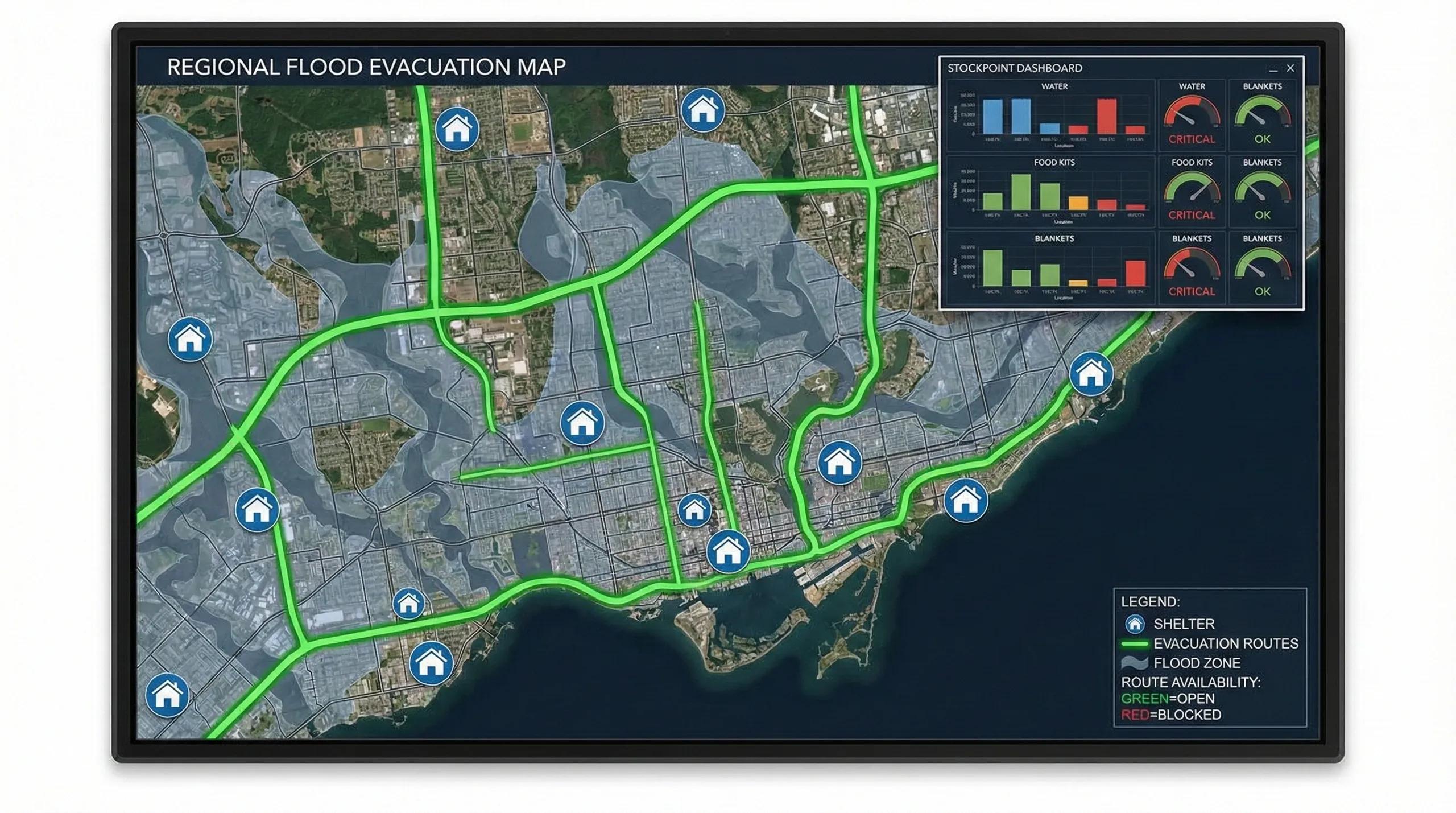
Shelter locations, evacuation routes, supply stockpoints, bridge choke points, and flood-prone corridors all exist in space , and they change dynamically as hazards unfold.
This is where GIS + digital twins + logistics optimization combine to support real-time humanitarian operations.
1️⃣ Disaster Logistics as a Spatial System
Every disaster response has the same core elements:
People → Populations at risk
Places → Shelters, safe zones, relief camps
Paths → Evacuation corridors, supply routes
Provisions → Food, water, medical stock
Priorities → Transparent, equitable distribution
But these elements are not independent, they form a graph of movement and reachability.
A flood or landslide doesn’t just block a road, it isolates an entire population cluster.
Geospatial intelligence reveals these dependencies.
2️⃣ Shelters: Where People Go First
Resilient disaster logistics begins with shelter planning . GIS helps identify:
A. Catchment Areas
Using network analysis:
Which communities can reach which shelter within 15, 30, 60 minutes?
How many people are served by each shelter?
B. Safety Criteria
Shelters must be located outside:
floodplains
landslide zones
storm surge lines
industrial hazard corridors
C. Accessibility Metrics
multiple approach routes
elevation & terrain
proximity to health facilities
pedestrian access for vulnerable groups
Shelters become nodes in the disaster network.
3️⃣ Evacuation Routes: The Spine of Response
Evacuation corridors must be designed using:
A. Road Network Graphs
high centrality = critical corridors
redundancy = reliability during road failure
bridge dependency = vulnerability
bottlenecks = risk points
B. Dynamic Modeling
Flood or landslide layers overlay on the graph to instantly show:
which roads will fail
which routes remain open
how travel times change
where congestion will build
C. Multi-modal Connectivity
Evacuation is not only by road:
boats during floods
helicopters in mountains
footpaths in dense settlements
rail for mass movement
Routing algorithms (A*, Dijkstra, OD matrices) determine who can reach where and how quickly .
4️⃣ Stocks, Supplies, and the Spatial Chain
Supply stockpoints form the logistical backbone during disasters.
GIS + logistics modeling helps plan:
A. Stockpoint Location Optimization
Ideal locations are found using:
facility location models
accessibility
population distribution
hazard exposure
transport connectivity
B. Stock Allocation
How much to store at each point? Optimized using:
demand prediction
historical damage
cluster-based needs
perishability
cold-chain constraints
C. Last-Mile Distribution
The toughest challenge. GeoAI predicts which neighborhoods will get isolated and need:
boat-based delivery
drone-based medical supply
scheduled relief cycles
foot-based relief teams
Logistics planning becomes scenario-based , not static.
5️⃣ Digital Twins for Disaster Logistics
A Disaster Logistics Twin integrates:
real-time rainfall
river levels
reservoir gate operations
flood models
landslide triggers
road closures
shelter occupancy
stock consumption
drone imagery
satellite hotspot detection
This twin can predict:
which shelter will be overloaded
which stockpoint needs replenishment
which route will fail first
how long isolation will last
when to pre-deploy relief teams
where additional field hospitals are needed
This is operational geospatial intelligence , not just mapping.
6️⃣ India: A Strong Foundation, But Gaps Remain
India already has excellent disaster frameworks:
NDMA
SDMA
IMD forecasts
INCOIS tsunami alerts
CWC river flood dashboards
ISRO disaster data distribution
But logistics is still the weakest layer because:
stock data is siloed
shelter lists are incomplete
road closures are not digitized
evacuation routes are static
district-level twins are rare
population data is outdated
The next decade demands a unified Geo-Logistics Platform for all states.
7️⃣ GeoAI for Humanitarian Operations
AI enhances situational awareness:
demand surge prediction
safe-path routing under evolving floods
supply redistribution optimization
real-time risk scoring
drone-based rapid damage mapping
anomaly detection
population movement tracking
This makes humanitarian logistics anticipatory , not reactive.
Conclusion
Disaster response is about moving people, supplies, and decisions faster than the hazard spreads.
GIS reveals where people are, what connects to them, and how disasters interrupt those connections.
With digital twins, route graphs, shelter analytics, and GeoAI forecasting, disaster logistics becomes:
faster
more equitable
more predictable
and ultimately, life-saving
In disasters, time is the only currency that matters.
Geospatial intelligence buys time.