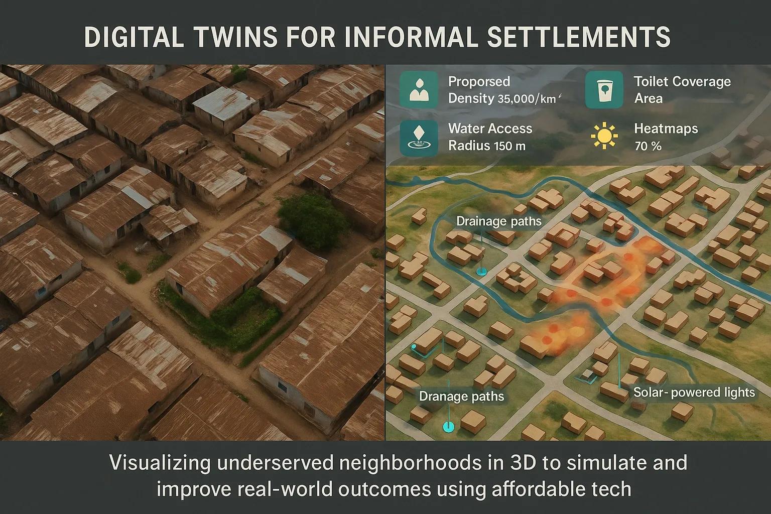
Informal settlements, often referred to as slums or unplanned neighborhoods, are a defining feature of urban expansion in many developing countries. These areas lack formal recognition, infrastructure, and often any structured planning data. With the rise of urban populations, especially in the Global South, city planners and policymakers are increasingly challenged to address the needs of these communities. Traditional methods of urban planning and infrastructure development are expensive and often ineffective in such dynamic, densely populated environments. Enter digital twin technology, an emerging tool that enables real-time, data-driven simulations of physical environments, now being adapted for informal settlements through low-cost 3D mapping.
The Challenge: Understanding Informal Settlements
Informal settlements present unique challenges:
Lack of cadastral data : These areas are usually not covered by official land records.
Irregular layout : Streets, buildings, and public spaces are developed organically.
High density : Population density is often several times higher than formal city areas.
Invisibility in planning processes : Their informal status makes them easy to overlook in city-level planning and budgeting.
These limitations make it difficult to extend public services like water supply, sanitation, drainage, waste management, and electricity, let alone advanced urban services such as emergency response, digital connectivity, or education and healthcare access.
The Digital Twin Advantage
A digital twin is a virtual representation of a physical entity. Traditionally used in industries like manufacturing or aerospace, digital twins have now found relevance in urban planning. When applied to informal settlements, digital twins allow planners and NGOs to:
Visualize community layout in 3D
Simulate infrastructure upgrades (like sewage, roads, or solar lighting)
Model risks (such as flood zones or fire hazards)
Plan targeted interventions (like smart sanitation points or water kiosks)
This can be achieved without the need for expensive equipment or full-blown city-level BIM implementation.
Low-Cost 3D Mapping: Enabler for Digital Twins
The primary barrier to developing digital twins in informal settlements is the lack of data. However, advances in low-cost geospatial data collection methods now offer feasible solutions:
1. Drone-Based Photogrammetry
Using consumer drones, planners can capture high-resolution images of dense settlements. These images are processed into 3D point clouds and orthophotos, which become the base layer for the digital twin.
2. Mobile Mapping and LiDAR Alternatives
Affordable handheld devices and smartphones with structured light sensors (e.g., LiDAR-enabled phones) can generate street-level 3D data, useful for modeling internal alleys and vertical structures.
3. OpenStreetMap and Community Mapping
Local residents can be trained to use open-source mobile apps like KoboToolbox, Mapillary, or Field Papers to record infrastructure, utilities, and building usage. These datasets can be georeferenced and integrated into the 3D model.
4. Satellite Data Fusion
Combining publicly available satellite imagery (e.g., Sentinel-2, Landsat) with drone and mobile data enhances accuracy and expands coverage, especially in cloud-prone or inaccessible areas.
Application Areas for Digital Twins in Informal Settlements
1. Infrastructure Planning
Digital twins can simulate road widening, drainage improvements, and energy network extensions. For example, hydrological modeling on a 3D terrain model can identify low-lying areas prone to flooding and prioritize them for intervention.
2. Sanitation and Water Supply
Using the model, planners can identify optimal locations for shared toilets, water tanks, and waste collection points. Simulations can estimate user access, walkability, and coverage.
3. Disaster Risk Reduction
Digital twins can overlay environmental hazard data to model fire spread, landslide zones, or inundation during monsoon. Emergency response simulations help develop evacuation plans.
4. Health and Education Access
By mapping population density and structure occupancy, planners can analyze whether schools and clinics are within reasonable walking distances and plan mobile or modular services accordingly.
5. Community Engagement
Augmented visualizations built from the digital twin can be used to communicate proposed changes to residents, enabling participatory planning. Community feedback can also be directly geotagged into the digital twin environment.
Case Studies and Emerging Examples
Kibera, Nairobi
Organizations like Spatial Collective and the Humanitarian OpenStreetMap Team (HOT) have developed base digital twins using drone imagery and citizen-collected data to guide public toilet placement and clean water kiosks.
Dharavi, Mumbai
Pilot initiatives involving academic institutions and NGOs have started using drone imagery combined with GIS layers to simulate infrastructure retrofitting without demolishing large parts of the neighborhood.
Rocinha, Brazil
Using a mix of drone photogrammetry and mobile mapping, planners modeled the impact of landslide mitigation structures on the steep slopes of the favela.
Implementation Framework
Stakeholder Alignment City authorities Local NGOs and community groups Academic institutions Technology partners
Data Collection & Processing Drone surveys Community mapping Satellite imagery fusion
Digital Twin Development 3D modeling using tools like Blender, QGIS, CesiumJS Integration with IoT data if available (e.g., water usage, air quality)
Use-Case Definition Prioritize based on community needs: sanitation, lighting, education, etc.
Validation and Iteration Continuous updates through resident feedback and periodic resurveying
Challenges and Considerations
Data Privacy and Consent : Residents must be informed and give consent, especially when imagery captures personal spaces.
Dynamic Settlements : Structures change frequently, so models must be regularly updated.
Technology Access : Need to ensure the tools used are open-source or low-cost for sustainability.
Policy Integration : Governments must recognize these models as planning tools to ensure their utility.
Future Outlook
With improving drone technologies, AI-based mapping, and cloud platforms, the development of digital twins for informal settlements is becoming more accessible. Integration with AI tools could soon enable automated feature extraction, predictive analytics, and automated service delivery planning. Partnerships with urban local bodies will be key to scaling this solution nationally and globally.
India’s Smart Cities Mission and programs like PMAY-U (Pradhan Mantri Awas Yojana - Urban) could benefit immensely from integrating these localized digital twins to bridge the urban data divide. Moreover, initiatives aligned with the UN Sustainable Development Goals (SDGs), especially SDG 11 (Sustainable Cities and Communities), can use digital twins to monitor and improve service delivery in underserved urban areas.
Conclusion
Digital twins, once confined to smart factories and city-scale infrastructure, are now emerging as a powerful tool for inclusive urban planning. By leveraging low-cost 3D mapping techniques, city planners, NGOs, and community stakeholders can visualize and simulate targeted improvements in informal settlements. This approach not only improves service delivery but also empowers residents by making them visible in urban data systems. For rapidly urbanizing nations, this could be a game-changer in ensuring equitable and data-informed development.