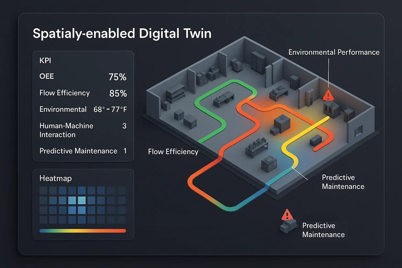
The advent of digital twins has revolutionized how industries approach asset management, operational optimization, and strategic decision-making. While traditional performance metrics like Overall Equipment Effectiveness (OEE) have served as foundational indicators for manufacturing efficiency, the comprehensive and dynamic nature of digital twins necessitates a more nuanced and expansive set of Key Performance Indicators (KPIs). This article delves into the limitations of relying solely on OEE for digital twin performance assessment and proposes a framework for spatially-enabled KPIs that more accurately reflect the multidimensional value generated by these sophisticated virtual replicas.
OEE, calculated as the product of Availability, Performance, and Quality, provides a snapshot of how effectively a manufacturing operation is running. It’s undeniably valuable for identifying bottlenecks and inefficiencies on the factory floor. However, a digital twin, especially one that is spatially enabled, extends far beyond the confines of a single production line or discrete manufacturing process. It encompasses an intricate web of interconnected systems, environmental factors, human interactions, and geographical contexts. Therefore, restricting digital twin performance measurement to OEE is akin to judging the health of an entire city based solely on the traffic flow of one street.
The true power of a digital twin lies in its ability to integrate data from diverse sources – IoT sensors, remote sensing platforms, UAVs, satellite imagery, Building Information Models (BIM), and even human input – to create a living, breathing model of a physical asset, process, or system. When this twin is spatially enabled, it gains an additional layer of intelligence, grounding its data within a precise geographical context. This spatial intelligence allows for the analysis of performance not just in terms of machine uptime, but also in relation to location-specific environmental conditions, supply chain logistics, resource distribution, and even the safety and efficiency of personnel within a defined physical space.
To truly capture the multifaceted value of spatially-enabled digital twins, a shift in KPI philosophy is imperative. We must move beyond OEE's singular focus on manufacturing output and embrace a holistic approach that considers efficiency, sustainability, resilience, and adaptability across an entire ecosystem.
Spatially-Enabled KPIs for Digital Twin Performance
The following categories outline a more comprehensive suite of KPIs, emphasizing the unique advantages offered by spatially-enabled digital twins:
1. Spatial Resource Optimization & Utilization:
Geospatial Asset Utilization Rate: This KPI measures how effectively geographically distributed assets (e.g., machinery across multiple sites, fleet vehicles, or even scattered sensor networks) are being utilized. Spatially-enabled twins can track real-time locations, operational status, and maintenance needs, allowing for dynamic reallocation and optimization of resources based on spatial demand and availability. This goes beyond simple uptime to consider travel time, proximity to demand, and efficient routing.
Location-Based Energy Efficiency (LBEE): While traditional energy efficiency focuses on overall consumption, LBEE leverages spatial data to identify and quantify energy losses or gains tied to specific geographical areas or environmental conditions. For instance, a digital twin of a smart city can pinpoint areas with high energy consumption due to inefficient building insulation (identifiable through thermal imaging from remote sensing) or suboptimal HVAC zoning, allowing for targeted interventions.
Proximity-Based Supply Chain Efficiency: This KPI evaluates the efficiency of supply chains by considering the spatial relationships between suppliers, production facilities, and distribution centers. A spatially-enabled twin can simulate different logistical routes, identify potential choke points, and optimize inventory placement based on real-time geographical demand and transit times, leading to reduced transportation costs and faster delivery.
2. Predictive and Proactive Maintenance & Resilience:
Spatially-Correlated Anomaly Detection Rate: Digital twins constantly ingest sensor data. A spatially-enabled twin can correlate anomalies not just with individual asset behavior but also with their geographical context. For example, a sudden temperature spike in a specific area of a pipeline, combined with localized seismic data (from geospatial sensors), could indicate a higher probability of failure, leading to proactive maintenance and preventing widespread disruption.
Geospatial Risk Exposure Score: This KPI quantifies the risk exposure of assets or operations based on their geographical location and susceptibility to environmental hazards (e.g., flood zones, seismic activity, extreme weather patterns). The digital twin, fed by satellite imagery and climate models, can dynamically update this score, enabling organizations to prioritize protective measures and develop robust disaster recovery plans.
Predictive Downtime Avoidance (Spatial Context): While OEE captures actual downtime, this KPI focuses on the avoided downtime through proactive, spatially-informed interventions. By analyzing patterns of degradation in assets situated in similar geographical environments or exposed to similar spatially varying stressors, the digital twin can predict potential failures and recommend preventative maintenance, minimizing future disruptions.
3. Environmental and Sustainability Impact:
Geospatial Carbon Footprint Tracking: A spatially-enabled digital twin can accurately track and attribute carbon emissions to specific geographical locations, processes, or even individual assets. This granularity allows for precise identification of emission hotspots and facilitates targeted interventions for reduction, moving beyond aggregated corporate-level emissions.
Resource Depletion Rate (Spatially-Aware): For industries relying on natural resources, this KPI tracks the rate of resource consumption within specific geographical boundaries. By integrating data from remote sensing and surveying, the digital twin can provide real-time insights into resource availability and depletion trends, supporting sustainable extraction practices and long-term resource planning.
Ecological Impact Assessment (Localized): For large-scale infrastructure projects or industrial operations, the digital twin can monitor and assess the localized ecological impact of activities using geospatial data (e.g., changes in vegetation cover, water quality, biodiversity). This enables organizations to mitigate negative environmental effects and demonstrate commitment to ecological stewardship.
4. Immersive Operations and Human-Centric Performance:
XR-Enabled Task Completion Efficiency: For tasks where immersive technologies (AR/VR) are used in conjunction with the digital twin, this KPI measures the efficiency and accuracy of task completion. The spatial awareness inherent in digital twins enhances these experiences, allowing for more precise guidance and reduced errors in real-world operations.
Spatially-Optimized Workforce Deployment: This KPI evaluates the effectiveness of deploying human resources based on their skills, availability, and geographical proximity to tasks or emergencies. The digital twin can simulate optimal team assignments, considering travel times and on-site requirements, leading to improved productivity and faster response times.
Safety Incident Reduction (Spatially Identified): By integrating location data of personnel and assets with environmental hazards or operational risks identified within the digital twin, this KPI tracks the reduction in safety incidents. The spatial context allows for pinpointing high-risk zones and implementing targeted safety protocols or training.
Conclusion
While OEE remains a valuable metric for discrete manufacturing processes, it falls short in capturing the holistic value proposition of spatially-enabled digital twins. These advanced models transcend the factory floor, offering unparalleled insights into geographically distributed assets, environmental interactions, and complex logistical networks. By embracing a comprehensive suite of spatially-enabled KPIs, organizations can move beyond a limited view of operational efficiency and unlock the full potential of their digital twin investments. This paradigm shift in performance measurement allows for more precise decision-making, proactive risk mitigation, enhanced sustainability, and ultimately, the realization of true digital transformation across diverse industries. The future of performance measurement lies in understanding not just "what" is happening, but "where" and "why," making spatially-enabled digital twins and their tailored KPIs indispensable tools for navigating the complexities of the modern industrial landscape.