India’s Digital Public Infrastructure (DPI), including Aadhaar, Unified Payments Interface (UPI), and national logistics systems, is already transforming governance and commerce. Yet, these systems often operate as standalone digital services. Integrating geospatial intelligence can provide a powerful layer of context, enabling smarter decision-making, better service delivery, and stronger national resilience.
From mapping underserved communities for targeted welfare delivery to optimizing last-mile connectivity for digital transactions, geospatial integration in DPI is no longer optional, it’s a strategic necessity.
The Problem: Context Blindness in DPI Systems
While DPI platforms are digitally advanced, they face operational challenges due to limited use of location data:
Aadhaar Services – Biometric authentication failures in remote areas due to network gaps or lack of real-time service availability mapping.
UPI Transactions – Fraudulent transactions often lack geospatial verification to detect anomalies (e.g., sudden location shifts in user patterns).
Logistics Networks – Inefficient route planning and lack of visibility into infrastructure bottlenecks, leading to delays and higher costs.
Without location context, these systems operate like GPS without a map, functional, but directionless.
Solution: Integrating Geospatial Intelligence into DPI
Geospatial intelligence can provide location-aware insights that make DPI systems adaptive, predictive, and more efficient.
Key Capabilities:
Geo-tagged Infrastructure Mapping – Mapping Aadhaar centers, UPI service providers, and logistics hubs.
Real-time Spatial Analytics – Traffic, weather, and environmental data overlays for dynamic decision-making.
Anomaly Detection – Identifying fraud patterns through location-linked transaction data.
Predictive Modelling – Anticipating demand spikes in welfare services or logistics capacity.
How It Works Across Three Core DPI Components
1. Aadhaar + Location Intelligence
Challenge: Rural and remote populations face authentication issues due to poor connectivity.
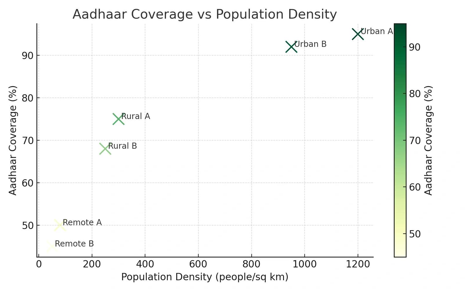
Geospatial Integration: Map all Aadhaar centers with real-time connectivity status; overlay population density and transport accessibility data.
Impact: Identify underserved areas and plan mobile Aadhaar units. Reduce authentication failure rates by targeting connectivity improvements.
2. UPI + Geospatial Fraud Detection
Challenge: Fraudulent transactions exploit system blind spots by masking device or user location.
Geospatial Integration: Add location verification to each UPI transaction, comparing device location with transaction origin in milliseconds.
Impact: Flag suspicious patterns such as location jumps between distant cities in short timeframes. Enable geofenced transaction limits in high-risk areas.
3. National Logistics Networks + Spatial Optimization
Challenge: Inefficient routes and poor visibility into road and port bottlenecks.
Geospatial Integration: Integrate GPS tracking, road condition mapping, and live congestion data into logistics platforms.
Impact: Reduce average delivery times. Lower operational costs via optimized fuel consumption.
Case Example: Geo-enabled PM GatiShakti
India’s PM GatiShakti National Master Plan already leverages GIS to unify planning a crossroads, railways, ports, and airports. Extending similar frameworks to Aadhaar and UPI could create a truly integrated DPI, where financial, identity, and logistics systems share geospatial data for mutual benefit.
Benefits & ROI of DPI-Geospatial Integration
For Government:
Better targeting subsidies and welfare services.
Improved infrastructure planning based on real location data.
For Businesses:
Reduced fraud and operational risks.
Smarter supply chain routes and inventory management.
For Citizens:
Faster, more reliable services in identity verification and payments.
Reduced delivery times for goods and services.
ROI Summary:
Fraud reduction: Up to 40% improvement with geolocation-based verification.
Operational efficiency: 15–20% cost savings in logistics.
Service reach: 25% increase in rural Aadhaar coverage through targeted planning.
Implementation Roadmap
Phase 1: Data Infrastructure
Integrate GIS platforms with Aadhaar, UPI, and logistics APIs.
Ensure compliance with India’s Digital Personal Data Protection Act, 2023.
Phase 2: Pilot Projects
Launch pilots in selected districts with high fraud rates or low service coverage.
Test geofencing and location-verification features in UPI.
Phase 3: Nationwide Rollout
Scale successful pilots.
Train local administrators and partners on geospatial analytics tools.
Future Outlook
As India moves toward Web 3.0 governance models and AI-driven services, geospatial intelligence will become the central nervous system of DPI. Combining satellite imagery, IoT sensors, and AI-based spatial analytics will not just enhance current services but also power future DPI layers like health, education, and disaster management platforms.
Conclusion
Integrating geospatial intelligence into India’s DPI is not just about adding maps, it’s about adding context, precision, and foresight to the country’s most critical digital systems. The result will be a more inclusive, secure, and efficient digital ecosystem, where identity, finance, and infrastructure work together seamlessly to serve every citizen.