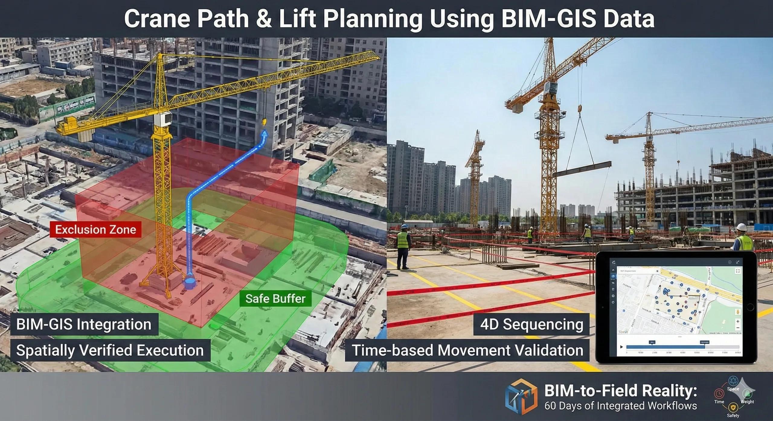
Crane operations are among the highest-risk, highest-impact activities on any construction site.
Yet, in many projects, lift planning still relies on:
Experience and rules of thumb
2D lift drawings
Static assumptions about access and clearance
BIM–GIS integration turns crane planning from confidence-based judgment into spatially verified execution .
1. Why Crane Planning Fails in Practice
Most crane incidents or inefficiencies stem from:
Unverified swing paths
Temporary obstructions not modeled
Changing terrain or ground bearing capacity
Overlapping crane envelopes
Poor visibility of exclusion zones
These are spatial problems , not procedural ones.
2. What BIM–GIS Adds to Crane Planning
When BIM is fused with GIS, planners gain:
Accurate terrain and bearing context
True spatial clearance checks (horizontal + vertical)
Proximity analysis to buildings, utilities, and people
Time-based movement validation
Lifts are no longer assumed safe, they are proven safe .
3. Crane Placement Is a Geospatial Decision
Optimal crane placement depends on:
Radius and reach requirements
Load paths and weights
Ground conditions
Access for erection and dismantling
Interaction with other cranes
GIS helps evaluate these constraints before committing to location.
4. Visualizing Lift Paths in 4D
Linking crane motion to 4D sequencing allows teams to:
Simulate lifts during actual construction phases
Detect conflicts with evolving structures
Identify periods of congestion or overlap
Test alternate lift windows
Time matters as much as space.
5. Managing Exclusion Zones and Safety Buffers
BIM–GIS enables:
Dynamic exclusion zone mapping
Validation of pedestrian and vehicle separation
Visibility of blind spots
Safer coordination with site logistics
Safety zones become living spatial layers , not static drawings.
6. Temporary Conditions Are the Biggest Risk
Crane planning often ignores:
Temporary scaffolding
Material stacks
Formwork systems
Access ramps
When these are modeled and tracked spatially, lift risks drop dramatically.
7. India Context: Why This Is Critical
In Indian construction:
Sites are congested
Crane radii often overlap public space
Ground conditions vary widely
Multiple cranes operate in close proximity
Spatially validated crane planning:
Reduces near-misses
Improves regulatory confidence
Enhances public and worker safety
8. From Approval Drawings to Operational Intelligence
Traditional lift plans satisfy approvals.
BIM–GIS-based plans support daily execution .
They allow:
Faster replanning when conditions change
Clear communication with operators
Evidence-based safety reviews
9. Common Pitfalls to Avoid
Crane planning fails when:
Terrain is oversimplified
Temporary works are ignored
Simulations aren’t updated
Planning stops after approval
Lift planning must evolve with the site.
10. A Simple Crane Rule
If a crane path hasn’t been spatially validated against today’s site conditions, it’s already outdated.
Conclusion
Crane operations are where:
Space
Time
Weight
Safety
intersect.
BIM–GIS integration allows teams to:
Anticipate conflicts
Reduce risk
Improve productivity
Execute lifts with confidence
When lifts are planned spatially, not just procedurally, cranes stop being bottlenecks and start becoming predictable assets .