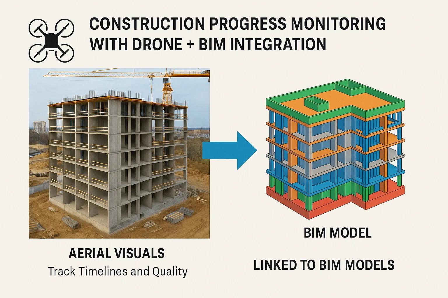
In an era where real-time information and digital precision are pivotal to infrastructure development, the fusion of drones and Building Information Modeling (BIM) has emerged as a powerful approach for construction progress monitoring. This integration is transforming how construction teams track project timelines, assess work quality, and manage deviations on-site. By combining high-resolution aerial visuals from drones with the structured data environment of BIM, stakeholders gain a comprehensive and dynamic understanding of construction progress. This article explores the technical foundations, benefits, and real-world implications of using Drone + BIM integration in construction progress tracking.
The Need for Enhanced Progress Monitoring
Traditional methods of construction monitoring, site visits, manual measurements, and static photographs, are labor-intensive and often lack objectivity. Errors in reporting, communication gaps, and delayed data processing can result in cost overruns and schedule slippages. The integration of drone-based surveys with BIM workflows addresses these inefficiencies through automation, accuracy, and visual clarity.
In the global construction sector, projected to grow to USD 15.2 trillion by 2030, digital tools that reduce rework and improve coordination are essential. Drone + BIM integration offers a scalable solution that supports proactive decision-making across infrastructure, commercial, and industrial projects.
Technical Workflow: Drone Data to BIM Integration
1. Aerial Data Collection
Drones equipped with RGB, LiDAR, or thermal sensors perform scheduled flights over the construction site. These flights are programmed to capture data at predefined waypoints and altitudes, ensuring consistency and repeatability.
Orthophotos and point clouds are generated through photogrammetry or LiDAR post-processing.
Flights can be performed weekly or bi-weekly to align with construction milestones.
2. Data Processing and Alignment
Collected data is processed using software such as Pix4D, DroneDeploy, or RealityCapture to create 2D orthomosaics, 3D textured meshes, and georeferenced models.
The output is aligned with BIM coordinate systems using control points or GPS references.
The result is a digital twin that reflects the as-is site condition.
3. Integration with BIM
The aerial model is imported into Common Data Environments (CDEs) like Autodesk BIM 360, Navisworks, or Trimble Connect.
Visual comparisons between the planned model (BIM) and actual site condition (drone data) help identify delays, deviations, and quality issues.
Clash detection and progress quantification can be automated through model comparison.
4. Progress Dashboards and Reporting
Digital platforms overlay construction schedules (4D BIM) with drone-captured visuals, generating visual dashboards that track:
% completion by structure/component
Schedule variance (planned vs actual)
Quality compliance (surface finish, spatial alignment)
Safety observations (unauthorized access, material clutter)
Benefits of Drone + BIM Integration
1. Visual Progress Verification
Drone visuals provide high-resolution, bird’s-eye views of the site that are easy to interpret and align with BIM elements. By comparing with the planned model, discrepancies can be spotted in real-time.
2. Time and Cost Efficiency
Automated flights and digital reporting eliminate the need for repeated manual surveys. According to McKinsey, digital monitoring solutions can reduce construction costs by up to 20%.
3. Schedule Control with 4D BIM
Integrating project timelines with drone visuals enables dynamic 4D simulations. Project managers can simulate work sequences and track critical path delays with visual evidence.
4. Improved Quality Assurance
Drones detect structural deviations such as misalignments, incomplete components, or unauthorized changes that might not be visible at ground level. These observations are tagged in the BIM model for issue tracking and resolution.
5. Stakeholder Communication
Site conditions and progress can be shared with remote stakeholders through interactive dashboards or 3D walkthroughs, improving transparency and accountability.
6. Historical Site Records
All drone surveys are archived and version-controlled within the BIM environment. This allows teams to audit progress, investigate disputes, and document construction phases for future facility management.
Real-World Application Scenarios
1. Infrastructure Projects
In large-scale infrastructure like highways, rail corridors, and metro stations, drone + BIM integration supports linear asset tracking. With geo-tagged progress visuals and model overlays, teams monitor embankments, bridges, and stations over long distances.
2. High-Rise Buildings
Vertical construction monitoring benefits from drone-captured façade inspections and floor-wise progress documentation. Integrated data allows floor-by-floor tracking of slab casting, façade cladding, and MEP installations.
3. Industrial Facilities
Factories and plants with large equipment installations leverage drone imagery to verify alignment with mechanical drawings and perform as-built validation against BIM models.
Key Technologies Enabling Integration
Component - Role
Drones (UAVs) - Aerial data capture using photogrammetry or LiDAR
Reality Capture Software - Converts drone imagery into 3D models or point clouds
BIM Software - Structured modeling (Autodesk Revit, Tekla, etc.)
4D Simulation Tools - Timeline-linked visualizations (Synchro, Navisworks)
Common Data Environment (CDE) - Central platform for storing and comparing drone and BIM data
Challenges and Considerations
Data Alignment Issues : Accurate georeferencing is essential for meaningful comparison. Poorly placed ground control points (GCPs) can cause errors in overlaying drone data on BIM models.
Regulatory Compliance : Drone operations in urban areas are subject to airspace and safety regulations. Licensed pilots and permits are mandatory in many jurisdictions.
Processing Overhead : High-resolution drone imagery and BIM files are data intensive. Processing and rendering may require robust computational infrastructure.
Change Management : Integrating new workflows demands training and adoption across construction teams. This cultural shift is often underestimated.
Future Outlook
As AI and automation mature, Drone + BIM integration will evolve to offer real-time anomaly detection, predictive analytics for schedule slippages, and automated compliance checks. Integration with IoT sensors on-site will further enhance monitoring capabilities by combining aerial data with environmental and equipment-level metrics.
Global construction tech startups are already experimenting with AI-powered drones that autonomously inspect and report construction progress, reducing reliance on human operators. Integration with Digital Twins will allow for continuous lifecycle monitoring from construction to operations.
Conclusion
The integration of drone technology with BIM has redefined construction progress monitoring by offering real-time visibility, data-driven insights, and improved decision-making. This approach enhances control over project timelines and quality, minimizes rework, and bridges the gap between design and execution. As more construction firms adopt digital transformation strategies, Drone + BIM will play a pivotal role in making construction projects more predictable, efficient, and transparent.