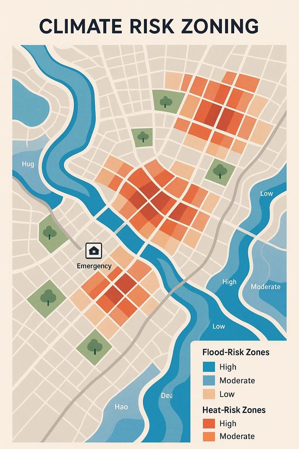
Climate change has intensified the frequency and severity of extreme weather events, with urban areas increasingly vulnerable to its impacts. Floods, heatwaves, and other climate-related hazards not only disrupt daily life but also inflict significant economic and social costs. In response, municipal governance needs proactive tools to reduce vulnerabilities and ensure urban resilience. One such tool is Climate Risk Zoning (CRZ), a spatial planning approach that helps city authorities identify, map, and manage areas prone to climate risks. This article focuses on how cities can pre-map flood and heat-risk zones and integrate them into urban planning, infrastructure development, and emergency management.
Understanding Climate Risk Zoning
Climate Risk Zoning is the process of delineating geographic zones within a city or region based on their exposure to specific climate-related hazards. These zones are created using a combination of historical data, predictive climate models, topographic and land-use information, and socio-economic vulnerability indices. CRZ is typically applied to:
Flood-prone areas: Based on rainfall intensity, drainage capacity, elevation, and proximity to water bodies.
Urban heat islands (UHIs): Identified using land surface temperature data, vegetation cover, and urban morphology.
By visualizing climate risks spatially, CRZ supports evidence-based decision-making in zoning laws, land-use planning, building codes, and disaster preparedness.
Why Pre-Mapping Climate Risks is Crucial for Cities
Informed Urban Planning Mapping climate risks helps urban planners avoid high-risk areas for future developments, reducing exposure to natural hazards. It informs decisions about infrastructure siting, housing, public spaces, and critical services.
Cost-Effective Resilience Building Identifying risk zones beforehand enables proactive measures, such as green buffers, elevated construction, or heat-resilient materials, before the costs of disaster response and recovery mount.
Data-Driven Governance CRZ enables municipal authorities to use geospatial intelligence and climate data for policy formulation, resource allocation, and climate adaptation strategies.
Equity and Risk Communication CRZ maps can highlight socially vulnerable populations living in high-risk areas, enabling targeted interventions and clearer communication with the public.
Methodology for Climate Risk Zoning
1. Data Collection
A robust CRZ system starts with multi-source datasets:
Topographic data: Elevation models (DEM), slope, watershed maps.
Hydrological data: River basins, flood frequency, drainage systems.
Meteorological data: Temperature, precipitation, humidity trends.
Remote sensing data: Satellite-derived indices such as NDVI, LST.
Socio-economic data: Population density, infrastructure distribution, income levels.
2. Hazard Modeling
Flood Risk Modeling: Hydrologic and hydraulic models such as HEC-HMS and HEC-RAS simulate runoff and flow patterns under various rainfall scenarios. In low-lying coastal cities, sea-level rise and storm surge projections are also incorporated.
Heat Risk Modeling: Urban heat island maps are generated using land surface temperature from satellites (e.g., Landsat or MODIS) and overlaid with land cover classifications. Tools like ENVI or Google Earth Engine are widely used.
3. Risk Classification and Zoning
The hazard exposure data is overlaid with vulnerability layers to produce composite risk indices. These indices are then classified into zones such as:
Low Risk
Moderate Risk
High Risk
Very High Risk
This zoning can follow a grid-based approach or be integrated with cadastral data for ward-level precision.
4. Validation and Stakeholder Consultation
Risk zones must be validated using historical records (e.g., past flood inundation maps) and field verification. Participatory mapping with local communities and consultation with urban planners, disaster management teams, and health departments strengthens the accuracy and acceptance of CRZ outputs.
Application in Municipal Governance
1. Development Control and Land-Use Regulation
CRZ maps inform the Master Plan or Development Plan of a city by identifying “No Development Zones” and areas suitable for restricted or resilient infrastructure. Building by-laws can be revised based on flood zone classifications (e.g., elevated plinths in high-risk zones).
2. Smart Infrastructure Planning
Smart stormwater systems, permeable pavements, green roofs, and heat-resilient public amenities can be prioritized in identified risk zones. For instance, thermal comfort standards may be enforced in housing projects located in heat-prone zones.
3. Climate-Resilient Budgeting
City budgets can allocate funds for resilience measures based on the spatial distribution of risks. CRZ helps in prioritizing wards for interventions like afforestation, water body restoration, or drainage network upgrades.
4. Disaster Preparedness and Early Warning
Emergency evacuation routes, shelter locations, and first-response infrastructure can be mapped and managed based on CRZ layers. This is crucial in flood-prone areas where rapid evacuation is needed.
Case Studies
a. Surat, India - Urban Flood Risk Zoning
Surat Municipal Corporation collaborated with TARU and the Rockefeller Foundation to prepare flood risk maps using rainfall, drainage, and population data. These maps guided infrastructure planning in vulnerable zones and were integrated into the city’s climate resilience strategy.
b. Ahmedabad, India - Heat Action Plan
The Ahmedabad Heat Action Plan used heat vulnerability mapping, including land surface temperature data and public health exposure, to pre-identify high-risk zones. These maps informed early warning systems, public awareness campaigns, and location-specific mitigation efforts.
Challenges in Implementation
Data Gaps: Many municipalities lack high-resolution data and technical capacity to generate accurate CRZ maps.
Institutional Coordination: CRZ requires cooperation across departments, urban planning, public works, disaster management, and environmental health.
Dynamic Risks: Climate risks evolve over time. CRZ systems need periodic updates based on new data and projections.
Integration into Legal Frameworks: Zoning maps must be legally binding or at least recognized in municipal policies to be effective.
Way Forward
Invest in Geospatial Infrastructure: Cities must invest in GIS labs, satellite data access, and skilled personnel to develop and maintain CRZ systems.
Adopt Open Data Standards: Standardization ensures compatibility across departments and encourages collaborative data sharing.
Incorporate Community-Based Mapping: Local knowledge and participatory risk mapping strengthen both accuracy and public trust.
Policy Mainstreaming: CRZ outputs should be mandated as part of urban development projects, environmental clearances, and smart city initiatives.
Use AI and ML Models: AI can enhance flood prediction, heat zone detection, and change monitoring in near real-time.
Conclusion
Climate Risk Zoning is an essential step toward climate-resilient urban governance. It empowers municipalities to act preemptively rather than reactively, aligning infrastructure, planning, and citizen services with climate realities. With the increasing availability of satellite data, cloud-based geospatial platforms, and predictive analytics, Indian cities, especially Tier 1 and Tier 2, can implement CRZ at scale. The key lies in institutionalizing this approach through clear mandates, capacity building, and sustained public-private collaboration.