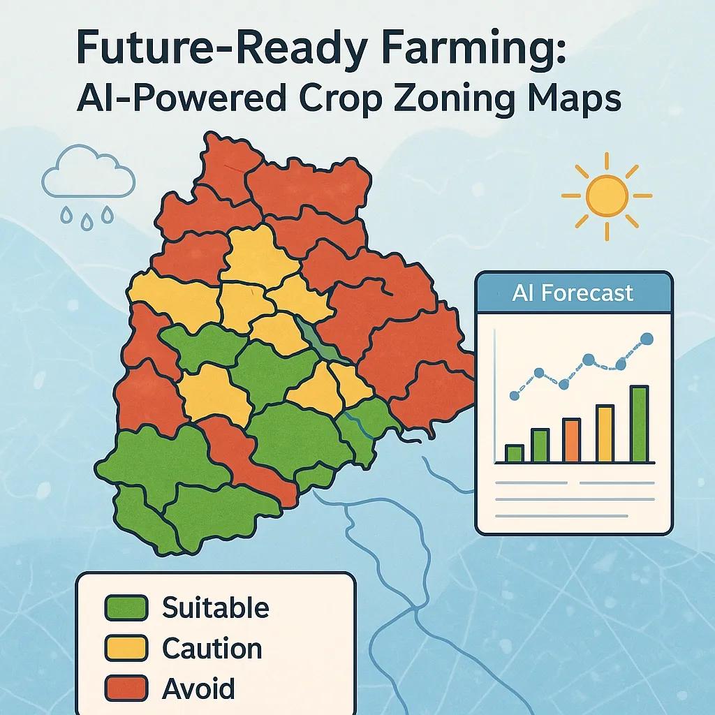
Climate change has intensified the uncertainty in agricultural productivity, particularly in countries like India where livelihoods and food security are closely tied to weather patterns. Traditional agricultural zoning practices, which depend on historical climatic data and static agro-ecological classifications, are proving insufficient to address the new challenges of erratic rainfall, rising temperatures, and shifting growing seasons. Climate-resilient crop zoning (CRCZ) is emerging as a necessary upgrade, powered by Artificial Intelligence (AI), Earth Observation (EO), and geospatial data analytics.
This article explores how AI-based climate forecasting, when integrated with dynamic regional zoning maps, can enable more adaptive and risk-informed crop planning. It focuses on the methodology, data infrastructure, and potential use cases of such integration, particularly in climate-vulnerable agrarian regions.
What Is Climate-Resilient Crop Zoning?
Climate-Resilient Crop Zoning (CRCZ) refers to the dynamic identification and classification of areas suitable for cultivating specific crops based on not just historical agro-climatic factors, but also forward-looking climate scenarios. It moves beyond static zoning toward a spatial decision-support system that incorporates seasonal climate forecasts, soil health, and water availability.
The core idea is to recommend crop choices and management practices at a hyperlocal level based on projected risks like drought, flood, heat stress, or pest outbreaks. These zones can be updated seasonally or annually based on forecasted data, enabling farmers and policymakers to make informed, adaptive decisions.
Role of AI in Forecasting Climate Risks
Traditional climate models (GCMs and RCMs) provide coarse spatial and temporal resolution. AI improves this by offering:
Downscaling : Machine learning models, such as Convolutional Neural Networks (CNNs), can downscale global climate models to district or even village-level resolution.
Seasonal Forecasting : Recurrent Neural Networks (RNNs) and Long Short-Term Memory (LSTM) models can capture temporal dependencies in weather data to provide 3-6-month seasonal forecasts.
Anomaly Detection : AI models can identify emerging stress patterns such as early drought signs or unseasonal rainfall using real-time satellite and sensor data.
Scenario Simulation : AI can simulate multiple “what-if” scenarios to model crop suitability under different future emissions pathways (RCP 4.5, RCP 8.5, etc.).
By training on historical climate data, EO datasets (e.g., MODIS, Sentinel-2), and ground observations, AI systems can generate highly localized, crop-specific advisories under changing climate scenarios.
Data Layers Used in CRCZ
To implement CRCZ effectively, the system must integrate multiple spatial and non-spatial datasets:
Data Layer - Description
Climate Projections - RCM-downscaled forecasts on temperature, precipitation, humidity, etc.
Soil Health Maps - pH, salinity, organic carbon, texture, drainage, often from Soil Health Cards or EO-derived models
Land Use/Land Cover - Satellite imagery used to identify cropping areas, vegetation health
Water Resources - Surface and groundwater availability maps derived from hydrological models
Crop Calendar & Typology - Crop duration, planting and harvesting windows, pest-prone phases
Socioeconomic Data - Smallholder landholdings, labor availability, input access, credit flow
These are combined in a GIS platform, where AI-based zonation models classify regions based on multi-criteria decision-making algorithms such as AHP (Analytic Hierarchy Process), Random Forest classifiers, or Support Vector Machines.
Workflow: Integrating AI Forecasts into Zoning Maps
Data Ingestion Real-time and forecasted data from IMD, NASA POWER, ECMWF, and national weather stations. EO data for soil moisture, NDVI, LST from platforms like Google Earth Engine or DIKSHA.
Preprocessing & Normalization Convert raster and vector datasets into a common georeferenced grid (typically 1 km² resolution). Apply anomaly correction and spatial interpolation.
Model Training Use supervised learning algorithms to correlate past yield and climate anomalies with environmental variables. Label data based on crop failure, moderate yield, or high yield zones.
Dynamic Zoning Predict future crop-suitability zones by overlaying AI climate forecasts with soil-water-climate layers. Generate seasonal advisories with color-coded zoning maps (e.g., Red for ‘Avoid’, Yellow for ‘Caution’, Green for ‘Suitable’).
Dissemination Zoning maps can be distributed through state agriculture departments, Krishi Vigyan Kendras, FPO dashboards, or mobile apps using SMS/IVR in regional languages.
Example Use Case: Groundnut in Telangana
In Telangana, groundnut cultivation has traditionally thrived in districts like Mahbubnagar and Wanaparthy. However, increasing frequency of delayed monsoons and dry spells post-sowing has led to repeated crop losses.
Using CRCZ:
Step 1 : AI models predict a high likelihood of delayed monsoon onset (by 3 weeks) and above-average temperatures during pod formation.
Step 2 : Regional zoning map updates indicate only northern Mahbubnagar and parts of Jogulamba Gadwal remain suitable.
Step 3 : Farmers in red-zoned areas are advised to shift to short-duration millets or pulses, while yellow zones are guided on drought-resistant seed varieties.
Step 4 : Government subsidy programs are dynamically adjusted to prioritize seed kits and irrigation assets in green zones.
This zonal advisory helped reduce economic losses and improve input allocation efficiency for both farmers and extension workers.
Benefits and Impact
Benefit - Explanation
Reduced Crop Losses - Early warnings and adaptive zoning reduce exposure to climatic extremes
Efficient Resource Use - Inputs like fertilizers, seeds, and water are deployed where productivity is viable
Policy Alignment - Supports MSP planning, procurement targets, and subsidy allocation
Livelihood Resilience - Enables smallholders to switch crops or stagger sowing based on micro-zones
Scientific Land Planning - Supports evidence-based district-level agricultural planning
Implementation Challenges
Data Gaps : Sparse ground-level observations in remote areas can limit model accuracy.
Interoperability : Integrating different spatial and temporal scales across datasets requires standardization.
Farmer Trust & Awareness : Local extension agents must be trained to interpret and communicate AI-based zoning insights.
Infrastructure : Reliable connectivity and digital literacy remain bottlenecks in Tier 2 and 3 rural areas.
These challenges need to be addressed through public-private collaboration, capacity building, and investment in national agro-informatics platforms.
Future Outlook
As India expands its digital agriculture mission and strengthens its climate adaptation goals, AI-integrated CRCZ systems will play a central role. Upcoming trends include:
Fusion Models : Combining AI forecasts with crop simulation models (e.g., DSSAT, APSIM) for yield prediction under multiple climate scenarios.
Blockchain for Zonal Certification : Tagging and certifying climate-resilient production zones for traceability in agri-value chains.
Hyperlocal Advisory Systems : Use of edge computing and low-power IoT sensors to continuously update zoning maps at the village level.
Conclusion
Climate-resilient crop zoning using AI is a transformative approach to align agricultural practices with climate realities. By moving beyond historical trends and incorporating predictive analytics, it empowers farmers, planners, and policymakers to make data-driven decisions that safeguard food security and rural incomes.
For regions like India that are climate-sensitive and agriculturally dependent, this integration of AI forecasts with regional zoning is not just innovation, it’s necessity.