Capability is uneven
Two organizations may use the same geospatial tools.
One generates occasional maps.
The other drives capital allocation with spatial scoring.
The difference is not software.
It is maturity.
The real decision behind maturity
Most organizations don’t ask:
“Do we have GIS?”
They ask:
Are we using location intelligence consistently?
Does spatial insight influence capital decisions?
Is risk prioritization data-driven?
Are spatial metrics part of governance?
Maturity is about how deeply geospatial thinking is embedded in decision systems.
Without a maturity lens, improvement remains incremental.
Why a maturity model matters
A structured maturity framework helps organizations:
Benchmark their current capability
Identify structural gaps
Align leadership expectations
Prioritize capability investments
Move from pilot projects to enterprise systems
It shifts the discussion from tools to transformation.
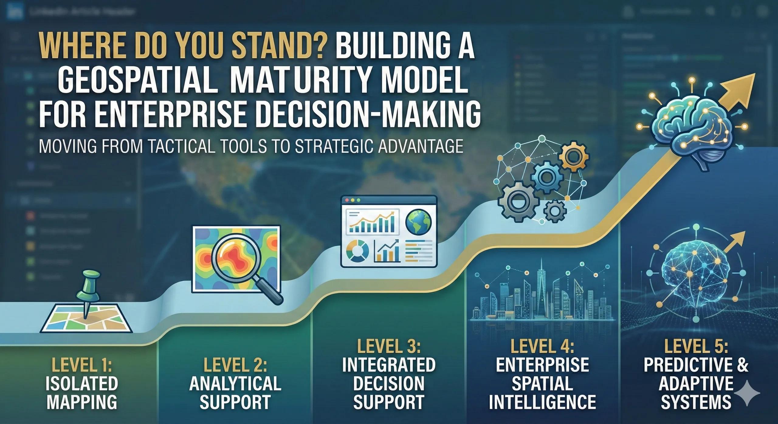
A practical 5-Level Geospatial Maturity Model
Here is a simple, decision-focused model.
Level 1: Isolated Mapping
GIS used for visualization
Project-specific analysis
No integration with enterprise systems
Limited executive visibility
Location supports operations but does not influence strategy.
Level 2: Analytical Support
Structured spatial analysis
Risk and demand mapping performed
Outputs inform some planning discussions
Still dependent on individual teams
Location begins to influence decisions, inconsistently.
Level 3: Integrated Decision Support
Spatial metrics linked to asset management
Risk scoring influences prioritization
Expansion decisions use location analysis
Executive dashboards include geographic indicators
Location becomes a recurring input in strategic discussions.
Level 4: Enterprise Spatial Intelligence
Geospatial integrated with ERP and financial systems
Capital allocation considers geographic exposure
Risk and opportunity scoring standardized
Cross-department governance established
Location becomes part of enterprise decision architecture.
Level 5: Predictive & Adaptive Systems
Real-time spatial intelligence embedded
Simulation-driven capital planning
AI-assisted prioritization
Digital twins continuously updated
Board-level geographic KPIs
Location is no longer supportive.
It is foundational.
A practical scenario
Consider two utilities.
Utility A uses GIS for outage mapping.
Utility B integrates spatial risk scoring into maintenance planning, capital sequencing, and executive reporting.
Both “have GIS.”
Only one has spatial maturity.
The difference shows up in resilience, capital efficiency, and investor confidence.
Organizational impact of maturity
Higher maturity typically correlates with:
Reduced capital misallocation
Faster strategic alignment
Improved regulatory defensibility
Stronger cross-functional coordination
Clearer ROI tracking
Maturity is not about complexity.
It is about consistency.
Where organizations underestimate the gap
Common blind spots include:
Confusing data availability with decision influence
Assuming tool deployment equals transformation
Ignoring governance and workflow alignment
Underestimating training needs
Without structured progression, organizations remain at Level 2 indefinitely.
Scaling maturity deliberately
Moving up maturity levels requires:
Executive sponsorship
Clear spatial KPIs
Process redesign
Cross-functional ownership
ROI tracking
It is not a technology roadmap.
It is an organizational roadmap.
The monetization bridge
As organizations seek to progress beyond isolated analysis, they increasingly look for structured advisory frameworks and scalable spatial decision systems that provide maturity benchmarking, workflow integration, governance alignment, and measurable progression toward enterprise-level spatial intelligence.
Looking ahead
In the coming years, geospatial maturity will separate organizations that experiment with location data from those that operationalize it as strategic infrastructure.
The question will not be:
“Do you use GIS?”
It will be:
“At what maturity level does location influence your decisions?”
Closing insight
Tools can be purchased.
Maturity must be built.
And maturity determines whether location intelligence remains a feature or becomes a competitive advantage.