“BIM-GIS integration” is often discussed as a concept.
In practice, it is implemented through very different philosophies depending on the platform.
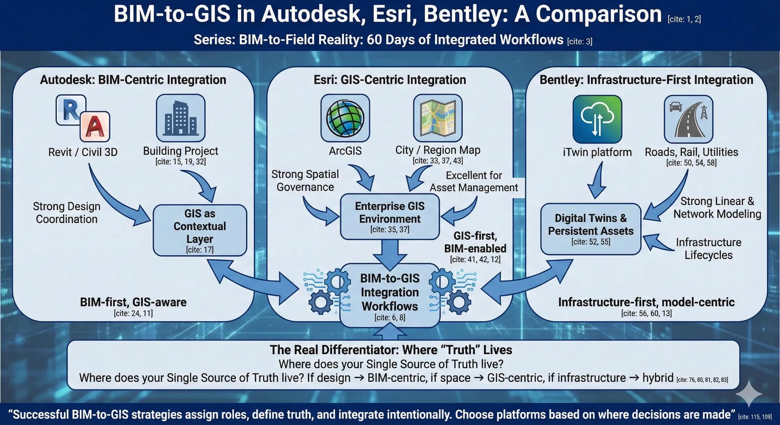
Autodesk, Esri, and Bentley all support BIM-GIS workflows, but they do so with different assumptions about ownership, authority, and scale . Understanding these differences is critical before choosing an architecture.
This article compares how BIM-to-GIS works across the three ecosystems, and where each fits best.
1. Three Platforms, Three Worldviews
At a high level:
Autodesk → BIM-first, GIS-aware
Esri → GIS-first, BIM-enabled
Bentley → Infrastructure-first, model-centric
None is “better” universally. Each is optimized for different outcomes.
2. Autodesk: BIM-Centric Integration
How It Approaches BIM-to-GIS
Autodesk treats BIM as the primary authoring environment , with GIS acting as a contextual layer.
Typical workflow:
Revit / Civil 3D models
Shared coordinates and survey points
Export or publish to GIS platforms
Autodesk Construction Cloud for collaboration
Strengths
Strong design and coordination workflows
Familiar to building-focused teams
Tight integration within Autodesk tools
Limitations
GIS often remains downstream
Large-area or multi-asset contexts are limited
Lifecycle asset management requires external systems
Best fit: Building projects, campuses, and design-led coordination where BIM is the core system.
3. Esri: GIS-Centric Integration
How It Approaches BIM-to-GIS
Esri treats BIM as one of many spatial data sources inside an enterprise GIS.
Typical workflow:
BIM ingested into ArcGIS
Models treated as spatial features
Integration with terrain, utilities, parcels, sensors
Strengths
Strong spatial governance and CRS handling
Excellent for asset management and planning
Scales across cities, regions, and portfolios
Limitations
Limited BIM authoring and editing
Design coordination still requires BIM tools
Requires BIM teams to adapt to GIS thinking
Best fit: Owners, operators, cities, and infrastructure agencies focused on long-term spatial intelligence.
4. Bentley Systems: Infrastructure-First Integration
How It Approaches BIM-to-GIS
Bentley blurs the line between BIM and GIS by focusing on infrastructure digital twins .
Typical workflow:
iTwin platform
Engineering models treated as persistent assets
Strong linear and network modeling
Strengths
Excellent for roads, rail, utilities, plants
Handles scale and continuity well
Strong alignment with infrastructure lifecycles
Limitations
Heavier ecosystem
Steeper learning curve
Less intuitive for pure building projects
Best fit: Large infrastructure programs, linear assets, and long-term digital twin initiatives.
5. Where Most Projects Go Wrong
Common mistake:
Trying to force one platform to do everything.
Examples:
Using BIM tools to manage city-scale assets
Using GIS tools for detailed trade coordination
Expecting platform integration to replace governance
Tools enable integration.
They do not define authority or truth .
6. The Real Differentiator: Where “Truth” Lives
The key question is not:
Which platform integrates best?
It is:
Where does your Single Source of Truth live?
If truth lives in design → BIM-centric
If truth lives in space and networks → GIS-centric
If truth lives in infrastructure systems → hybrid / infrastructure-centric
Platform choice should follow this decision.
7. India Context: Why This Choice Is Strategic
In Indian projects:
Multiple agencies interact
Assets outlive projects
GIS continuity matters
BIM-only strategies struggle to scale.
GIS-only strategies struggle during execution.
Hybrid thinking, clear roles, clear handoffs , works best.
8. Interoperability Is Necessary, Not Sufficient
Data exchange formats help.
APIs help.
Connectors help.
But without:
Spatial governance
Validation workflows
Clear ownership
Integration remains fragile.
9. A Practical Decision Framework
Ask these three questions:
Who owns spatial truth long term?
Who needs to edit geometry day-to-day?
Who answers during audits and disputes?
Your platform architecture should mirror those answers.
10. The One Rule That Prevents Regret
Choose platforms based on where decisions are made, not where models are created.
Conclusion
Autodesk, Esri, and Bentley all support BIM-to-GIS integration, but they solve different problems .
Autodesk excels at design coordination
Esri excels at spatial intelligence
Bentley excels at infrastructure continuity
Successful BIM-to-GIS strategies don’t pick a winner.
They assign roles , define truth, and integrate intentionally.