Why do so many Digital Twin projects struggle, even after investing in BIM, GIS, and IoT?
Because the problem is not the absence of data.
It is the lack of connection between systems .
Introduction
Most organizations today already have pieces of the puzzle:
BIM models for design and construction
GIS systems for location and context
Sensors generating operational data
Yet, these systems often operate in isolation.
A Digital Twin is not about creating something new.
It is about bringing these disconnected systems together into a single decision environment .
The Core Problem: Siloed Systems
In many projects:
BIM lives with design and engineering teams
GIS is used for planning and mapping
IoT data is handled separately by operations
Each system answers a different question:
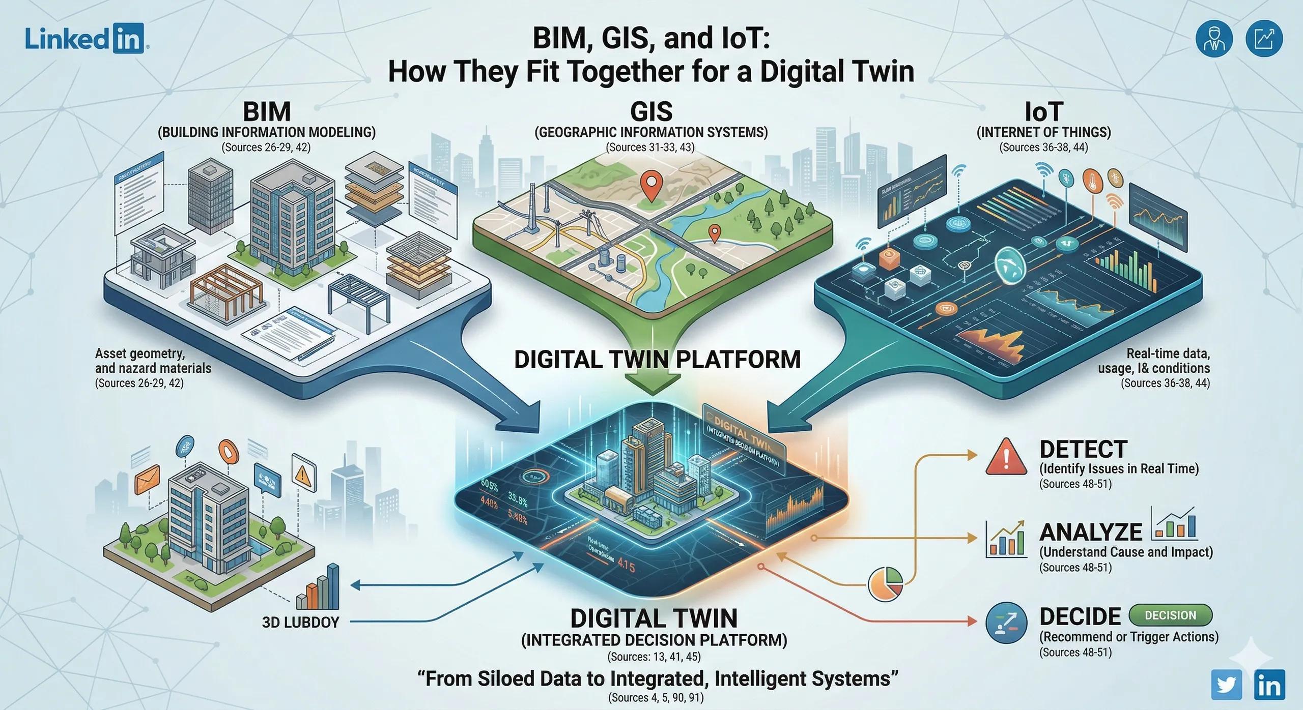
BIM → What was built?
GIS → Where is it located?
IoT → What is happening right now?
But no single system answers:
👉 What should we do next?
Understanding Each Component
1. BIM (Building Information Modeling)
Detailed representation of assets
Geometry, materials, specifications
Strong in design and construction phases
Limitation: Often becomes static after project handover.
2. GIS (Geographic Information Systems)
Provides spatial context
Connects assets to surroundings (roads, utilities, environment)
Enables large-scale analysis
Limitation: Lacks deep asset-level detail.
3. IoT / Sensor Data
Real-time information from the field
Performance, usage, environmental conditions
Limitation: Data exists, but often without context or integration.
How They Come Together in a Digital Twin
A Digital Twin integrates all three:
BIM → Defines the asset
GIS → Places it in context
IoT → Brings it to life
👉 The result is not just a combined system, but a continuously updated, context-aware decision platform
From Integration to Intelligence
Simply connecting systems is not enough.
The real value comes when integration leads to actionable outcomes :
Detect → Identify issues in real time
Analyze → Understand cause and impact
Decide → Recommend or trigger actions
Practical Example
Scenario: Urban Utility Network
BIM provides pipeline structure and specifications
GIS shows location, terrain, and surrounding infrastructure
Sensors track pressure, flow, and leakage
With integration:
Leaks are detected early
Impact zones are identified instantly
Maintenance teams are guided to exact locations
👉 This is where integration becomes decision-making
Where Most Projects Go Wrong
1. Treating Integration as Optional
Systems are implemented independently.
2. Over-Reliance on One System
Trying to use BIM or GIS alone for all use cases.
3. Lack of Data Standards
Different formats, no interoperability.
4. No Clear Decision Workflow
Even integrated data does not translate into action.
Ask Yourself
Are your BIM, GIS, and operational systems working together, (or) are they still functioning in silos?
Indian Context
In India, large-scale initiatives like:
Smart Cities
Highway infrastructure
Urban utilities
already generate data across multiple systems.
The opportunity is not in adopting new tools but in connecting existing ones effectively .
Benefits of Integration
Better situational awareness
Faster response to issues
Improved planning and forecasting
Reduced operational inefficiencies
Stronger foundation for Digital Twin systems
Conclusion
BIM, GIS, and IoT are not competing technologies.
They are complementary layers of the same system.
A Digital Twin is where they converge.
Organizations that understand this will move from:
Managing disconnected tools→ to operating integrated, intelligent systems