Satellites Are Becoming Reservoir Gauges
Managing a reservoir used to mean relying on manual readings, sparse sensors, and delayed reports.
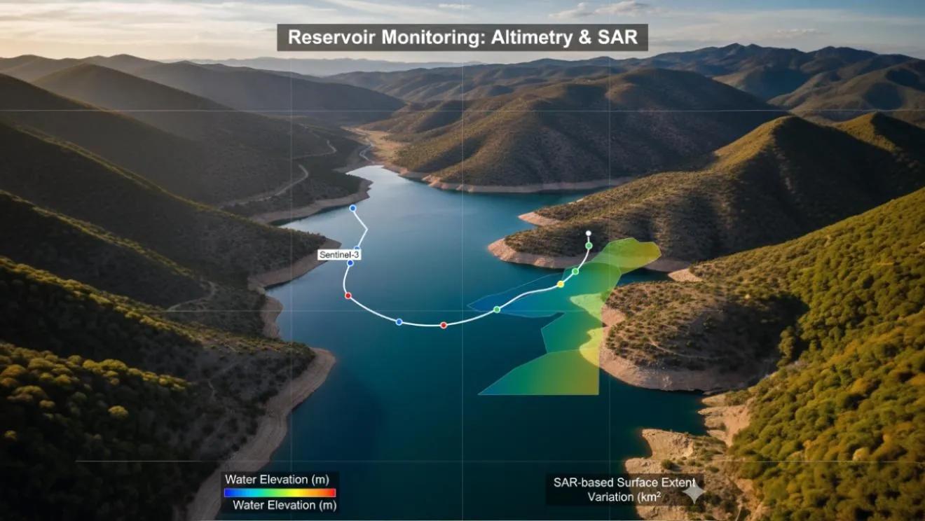
Now, radar altimetry and SAR (Synthetic Aperture Radar) allow us to measure water levels directly from space , turning every major reservoir into a remotely monitored system.
Satellites like Sentinel-3 , Jason-3/CS , and SWOT are redefining hydrological intelligence, giving water managers daily, near-real-time updates on surface elevation, storage volume, and operational health.
In short, altimetry has become the new telemetry.
The Physics Behind Spaceborne Altimetry
Altimeters emit radar pulses toward the Earth and measure the two-way travel time of the signal reflected from a water surface.
From this, the surface height (H) is derived as:
H = h satellite - (range + atmospheric + geoid + tidal corrections)
Each corrected signal provides centimeter-scale precision in elevation over open water bodies.
For large reservoirs and lakes, these readings create continuous time series of water level variations.
Key satellite missions:
Sentinel-3 SRAL: 300 m along-track resolution; global revisit every ~27 days.
Jason-3 / Sentinel-6: Long-term reference altimetry with <3 cm accuracy.
SWOT (Surface Water & Ocean Topography): 50–100 m spatial resolution, maps smaller reservoirs and rivers.
Together, they make up a global hydrological observation network from space.
From Elevation to Operations: The GIS Connection
Altimetry data gains operational value only when fused with GIS-based reservoir footprints and inflow-outflow models.
By combining satellite altimetry with SAR-based surface area extraction , we can estimate storage volume changes over time.
Workflow:
1️⃣ Detect Reservoir Boundaries , Sentinel-1 SAR imagery differentiates water from land via backscatter contrast.
2️⃣ Estimate Surface Elevation , Sentinel-3 altimetry provides mean water height.
3️⃣ Calculate Volume Change (ΔV): Combine area (A) and height (H) variations using a geometric approximation or elevation–area–volume curve.
4️⃣ Integrate into GIS: Update water resource dashboards and operational models (e.g., inflow forecasting, irrigation scheduling).
This transforms altimetric datasets into decision-ready intelligence.
India’s Reservoirs from Space
India operates more than 5,000 major and medium reservoirs , collectively storing 258 billion cubic meters of water.
Yet monitoring them in real time is still a challenge.
Recent efforts by ISRO (National Hydrology Project) and INCOIS use Sentinel-3 altimetry and Sentinel-1 SAR to monitor:
Water level changes in reservoirs like Nagarjuna Sagar, Srisailam, and Bhakra.
Seasonal variation mapping to optimize irrigation release.
Early warning for low storage during monsoon shortfalls.
For example, in 2023, Sentinel-3 tracked a 1.4 m drop in water level at Srisailam Reservoir during late monsoon, weeks before ground sensors reported it, giving managers lead time for water rationing.
This fusion of altimetry + SAR + hydrological models is fast becoming the backbone of digital water governance in India.
SAR for Surface Area and Flood Extent
While altimetry measures elevation, SAR complements it by mapping extent. Its ability to penetrate clouds makes it indispensable during monsoon monitoring.
Sentinel-1 SAR applications include:
Detecting inundation extent changes.
Mapping dynamic reservoir boundaries for storage calculations.
Assessing spillway operations and flood impact zones.
When paired with altimetry, SAR enables a 2D–3D view of water behavior, not just how high, but how far it spreads.
Integrating HEC-RAS and SWAT for Volume Simulation
Once altimetric data is fed into models like HEC-RAS (2D) or SWAT (Soil and Water Assessment Tool) , they can simulate:
Reservoir inflow–outflow relationships.
Flood routing and spillway discharge.
Upstream rainfall–runoff coupling.
Downstream irrigation potential analysis.
In a Rain–Runoff Twin setup, these updates automatically refine forecasts, producing daily storage analytics across an entire basin.
This integration transforms remote sensing from observation to operation.
Case Example: Godavari Basin Reservoir Chain
Using Sentinel-3 altimetry and Sentinel-1 SAR, a chain of six reservoirs across the Godavari was monitored for 2022–23:
Monthly elevation variations averaged ±2.3 m .
SAR-derived surface area correlated with inflow trends (R² = 0.88).
Combined model predicted storage volume changes with 5% error margin , sufficient for weekly irrigation planning.
This project demonstrated that space-based altimetry can supplement or even replace in-situ gauges in inaccessible basins.
The GeoAI Edge
Machine learning adds automation and predictive intelligence:
Altimetry-SAR Fusion Models: Predict missing altimeter passes using SAR texture metrics.
Recurrent Neural Networks (RNNs): Forecast reservoir level trends from multi-year time series.
Anomaly Detection: Identify abnormal drawdown or spillage events.
AI effectively closes the data gaps between satellite revisits, making reservoir management both continuous and predictive.
Outlook: Toward India’s Water Digital Twin
Imagine a national water twin integrating Sentinel altimetry, SAR, IoT gauges, and HEC-RAS models across all major reservoirs.
Decision-makers could visualize:
Real-time water storage.
Projected irrigation availability.
Flood risk from synchronized spillway releases.
That’s not a future vision, it’s an achievable system using existing open datasets.
With proper integration, every reservoir can function as a digitally visible, dynamically updated asset.
Conclusion
Reservoirs are no longer static blue patches on maps.
With altimetry and SAR, they’ve become live instruments, responding, adapting, and communicating through data.
By measuring height from space and flow from models, we are building the most complete hydrological mirror yet , a twin that watches every rise and fall of India’s lifelines.