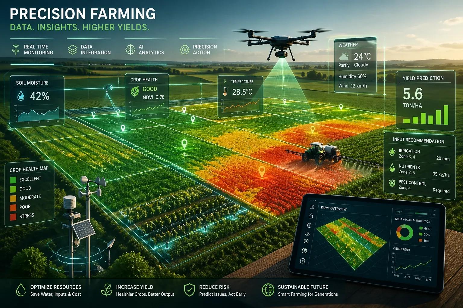
Farming decisions are still often made field by field.
But variability exists within every square meter.
Introduction
In the previous articles, we explored how Digital Twins enable:
predictive maintenance in infrastructure
real-time coordination in airports
safety-driven intelligence in railways
production optimization in manufacturing
supply chain visibility in logistics
risk monitoring in oil & gas
performance optimization in power plants
compliance management in mining
Now we move to a sector where:
👉 nature, data, and decision-making intersect directly
👉 Agriculture
Agriculture systems are influenced by:
soil conditions
weather variability
water availability
crop health
In Phase 3, the focus remains:
👉 how Digital Twins enable precision farming and yield optimization
The Core Problem: Uniform Decisions in a Variable Environment
Most farming practices today:
apply uniform inputs
rely on periodic observation
respond to visible issues
But:
👉 fields are not uniform
This leads to:
inefficient resource usage
uneven crop growth
reduced yield
Where Digital Twins Change the Approach
A Digital Twin enables:
👉 real-time, location-specific decision-making
Instead of:
treating fields as uniform
It creates:
a dynamic, data-driven model of the farm
Key Components of an Agriculture Digital Twin
1. Data Layer
satellite imagery
UAV/drone data
IoT sensors: soil moisture temperature humidity
weather data
2. Integration Layer
combines: spatial data sensor data historical data
👉 creates a unified farm view
3. AI/ML Layer
predicts crop health
identifies stress zones
recommends input application
4. Visualization Layer
GIS-based field maps
crop health heatmaps
yield prediction dashboards
Use Case 1: Precision Irrigation
Traditional Approach
uniform irrigation
👉 overuse or underuse of water
Digital Twin Approach
monitor soil moisture in real time
irrigate based on need
👉 Outcome:
optimized water usage
improved crop health
Use Case 2: Crop Health Monitoring
detect stress zones using satellite and UAV data
identify issues early
👉 Outcome:
targeted intervention
reduced crop loss
Use Case 3: Input Optimization
apply fertilizers and pesticides based on need
👉 Outcome:
reduced cost
improved yield
Practical Example
Scenario: Crop Stress Detection
satellite imagery detects variation in vegetation index
AI identifies:
👉 stress zone
System triggers:
targeted irrigation
nutrient application
👉 Outcome:
issue resolved early
yield protected
Where Most Implementations Fail
1. Data Without Action
insights generated
👉 not applied
2. Lack of Integration
satellite, sensor, and weather data not combined
3. Delayed Decision-Making
actions taken after visible damage
4. No Predictive Capability
focus on observation, not forecasting
Ask Yourself
Are your farming decisions:
👉 uniform
Or
👉 location-specific and data-driven?
Indian Context
India’s agriculture sector faces:
water constraints
climate variability
fragmented land holdings
Digital Twins can help:
👉 improve yield
👉 optimize resources
👉 enable precision farming
Benefits & ROI
improved crop yield
optimized water usage
reduced input cost
better decision-making
increased sustainability
Conclusion
Agriculture is inherently variable.
Digital Twins enable:
👉 understanding that variability
👉 predicting outcomes
👉 acting precisely
This transforms farming from:
👉 uniform practices
to
👉 precision-driven agriculture